Canoeing the Upper North Branch of the Chicago River

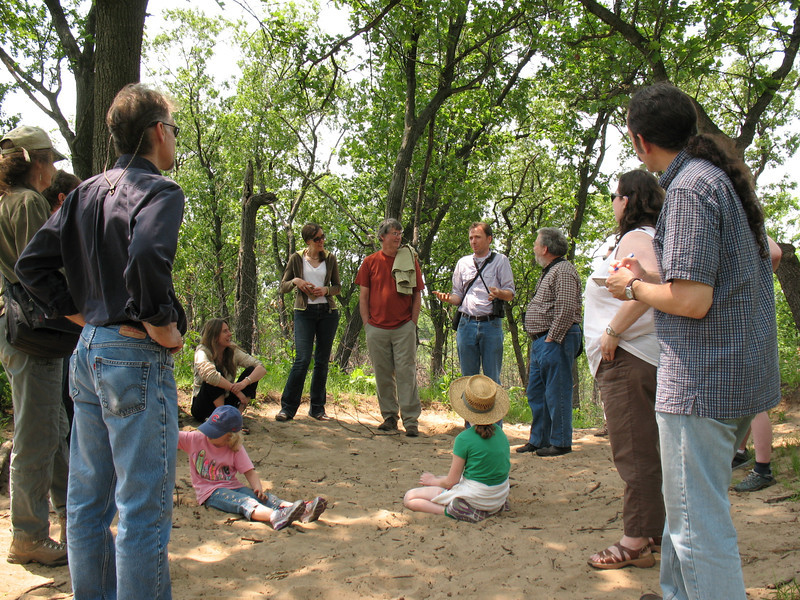
This past Saturday, students in my SUST 220 Water and PLS 391 Natural Science seminars at Roosevelt University joined me for an urban ecology adventure on the Upper North Branch of the Chicago River. We convened mid-morning at Linné Woods, a woodland site locatedin the Cook County Forest Preserve system in Morton Grove, IL, where we met up again with Mark Hauser and Claire Snyder, naturalists from Friends of the Chicago River, for a water quality sampling session of the river where it flows past the lovely picnic grounds in Linné Woods.

Claire Snyder and Mark Hauser, naturalists from Friends of the Chicago River (M. Bryson)

While this was the second go-round for my 220 Water students on field sampling (our first session was further downstream on the North Branch, at West River Park in Chicago), the students from my natural science seminar were new to this exercise; however, after three weeks of being introduced to issues and concepts in urban ecology (from biodiversity to climate change), they were ready to get out in the field and get their hands dirty.

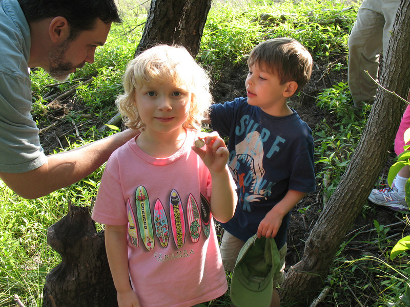
Breaking up into different teams, we measured key chemical indicators such as temperature, turbidity, pH, dissolved oxygen, nitrate, phosphate, and total dissolved solids; and wading into the river with D-nets to scrape up mud in search of macro-invertebrates (worms, leeches, crawfish, snails, damselfly nymphs, etc.), we also garnered a biological snapshot of the river’s relative quality.

Down from the meadow and near the riverbank, Claire discusses the various chemical and physical tests we’ll perform to assess the water’s overall quality: pH, nitrate, phosphate, dissolved oxygen, temperature, total dissolved solids, and turbidity. Half our group work on gathering these measurements, while the other half work on the biological survey with Mark. (M. Bryson)

Taken together, these two approaches give us an in-the-moment (chemical) and over-the-longer-term (biological) assessment of the ecological health of the North Branch. This is because while the chemical profile of a river can change day to day — even hour by hour — depending upon the weather and various inputs into the watercourse, the biological community in the river’s benthos is stationary; and some of organisms that live there have been there awhile.

Our quality results were decidedly mixed.The chemical profile we established had some indicators looking rather good, such as a low nitrate reading of 1.3ppm and a fairly neutral pH of 6.5; turbidity levels were also reasonable. The low nitrate reading makes sense, given that in this area of the northern suburbs north of Dempster Ave. (Glenview, Golf, Morton Grove), communities use a separate sewer system, so wastewater treatment plants are not burdened by high inputs of stormwater run-off, and the waterways do not received Combined Sewage Overflows as they do in older suburbs and the city. Moreover, there is not much, if any, agricultural land in this part of the river’s watershed, meaning that fertilizer run-off from farm fields is not an issue.

Hunting for macro-invertebrates in the river’s water and sediments, under rocks, and along the shoreline (M. Bryson)

On the other hand, phosphate levels were rather high at 0.7ppm and the all-important indicator of dissolved oxygen was fairly low (at 7ppm and 60% saturation), posing challenges for many types of organisms to thrive in the river’s watercolumn and benthos. All in all, we calculated a “Quality Index” grade of 68% on our collective chemical analyses, or if you’re using a letter-grade system, D-plus. Nothing to write home about, despite the lovely, even bucolic, scenery in this part of the Chicago River which follows its natural watercourse and winds through forest preserve land. This assessment was echoed rather closely by our macro-invertebrate survey, which identified 8 different taxa of organisms, ranging from several that are “modertely intolerant to pollution” to four that are “fairly” to “very tolerant” of impaired water quality. Our Water Quality index of 2.6 was on the low end of “fair” in terms of biological diversity (call it a C-minus).

Measuring stream flow (M. Bryson)

Finally, our group waded into the stream and use measuring tape, rules, a stopwatch, and a collection of sticks to calculate the stream flow rate. The trick here is to stake out a place where the width and depth of the river is known, and then release the sticks in the current. Students time how long it takes each stick to travel a given distance (here, 40 feet) and then calculate the stream flow (cubic feet/second) accordingly. Our result: a stream flow rate of 98 cubic feet per second.

Curious readers can review our original field data sheets and calculations here; and for photos of our water sampling activities, see this online slideshow.

Here on the upper North Branch, the river follows its natural course and thus has lots of twists and turns. It took us about two hours to paddle five miles. Lots of overhanging branches required careful maneuvering. (M. Bryson)

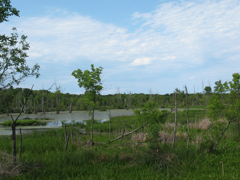
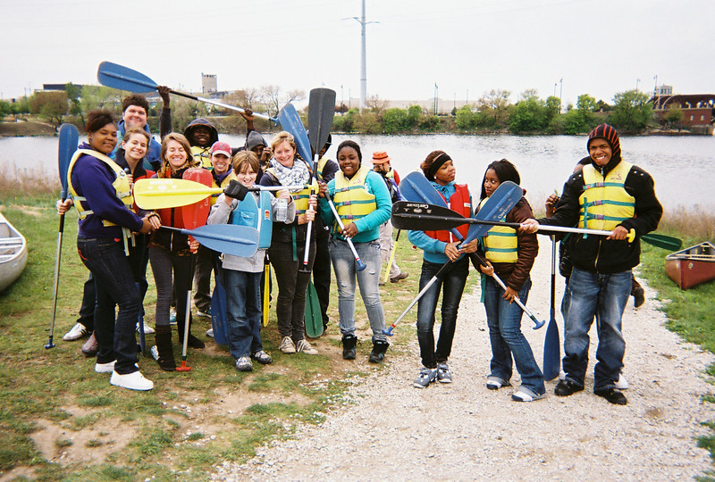
After a picnic lunch, we used several of our vehicles to  shuttle our group up to our canoe launching spot five river miles north, at Blue Star Memorial Woods in Glenview. Here we met up with Dave Rigg and his fellow volunteer canoe guides from Friends of the Chicago River, who would lead us on an intimate exploration of the water, woodlands, and wetlands of the West Fork of the Upper North Branch of the Chicago River — one of the most scenic and naturalistic stretches of the entire Chicago River system. Dave and Co. gave the many inexperienced but enthusiastic paddlers in our group a paddling lesson, and once outfitted with our safety gear, paddles, and a canoe partner, we hit the water for what would be a two-hour downriver journey in utterly perfect October weather.

Ron and Ken getting ready for our first portage (M. Bryson)

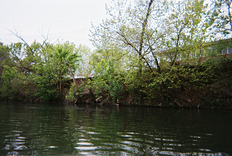
The majority of this trip runs through forest preserve property, with the notable exception of the Chick Evans Golf Course that straddles the river where the North Branch splits into its Middle and West Forks. The result is that we traveled along the natural course of the stream, mostly unchanged from before the time of European settlement, with all its twists and turns and with a wide buffer zone of floodplain forest. The heavily vegetated riverbanks proved to be a stunning contrast to the reinforced concrete and rusty steel that encases much of the Chicago River further south in the watershed.

Besides navigating all the twists and turns of a sometimes narrow and always lovely river channel, as well as ducking under overhanging branches, we had to negotiate two portages — the first for a couple of large downed trees, the second for a dam that is slated by the Cook County Forest Preserve for future removal, since it no longer serves a practical purpose and has deleterious impacts upon the river’s flow, water quality, and recreational value.

Portaging around some downed trees (M. Bryson)

These proved to be an interesting and fun challenge, though — especially given our previous contemplation of the long portages done by explorers and Native Americans between the West Fork of the South Branch, through the wetlands of Mud Lake, to the Des Plaines River (a place now commemorated by the Chicago Portage Historic Site).

More photos of our canoe trip can be seen in this online slideshow. In the near future, I’ll post some additional comments about the state of the river and its surrounding landscape that we observed on this trip.

This dam is a significant obstacle for canoeing humans and swimming fish; Friends of the Chicago River advocates its removal, the sooner the better. (M. Bryson)
Heading downstream on the Upper North Branch, about a half-mile from our destination in the Linné Woods forest preserve in Morton Grove, IL (M. Bryson)

Assessing Water Quality on the Chicago River’s North Branch at West River Park

Saturday, Sept. 8th, was the first day of class for my Fall 2012 Sustainability Studies 220 Water seminar at Roosevelt University. Instead of staying inside our classroom all day, though, we took advantage of excellent late-summer weather here in Chicago to take an urban river parklands adventure to Chicago’s North Side. From RU’s campus in downtown Chicago, we caught the Brown Line L train to a quiet and charmingly at-ground-level station near the end of the line (Francisco, in case you’re curious), where we walked through a quiet residential neighborhood just south of Lawrence Avenue to the entrance of Ronan Park. This is one of several parklands that border the North Branch of the River as it winds its way south through the city.

The North Branch of the Chicago River, as seen from the Ronan Park Bird Sanctuary trail
(M. Bryson)

We met up with naturalist-educators Mark Hauser and Claire Snyder from the environmental organization Friends of the Chicago River, who led us on a hike through the community-established Bird Sanctuary in Ronan Park — a charming linear greenspace that hugs the river and provides excellent wildlife habitat as well as soil stabilization with a lush landscape of native grasses and wildflowers as well as trees.

Hiking along the Ronan Park trail, through its restored Bird Sanctuary along the west bank of the river.
(M. Bryson)

Immediately north of Ronan Park, we entered West River Park, a multi-use parkland which provides numerous recreation activities as well as open space and excellent public access to the river. Prominent here is the confluence of the North Branch, which heads north for several miles out of the city and toward the Wisconsin border; and the North Shore Channel, a canal that was dug between 1907 and 1910 to provide a connection between Lake Michigan and the North Branch, thus increasing the flow and improving the water quality of the latter.

This confluence is an excellent place to examine the water quality of the river, for we were able to take a chemical and biological profile above and below the dam/spillway on the North Branch, which is just upstream from the North Shore Channel’s mouth. We measured key chemical indicators such as temperature, turbidity, pH, dissolved oxygen, nitrate, and phosphate; and wading into the river with D-nets to scrape up mud in search of macroinvertebrates (worms, leeches, crawfish, snails, damselfly nymphs, etc.).

In West River Park, north of Argyle Ave, looking north toward the dam/spillway on the North Branch. This wide area is the confluence of the N. Branch (which heads upstream to the upper left of this photo) and the North Shore Channel, built between 1907 and 1910 to provide an influx of Lake Michigan water (from Wilmette) for the North Branch.
(M. Bryson)

Above the dam, where the water travels downstream from the North Branch’s long journey southward through forest preserves and residential areas in the northern suburbs and North Side of the city, the water quality rated a “D” according to our chemical profile, mainly due to high suspended solids, high phosphates levels from polluted stormwater runoff, and low dissolved oxygen concentrations. Here our biological profile was slightly better (rated as “fair”) since we found a decent diversity of organisms, some of which are not highly pollution tolerant.

Sampling the macro-invertebrates living in the sediment and along the margins of the river, north of the spillway. This provides a biological sample of the river’s biodiversity and water quality, since different species of macro-inverts have different tolerance levels for pollution.
(M. Bryson)

Downstream of the dam, the chemical analysis results were a little better (“C-“), since the spillway served to oxygenate the water and significantly raise the dissolved oxygen value, which is critical for aquatic life to flourish. This was despite somewhat higher nitrate levels, which likely result from the wastewater effluent inputs to the Channel north of here, at the MWRD’s O’Brien wastewater treatment plant just north of Howard St.

The spillway is a great place for fishing, whether you’re a human or one of three heron species we saw that day (great blue, green, and black-crowned night).
(M. Bryson)

Both the North Branch and North Shore Channel are impacted by polluted stormwater runoff in the city and suburbs (which includes excess pesticides and chemical fertilizers applied to residential and commercial lawn properties, as well as from the ten golf courses within 20 miles of our sampling site); normal wastewater effluent discharges (where treated water nevertheless contains high bacterial levels, since effluent is not yet disinfected in a final stage of treatment, as in all other major US cities); and periodic combined sewage overflow (CSO) events, which occur when during a rainstorm the sewage system reaches capacity and untreated wastewater is released into the waterways to prevent sewage system back-ups into people’s homes.

Beyond learning to use the water sampling equipment and calculating a quick chemical and biological profile of the For images and notes from our trip, this trip allowed us to examine the way people interact with the river in an urban parkland, as well a discuss the river’s history of transformation here in Chicago. For more images from our day, see this annotated slideshow of photos; and check out the data from our sampling work at the link below.

West River Park Water Quality Data 2012-09-08 (pdf)

Looking southward on this scenic stretch of the North Branch, in West River Park.
(M. Bryson)

City Creatures: A New Blog

Here’s an exciting new blog to check out: City Creatures, a place of insightful writing about animals (and their human neighbors) here in Chicago’s urban and suburban environments. This is a project of the environmental non-profit organization, the Center for Humans and Nature, that will support and complement a book and art exhibit of the same name.

As a contributing author to the project and the blog, I’ll be writing about the Bubbly Creek ecosystem on Chicago’s Near Southwest Side and the many animals, past and present, that exist in that damaged yet resilient landscape — from the herons and other birds that find food and shelter within the creek’s waters and riparian zone; to the carp swimming below the surface that harbor bio-accumulated toxins in their tissues; to the decades-old offal from the millions of processed cows and pigs that was once dumped untreated into the waters of Bubbly Creek, and which is still slowly decomposing within its sediments.

Paddling south on Bubbly Creek, May 2012, on Chicago’s Southwest Side; to the right are 34th Street and the Iron Street Farm (M. Bryson)

The Ethics of Place in Urban Areas

This weekend I’m at Santa Clara University in California’s Silicon Valley at one of my favorite professional conferences: the annual gathering of the Association for Environmental Studies and Sciences. Like the literature and environmental folks I hang out with at ASLE‘s biannual conferences, these folks in AESS are my professional tribe: educators, students, writers, scientists, and activists working on every conceivable kind of issue or project related to environmental education and sustainability. (In fact, I’m struck by how pervasive a theme sustainability has become at the AESS conferences, despite the fact that it is not explicitly a part of the organization’s name or identity).

Santa Clara University

This morning I’m part of a presentation panel entitled “Ethics of Place in Urban Areas,” which was organized by my colleague and friend Gavin Van Horn of the Center for Humans and Nature in Chicago. Here he describes the context, themes, and over-arching issues our panel addresses:

Place has become a topic of increasing scholarly attention and research. Place is particularly relevant to environmental studies and environmental sciences, because place provides a spatial anchor of memory and meaning in which care for the natural world is fostered. Most work in moral philosophy and Western ethics is abstract in the sense that it seeks to discover standards of right and wrong that are universally valid and applicable. Paradoxically, moral psychology tells us that ethical thinking and our sense of value are rooted in the lived experience in a specific place, with specific natural and social characteristics, landscapes, and cultures. The session panelists submit that an ethics of place which roots our ethical obligations more concretely and locally is essential for a more robust environmental future. We examine the ways in which ethics might be re-envisioned to include a respect for complexity and multiplicity of place in an urban context.

Our presentations integrate urban agriculture and alternative economies, landscape aesthetics, urban water quality, environmental education, and the ethics of care to discuss the ways in which place can inform an ecological ethic that is democratic and participatory in its orientation. Our approach is rooted in the disciplines of geography, political science and bioethics, religious studies and ethics, urban ecology, and sustainability studies. While addressing conceptual and ideological questions about the ethics of place, we profile on-the-ground case studies and relevant research from each panelist’s community-based work. Our goal is to engage audience members in a dialogue about how scholars and citizens can better understand how to cultivate respect for and engagement with nature in metropolitan areas – spaces frequently misunderstood as un-conducive to an ethics of place.


Photo by Ryan Hodgson-Rigsbee (2010)

My presentation, “Exploring the Chicago River: Ethics, Sustainability, and a Sense of Place” (view pdf of slideshow) looks at this waterway/ecosystem as one key manifestation of urban nature in Chicago. I explore how scientific and artistic engagement with the river can contribute to one’s sense of not just the river’s history, ecology, and identity, but also that of Chicago in particular and watersheds more generally. As my abstract notes,

The degraded yet undeniably charismatic urban waterway, the Chicago River, is a mighty fine place to contemplate the tangled relationships among water quality, land use, and sustainability within cities and suburbs. As a site for exploring urban nature, an object of analysis in the scientific assessment of water quality and urban ecology, and a case-study in landscape aesthetics, the Chicago river provides students and citizens myriad opportunities to develop a sense of place. More generally, experiencing urban rivers — and understanding their function within the complex watersheds of metropolitan regions — can foster not just ecological literacy about urban ecosystems but also ethical engagement with one’s community.

You can also view a Powerpoint slideshow of my presentation (here with annotations) that features several photographs of the river by Ryan Hodgson-Rigsbee, who collaborated with me on a Mindful Metropolis cover story about the Chicago River back in 2010. Read more about rivers here on this blog, as well.

From the Chicago Portage to the Iron Street Farm: An Urban Landscape Exploration

Last Saturday was the first field trip opportunity of the summer for my PLS 392 Seminar in Humanities class at Roosevelt, the focus of which is “Representing the Urban Landscape.” After last summer’s trip to Canal Origins and Stearns Quarry Parks on Chicago’s Southwest Side, I decided to choose two different urban areas to explore — but sticking with the theme of how water and the land interact through time and space.

Ferdinand G. Rebechini’s massive sculpture of Father Jacques Marquette, explorer Louis Jolliet, and an unnamed Native American guide, erected 1989 at the Chicago Portage National Historic Site (M. Bryson)

We convened first at the Chicago Portage National Historic Site in Lyons, IL (on Harlem Ave just north of the Stevenson/I-55 expressway) for a guided tour run by the Friends of the Chicago Portage volunteer organization. Our two-hour walking tour through this historic site within the Cook County Forest Preserve was led by local historian Jeff Carter, a longtime member of the Friends of the Chicago Portage volunteer organization. FCP runs tours, produces educational documents and videos, organizes clean-up days for the preserve, and advocates for the creation of an interpretative center that could enhance the educational and public outreach value of the site.

Portage Creek, a tributary of the Des Plaines River, where Marquette and Jolliet canoed and portaged in their journey north to Chicago in 1673 (M. Bryson)

As it is, though, the Chicago Portage — sometimes referred to as Chicago’s Plymouth Rock because of its incredible historical significance to the city’s and state’s geography, cultural history, and economic development — is a wonderful out-of-the-way place to visit. Its woods, meadows, ponds, and creeks not only harbor a rich array of wildlife, but serve as a space-and-time capsule of the days of the late 17th century, when European explorers such as Jacques Marquette, Louis Jolliet, and René Robert Cavalier, Sieur De La Salle walked and canoed the area with the help of Native American guides.

After an extremely pleasant picnic lunch at the foot of the remarkable Marquette and Joliet sculpture at this Cook County Forest Preserve site (one of only two Nat’l Historic Sites in IL), we headed up Interstate 55, into Chicago proper, to Growing Power’s Iron Street Farm — at 7 acres one of the biggest among the many urban farms operating within Chicago’s city limits.

Lavender pots and the big mural at Iron Street Farm (M. Bryson)

Located in a former truck depot / distribution center at Iron and 34th Streets in Chicago’s Bridgeport neighborhood, the Iron Street farm represents a 21st century adaptive and sustainable re-use of a post-industrial 20th century urban site. As such, it’s both an actual and symbolic transformation of the land — not to mention an aesthetically (as well as ecologically) significant improvement of the area.

Lily Bryson (age 10) walks through one of the many hoop houses at Iron Street (M. Bryson)
Iron Street farmer and tour guide Erica Hougland shows my kids the red wiggler worms in one of the many vermiculture compost bins inside the farm’s building (M. Bryson)

Iron Street Farm has a Chicago River connection, too. It’s located right on the west bank of Bubbly Creek, the infamously polluted yet still fascinating industrial tributary of the South Branch of the Chicago River.

A view of Bubbly Creek, looking southwest from the roof of Iron Street Farm (M. Bryson)

So not only does the rooftop of Iron Street’s building provide a good view of Bubbly Creek, but also any rain that falls on the farm property is retained there, on-site, for use in growing plants and accelerating the decomposition of compost piles — rather than entering the stormwater sewer system and contributing to the combined sewage overflows that still plague the Chicago waterway system.

Both of these sites within the urban landscape — the Chicago Portage and Iron Street Farm — are connected by the history and present status of Chicago’s waterways; and both are intimately linked to how we can re-imagine and redevelop the city’s natural resources for the benefit of water quality, wildlife, and our own human experience.

For more pictures of this field trip, see these Chicago Portage and Iron Street Farm annotated photo albums.

Nature and Culture Explorations in Chicago and Joliet

This weekend I’m schlepping my two children around the Chicago region from one interesting bit of landscape to another. I’m testing their patience, as Lily and Esmé are only ten and five years old, respectively; but the beautiful weather and the fascinating people we’ve met along the way have made it a rewarding experience.

Ferdinand G. Rebechini’s statue of Marquette and Joliet at the Chicago Portage National Historic Site (M. Bryson)

Yesterday I organized a two-part field trip for my PLS 392 humanities seminar at Roosevelt University, the theme of which is “Representing the Urban Landscape.” This was our urban field trip opportunity, and we convened first at the Chicago Portage National Historic Site in Lyons, IL (on Harlem Ave just north of the Stevenson/I-55 expressway) for a guided tour run by the Friends of the Chicago Portage volunteer organization. After an extremely pleasant picnic lunch at the foot of the remarkable Marquette and Joliet sculpture at this Cook County Forest Preserve site (one of only two Nat’l Historic Sites in IL), we were treated to an in-depth tour of Growing Power’s Iron Street Farm, one of the biggest among the many urban farms operating within Chicago’s city limits.

Lily Bryson walks through one of the hoop houses at Iron Street Farm (M. Bryson)

After the kids and I said goodbye to my students, we ventured through the South Side to the Hyde Park neighborhood with my brother, David (the Cool Uncle), and explored two of my favorite Chicago bookstores: the bastion of all-things-scholarly (and beyond) Seminary Co-op and the kid-friendly 57th Street Books. After loading up some books (and saving 20% during the annual Member’s Sale), we strolled through the 57th Street Art Fair and then had a fine dinner at Medici on their upstairs patio. Uncle Davey went his separate way into the lovely evening, while the kids and I strolled through the charming quadrangle of the University of Chicago, then drove out to Promontory Point — one of Hyde Park’s gems and a fine spot along the lakefront to gaze out over Lake Michigan and to admire the distinctive Chicago skyline.

Today we venture out in the opposite direction from our home in Joliet, heading south to Midewin National Tallgrass Prairie where I’m meeting with a group of faculty from Joliet Junior College on a weekend retreat about sustainability education. As I’ve been polishing my presentation slideshow for the morning’s session, I came across this excellent blog post about the Midewin landscape from 2010 by Adrian Ayers Fisher on his site, Ecological Gardening; as well as this beautifully-design blog, A Midewin Almanac, by Arthur Melville Pearson.

It’ll be good to see Midewin again. Despite living in Joliet, only about 25 minutes from the site, I don’t get there nearly enough. We’ll see if I can cajole my tired children into a prairie hike after our morning session!

City Creatures Retreat at the Indiana Dunes (Pictures and Random Thoughts)

A marsh within the Calumet River watershed in the Indiana Dunes National Lakeshore

I’ve never been invited to a writer’s retreat before (not to mention a writers and artists retreat), and despite long anticipation and careful planning for this one, I almost didn’t get to go to this one when my spouse took ill and the kids needed tending. Thank goodness for CHN retreat organizer and all-around problem-solver Gavin Van Horn’s wisdom and quick decision-making, as he called me up and said, “Bring the girls along.”

I’m glad I did, as we had a terrific time — and I’m grateful to Gavin’s wife Marcie, who generously and graciously volunteered to watch my children during the times when I was occupied with fellow participants in wonderful discussions about our forthcoming City Creatures project.

For me the retreat had a number of highlights. Some of them were formal, in the sense that they were on the planned agenda — like the splendid hike through the wetlands of the Great Calumet Marsh on Friday led by Ron and Joan Engel, who escorted us along some of their favorite biodiversity-rich trails in the Dunes back-country; the lovely reception hosted by the Engels at their beautiful home in Beverly Shores (which surely has the best home study/library I’ve ever seen); the delightful dinner at Sage restaurant in Chesterton; and the “soundwalk” excursion we took in Gary on the grounds of the Paul Douglas Environmental Learning Center at the western end of the National Lakeshore.

Joan and Ron Engel, with Steve Packard

But the less-scripted elements of the retreat held many delights, as well. I became pals with a conservationist and writer I much admire, Stephen Packard, who rode in my car from field site to field site, and delighted my children with his funny stories, endless questions, and brilliant bird call imitations. At one point on our way to the soundwalk field trip, I deliberately got us lost (no, really!) so I could listen to the end of a story that involved “mucking about” a salt marsh on Cape Cod; the ensuing delay was worth it. I met some old friends but also made a bunch of new ones among a group of immensely talented and utterly fascinating people. And I learned a lot about what our collective project is aiming for, and had time and encouragement to think about how my small contribution fits into the bigger picture.

Lea Schweitz holds an opossum mandible

My two girls, Lily (age 10) and Esmé (age 5), had fun cavorting with Gavin’s 5-year-old son Hawkins, and they got a kick out of our field hikes, too. During our marsh walk, we had  several great kid discoveries: Steve Sullivan found the mandible of an opossum; Steve Packard found some eggshell fragments, still soft and pliable, from a turtle; and we all admired a large beaver lodge and the abundant nearby evidence of busy-ness on the part of this intrepid wetland mammal and fellow water engineer.

On our Saturday morning hike, I was initially concerned that my chatterbox children would fill the “soundscape” with their songs, stories, and sisterly bickering and thus necessitate my hanging back from the group. Turns out I greatly underestimated them. Lily hiked ahead with the grown-ups, while Esmé and I lollygagged with the renowned naturalist and writer Joel Greenberg, who happily pointed out flowers and identified bird calls for us. Esmé got a nosebleed for no apparent reason, but rather than crying or complaining, she just asked me for tissues until it stopped, and kept trudging along behind Joel and looking at everything he noted.

At a rest stop on our soundwalk, listening to the marsh and woods

The best part of that wonderful hike was when we ascended a hill about two-thirds of the way along the circuitous trail we were following, and stopped for a long listen. Here in the Dunes there’s lot of sand, of course, and this summit we were on was like a big sandbox. As we naturally formed a circle to listen, observe, and talk quietly about what we were experiencing, the girls just played quietly in the sand.

We watched them, too, and I couldn’t help but think about how our project — about connecting with nature and, more specifically, the non-human animals within the urban and suburban environment of the Chicago region — is also, ultimately, about nurturing an ethic of stewardship and love of nature in our children.

Esmé holds a piece of turtle eggshell; Gavin shows another to Hawkins

It had been way too long since I had been to the Dunes. This was a splendid excuse to return to that special landscape, and to introduce my kids to some of its treasures. It was also an inspiring way to begin our work on City Creatures.

I’m looking forward to future gatherings with these new friends and colleagues. I wonder what critters, or the leavings thereof, we’ll come across on our ensuing explorations?

City Creatures Writer’s/Artist’s Retreat at the Indiana Dunes (Midstream Reflections)

There are many times when I give thanks for having the wonderful job of being a professor — and today is one such day. I’m writing this update from a motel room in Chesterton, Indiana, where I’m attending a writer’s/artist’s conference (with my two children in tow) sponsored by the Center for Humans and Nature, an environmental humanities organization which is leading the development of a book project / art exhibit scheduled for 2014 entitled City Creatures.

As a contributing author to this project, I’m lucky enough to be a part of this retreat to the amazing and inspiring landscape of the Indiana Dunes National Lakeshore, one of the most ecologically significant places in the Midwest and the closest national parkland to Chicago. Our goal is to think of ways in which humans relate to, connect with, and/or learn from non-human animals in the Chicago metro region — precisely the kind of “urban nature” questions my students and I have been grappling with the first two weeks of our summer humanities seminar on “Representations of the Urban Landscape.” Talk about a happy coincidence of timing!

Yesterday afternoon, before taking a leisurely hike in the Calumet River marshlands of the Dunes, I heard a remarkable presentation by Ron Engel, a theologian, social activist, writer, and conservationist who lives in the Dunes community of Beverly Shores with his wife, Joan — herself a gifted writer and fellow conservationist. For four decades, Ron and Joan have dedicated themselves to protecting the Dunes from further industrial/commercial encroachment, advocated for their continued conservation and restoration, and documented their historical and cultural significance to the region. Ron is the author of the well-received book, Sacred Sands: The Struggle for Community in the Indiana Dunes (1983), which is sadly out of print but available at local libraries.

Today we gather again for a morning of discussion, brainstorming, and essay planning — the goal of which is to create a book and accompanying art exhibit that explores our human relationships with and connections to the non-human animals we encounter in a variety of urban settings within the Chicago Region: backyards, parklands, industrial sites, rivers and lake shoreline, etc. Then we’ll take another hike through the rich Dunes landscape to learn more about the complex cultural and natural history of this place — and how they are intricately intertwined.

It’s good to meet people this way — interacting, conversing, exploring . . . all with a common goal in mind. Yes, we could’ve planned and brainstormed this project solely by email and conference call. But I’m glad the project’s organizers, Gavin Van Horn and David Aftandilian, set up this retreat — a rare opportunity for many of us to take time out from our busy lives and collaborate face to face in a deep and meaningful way.

Next week — pictures from the retreat!

Paddling Bubbly Creek: Water, Food, and Urban Ecology

This past Sunday, 29 April 2012, students from my SUST 350 Service & Sustainability class joined staff and student interns from Growing Power‘s Chicago Lights Urban Farm for a canoe trip on Bubbly Creek, aka the South Fork of the South Branch of the Chicago River. This was the second of two field trip experiences for RU undergrads and Growing Power Youth Corps job interns who have been working together in the Spring of 2012 at the Chicago Lights Urban Farm. (The first was a road trip to Growing Power’s original farm site on Milwaukee’s Northwest Side.)

Paddling south on Bubbly Creek (M. Bryson)

Led by Friends of the Chicago River, this outdoor adventure introduced RU undergrads and Cabrini-Green teens and young adults to river ecology, wastewater policy, Chicago history, and urban biodiversity — not to mention the no-less-important skills of teamwork and good paddling technique. Most of the day’s participants had limited to no canoeing experience prior to our adventure; but they learned quickly with the help of a pre-launch paddling lesson by our Friends of the Chicago River guides, and by the end of our 2.5 mile journey had proven themselves adept at handling a canoe on one of America’s most infamous urban waterways. Talk about baptism by fire . . . er, wastewater effluent!

This industrialized and heavily polluted channel on Chicago’s South Side got its name years ago from the methane gas that bubbled up from the bacterial decomposition of organic waste on the creek’s bottom. Bubbly Creek was the notorious dumping ground for the Chicago Stockyards for decades. Things were so bad in 1909 that a chicken was photographed walking across the sludgy surface of the river.

Paddling south on Bubbly Creek; to the right (west) are 34th Street and the Iron Street Farm (M. Bryson)

The South Fork’s revolting environmental history inspired me to take urban sustainability seminar students to the waterway as our capstone field trip back in May of 2009 — and I’ve been canoeing Bubbly Creek with my students ever since.

The mild spring weather, sluggish current, and lack of boat traffic made for exceptional paddling down the one-and-a-quarter-mile length of Bubbly Creek this past Sunday. Our view was one of arresting images and stark contrasts. Along some stretches, vegetation reclaimed the industrial riverbank. Elsewhere, pipes stuck out from concrete or steel embankments, water from area street-level drains trickling from their openings — a hint of the deluge that would ensue were it to rain. We floated slowly and quietly under massive railroad and highway bridges, the dim roar of traffic far above us.

Near the headwaters of Bubbly Creek; on our right is the massive Racine Avenue Pumping Station. Each of its eight pipes is 5 feet in diameter. This station pumps wastewater from this area of Chicago southwest to the MWRD's Stickney wastewater treatment plant -- the largest such facility in the world. In times of significant rainfall, these pumps reverse and pump untreated combined sewage into Bubbly Creek, where the water levels quickly rise three feet. (M. Bryson)

Visible evidence of pollution was everywhere — old plastic garbage bags hanging from trees; floating bottles and cans; the occasional used condom (nicknamed “Chicago River Whitefish” by jaded river veterans); and the infamous bubbles, still percolating up from the murky depths. At times the faint stench of sewage drifted over us.

Yet, we also saw encountered wildlife, including Canada geese, Mallard ducks, a juvenile red-tailed hawk, and a green heron (one of the three heron species native to Illinois). Tree swallows swooped over the water, hunting for insects, and red-winged blackbirds and white-throated sparrows sang lustily from the brush riverbanks. Although we didn’t see any that day, beavers are known to be active along the creek, despite its persistent pollution. Such observations provided a dramatic ecology lesson: while Bubbly Creek is still in rough shape, it has come a long way from its earlier environmental desecration.

A significant moments of our trip occurred as we paddled southward along an imposing, rusted metal retaining wall on the east bank of the river; to the west was a more vegetated riparian zone that ended at a chain link fence.

Malcolm, a longtime Growing Power Youth Corps intern on his first canoeing adventure, points to the Iron Street Farm with his paddle (M. Bryson)

The view itself was unremarkable, save for the fact that we knew what was on the other side of that fence, mostly hidden from view on the high bank: the Iron Street Farm, one of Growing Power’s urban farming operations in Chicago that occupies several acres of former industrial land just west of Bubbly Creek at the intersection of Iron and 34th Streets. With a large building that has been adapted and re-purposed for integrated indoor urban agriculture (aquaponics and vermicomposting) and a bike repair facility, as well as extensive grounds for several hoop houses and even more composting bins, Iron Street Farm represents a sophisticated 21st-century post-industrial refashioning of a 19th century industrial landscape.

Iron Street Farm, as seen from Bubbly Creek (M. Bryson)

And what of the connections between the water of the creek and the food growing enterprise along its west bank? They are many and various, as we discussed while “rafting up” our canoes at the southern terminus of Bubbly Creek, where we contemplated the urban ecology of stormwater runoff and combined sewage overflows while floating in the shadow of the massive Racine Avenue Pumping Station. Every drop of water that falls on the compost-enriched soil of Iron Street Farm not only is utilized by edible plants in food production, but also is diverted from the sewer system of the city, thus reducing the total amount of surface run-off that results (in times of sufficient precipitation) in the release of untreated sewage into Bubbly Creek and the many other channels of the Chicago Area Waterway System.

Hoop Houses at Iron Street Farm; Bubbly Creek is just past the fence to the right (M. Bryson)

Beyond this systematic analysis, though, was a more emotional revelation about urban waterways that I felt may have occurred, tacitly but undeniably, amongst us on our trip — one that runs counter to the fears of the uninitiated that scary creatures lurk in the deeps, or that urban rivers are degraded beyond reclamation. Given the chance to experience a river, up close and personal, people of all ages respond to its rough and imperfect charms.

If we can learn to love and value the likes of Bubbly Creek — if we can see that a channelized, polluted, and long-neglected waterway has the potential to become, well, a river again — then just about anything’s possible.

Ivory (foreground) and Deja, two of the Growing Power Youth Corps interns who work at the Chicago Lights Urban Farm (M. Bryson)
Our group combined folks from Roosevelt University's SUST 350 Service & Sustainability class, Growing Power staff and Youth Corps interns, and guides from Friends of the Chicago River (M. Bryson)

Want to see more? Check out these annotated slideshows of our RU-Growing Power canoe trip on Bubbly Creek as well as the Iron Street Farm.

Biking to Work in Joliet, IL

Since I’m discussing transportation this week in my SUST 210 Sustainable Future online class at Roosevelt University, I thought it most appropriate to use my bike to commute to work. Some of our sources I’m analyzing with my students speak directly to the need for active/alternative transportation modes, and how such systems relate to urban design and community structure.

I am not a “hard core” cyclist who buys fancy gear and takes 100-mile rides through the countryside; nor am I an urban bike renegade who likes to blow through any intersection at as high a speed as possible. I consider myself very much an average-ability and safety-minded cyclist of modest endurance, someone who doesn’t mind putting on warm clothes and biking to the train station or to a local destination in cold weather or a drizzle. In the Netherlands, I would be in good company; here in the US, that probably puts me within 0.5% of Americans.

My first decision yesterday: should I really take my bike, or should I drive? I had to go to Joliet’s Barnes and Noble bookstore way out by the Louis Joliet Westfield Mall, a destination located about 6 miles from my house and on a very busy road (US Route 30). Then I had to go to the public library to work, then back home. It would be a long trip, and I had a lot to do that day. Did I really have time for all that? And what about carrying my notes and computer on my back, plus the presents I would be purchasing at the bookstore?

It was cold, 28 degrees F, but sunny and not too windy — and I decided to try it. After all, biking would keep my GHG emissions down to zero, plus I’d get some much-needed February exercise. The extra time from biking would be more than repaid by the free workout I’d be getting! My rationalization complete, I tapped into my somewhat extensive personal knowledge of safe Joliet street/trail routes, and headed off. Here is a map of the route I took.

Note the out-of-the-way path I took to get to the bookstore, a 6.1 mile trip that could’ve been much shorter had I traveled directly. But Route 30 is a busy and dangerous road, and I prefer to avoid hi-traffic streets. There are no bike lanes on Rt. 30. In fact, there are no bike lanes anywhere in Joliet. So I took a quiet E-W residential route to a N-S rails-to-trails path on Joliet’s West Side, then headed north along the trail. That linked up with another trail, one within the Will County Forest Preserve’s Rock Run Marsh. Consequently, even though I was in a highly developed part of Joliet’s West Side, much of my ride was bucolic, and all of it was safe and quiet, except for crossing busy arterial streets. This is a route I’ve ridden with my kids many times. You can see water, trees, cattails, and prairie grasses; you can hear and see a lot of birds. It’s a nice way to travel.

That left me with a short job on Route 30 to get to the bookstore, which actually was OK. Once there, I was able to relax while listening to Miles Davis on the store radio, surrounded by books (itself a delight), and with good access to a bathroom and the BN cafe, which has free wi-fi. Life was good!

My ride to the public library was shorter, but on a busy N-S road on Joliet’s West Side. Lots of room for cars, but no dedicated bike lane here. As noted above, there no bike lanes in the city of Joliet, a real flaw in the town’s transportation infrastructure. Despite this deficiency, parts of town are very bike-able because of a plethora of quiet residential streets, some of which cut through town in helpful ways. However, this network is very limited, and known only to people who seek out such knowledge.

Back to my journey to the library: Essington Road had a good sidewalk, so I used that as well as the street to head south to my destination. Upon reading the Rock Run Forest Preserve trailhead, I left the street and rode a paved trail the rest of the way to the library, which sits on the eastern edge of the preserve and has beautiful views of its woods and marshlands. It is always uplifting to my spirits to come here, and sometimes I take a short break from working at the library to take a stroll in the woods or along the marsh’s edge.

So, my commute to work was about 9.5 miles, according to Google maps (which lets you map out bike routes, by the way), plus the 3.5 miles home after my library session (13 miles total). My total commuting time for this workday was 30min + 18min + 20min for the three legs of the commute, or 68min total. This compares most favorably with my door-to-door commute to the Schaumburg Campus (120min in the car) or my train commute to downtown Chicago (1hr 45min each way, door-to-door, or 3.5 hours total).

Guess how many bikes I saw on my cycling route yesterday? None. I did see several people walking or working in their yards, and all of us greeted each other with a pleasant hello. (I don’t do that while driving; do you?) I also saw hundreds of cars. I can’t recall if I saw a PACE bus, which probably means I didn’t.