Water Stories: Narrative, Urban Sustainability, and the Fluid Future of the Otakaro-Avon River in Christchurch, New Zealand

Atop Observation Hill near McMurdo Station, Antarctica (Oct 1991)

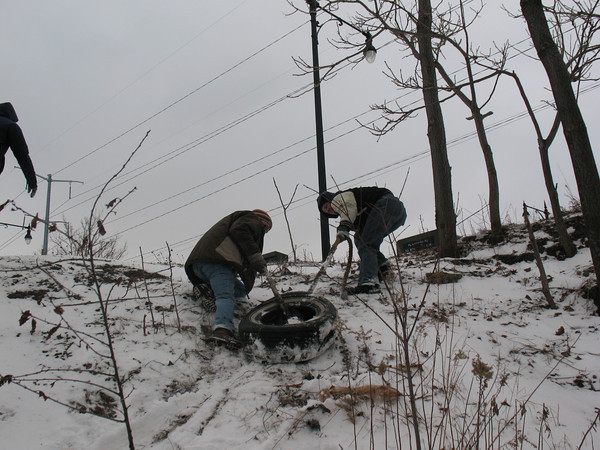
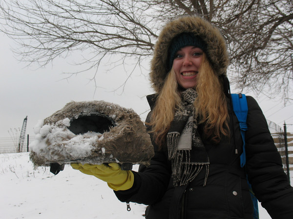
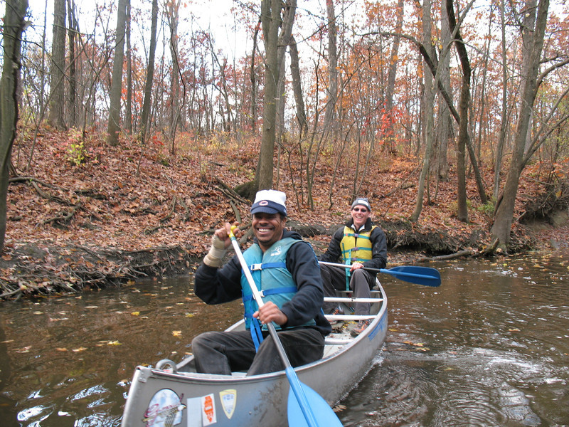
Twenty-five years ago, I had a once-in-a-lifetime opportunity to travel to Antarctica as part of a scientific research expedition from Woods Hole Oceanographic Institution. Taking a semester’s leave from my graduate studies at SUNY Stony Brook, I worked for two months as a field technician and writer-in-residence on a team researching the biogeochemistry of Lake Fryxell, a permanently frozen-over lake in Antarctica’s Dry Valleys. This extraordinary experience was memorable in many ways, including a brief three-day stopover in New Zealand, where we made our final preparations at the US Antarctic Program’s headquarters in Christchurch before flying to McMurdo Station on the Ross Ice Shelf.

new-zealand-mapNow as a mid-career academic seeking new challenges and opportunities beyond my Midwestern home at the southern rim of the Great Lakes — and having traveled outside the US (to Canada) only twice during this time — I decided to apply for a Fulbright Scholar fellowship to explore a distant locale that has always resonated powerfully in my memory. But this time, instead of a mere fleeting taste of Christchurch and a brief fly-over of the North and South Islands, I hope to spend several months in 2018 researching, writing, and living in New Zealand, based at Lincoln University a few kilometers outside of Christchurch, in order to enrich my understanding of urban river ecosystems as well as gain a much-needed global perspective on my scholarship and teaching.

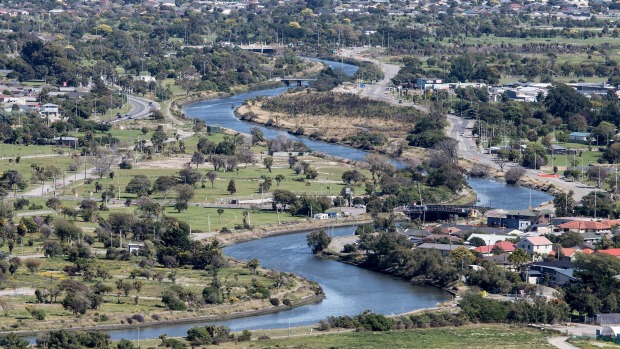
Objectives and Methodology: My proposed project focuses on the Otakaro-Avon River that flows through Christchurch, NZ, as a natural and human ecosystem undergoing stress and change. The Otakaro-Avon is an important focal point of urban sustainability planning and ecological restoration. Using the qualitative research framework of the environmental humanities, which blends insights and analytic methods from literary studies, environmental history, ecology, and other disciplines, I plan to undertake an ecocritical study of this urban river’s history, present condition, and future prospects in the context of urban redevelopment underway after the 2011 earthquake that devastated Christchurch and many of its suburbs. This place- and observation-based perspective on the Otakaro-Avon watershed merges humanistic scholarship with physical exploration of the river as a highly modified, impaired, yet still biologically rich ecosystem with great sociocultural significance.

Otakaro-Avon River, Christchurch NZ (photo: Ian McGregor, The Press, 15 July 2016)

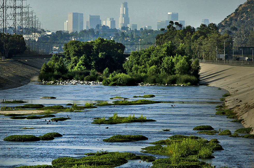
I will examine a wide range of “water stories” focused on the river — from historical documents to scientific analyses to technical reports — as well as current representations of the river in post-earthquake planning documents and journalistic accounts; conservationist, community-based, and indigenous discourse; plans for memorials and sustainable redevelopment along the river; and works of literature, film, and online media. This research will influence the crafting of my own stories of the Otakaro-Avon River and its fluid future, based on my in-the-field observations and experiences, in both narrative forms suitable for general readers as well as in scholarly prose for academic audiences — much as I have done in my recent work on the Chicago River‘s history, ecology, and future sustainability.

Key questions to be addressed in this project include but are not limited to:

  • How has the Otakaro-Avon River been utilized, modified, polluted, exploited, abused, defended, etc. over time? How does the history, quality, and character of the river inform people’s relationship to its present state and future prospects?
  • In what ways is the river important, economically and culturally, to the Maori indigenous people (as mahinga kai, a food-gathering place) as well as New Zealanders of European descent? How do people in Otakaro-Avon River’s watershed connect to the waterway? What kinds of activities do they undertake in terms of recreation, industry, and conservation?
  • What role do the river’s conservation and restoration have in the ongoing redevelopment of Christchurch’s Red Zone and within the city’s future sustainability?
  • How do the above issues intersect with questions of environmental justice, especially with respect to toxic pollution, public access to water resources and open space, and iwi (indigenous people) living with the Otakaro-Avon River watershed?

As an interdisciplinary-minded scholar within the environmental humanities, I employ a qualitative research approach. Using the analytic tools of ecocriticism, I emphasize the close reading and analysis of individual texts, their relationships with one another, and their place in the broad contexts of scientific discourse, nature writing, environmental history, and sustainability. At root, my work starts from the premises that the urban environment (both built and natural) is a worthy object of study; that natural resources are imperiled and therefore in need of protection and conservation; and that humanistic inquiry about the myriad relationships between humanity and nature in cities can foster, in the long run, ecological awareness and environmental progress.

The LA River in 2010 (photo by Mark Boster of the LA Times)

Academic and Professional Context: Urban rivers are many things simultaneously: corridors of biodiversity, green infrastructure for storm water retention, transportation arteries for commerce, waste sinks, places of human recreation, and sites of environmental restoration. This partial list illustrates their dual nature: waterways in cities are all too often heavily polluted, modified, and abused ecosystems that bear scant resemblance to their former selves. They function as receptacles of waste and servants of commerce/industry, at the expense of water quality and biodiversity; and in many cases, city dwellers are physically as well as culturally cut off from access to waterways.

RU students paddle the North Branch of the Chicago River, Fall 2013 (M. Bryson)

Yet urban rivers also harbor tremendous renrenga ropi (biodiversity) and exhibit a capacity to connect citizens to the natural world that exists cheek-by-jowl with the built environment as well as to their cities’ natural and cultural histories. In this sense, damaged urban water systems are pathways of connection that can foster a sense of place vital to building an environmental ethic of care among city dwellers.

Geographers, urban ecologists, environmental scientists, and sustainability scholars are assessing waterways as a critical component of urban ecosystems. Given that cities consume energy and resources from far beyond their geographic boundaries and produce high levels of waste as well as greenhouse gases, their future sustainability depends upon large-scale actions such as repairing water/wastewater infrastructure, conserving energy, improving transportation access and efficiency, enhancing biodiversity, and reducing material waste.

RNZAF aerial survey of damage, showing flooding due to soil liquefaction in Christchurch NZ (Royal NZ Defence Force)

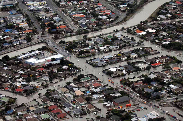
Such goals are complicated and made urgent by the destructiveness of natural disasters. The 2011 Christchurch earthquake provides a monumental challenge as well as golden opportunity for inclusive and socially just urban planning that embraces environmental sustainability as a central goal. Unsurprisingly, the Otakaro-Avon River is prominent within this planning and rebuilding process (and illustrative of its many challenges).

More broadly, urban rivers provide a specific context for assessing the impacts of global urbanization on human relationships to nature. As of 2015, over 50% of the world’s population is urban; in the US and NZ, that figure is 82% and 86%, respectively, according to the World Bank. A consequence of this is a pervasive (though hardly universal) alienation from the natural world of urban citizens. River systems constitute important natural resources where people can have direct and meaningful contact with nature close to where they live.

The stories we tell about cities and rivers are a means of grappling with the ideas and questions noted above. While the natural and social sciences generate vital empirical data on urban rivers, the role of the arts and humanities is uniquely critical to understanding urban waterways and our relationships to them. Our “water stories” are both a means of representing our values and history as well as a method of critique. The fundamental power of storytelling within human experience points to the impact of artistic expression and humanistic analysis on understanding the importance of waterways within urban ecosystems and human communities.

Significance of Study: Understanding the role of water in urban ecosystems is vital to improving the resilience of cities (e.g., protecting people and property from floods and other environmental disasters) and making them more sustainable (e.g., improving water retention and quality through expansion of green infrastructure). Cities are where most people in the world now live, a trend that will continue in coming decades as we grapple with the impacts of climate change, water quality degradation, toxic pollution, and environmental injustice. As a vital resource for all human communities, water is an important node of inquiry within environmental science and, more broadly, sustainability studies.

Urban rivers (and their watersheds, which include tributaries, wetlands, and estuaries) are ideal barometers of the ecological and socio-cultural health of our cities as well as our attitudes about and connections to the natural world. The Otakaro-Avon River is one of New Zealand’s most polluted waterways and, at the same time, one of its most important — both ecologically and symbolically — given the high number of people who live and work within its watershed and its centrality within the city’s earthquake recovery process.

Enhancing our knowledge, awareness, and appreciation of the river’s status and value is vital to its remediation and restoration as a living ecosystem that is not just an integral part of Christchurch’s green infrastructure, but also a significant thread within the city’s historical and cultural fabric. My research will explore how stories have defined the Otakaro-Avon River thus far, and how new ones might shape its sustainable future.

Why New Zealand? As an island country distinguished by highly diverse ecosystems, small and large cities, a vibrant indigenous culture, famously productive agricultural lands, longstanding conservation values, and threatened ecosystems and natural resources, New Zealand is a remarkable laboratory for exploring questions of environmental sustainability in the early 21st century.

Possessing a uniquely complex postcolonial mix of people from indigenous Maori (tangata whenua), European, and trans-Pacific Island cultures, New Zealand is progressive in its formal and structural recognition of indigenous rights, which has important implications for urban sustainable development and environmental conservation. More locally, Christchurch is a vitally important urban center: not only is it the biggest city on the South Island (pop. ~366,000), but its ongoing efforts to recover from the devastating earthquake in 2011 make it a test case for how cities can respond to natural disasters and seize opportunities to improve the sustainability of urban infrastructure, revitalize waterways, increase open space, enhance biodiversity, and involve the citizenry within the ongoing planning and reconstruction process.

Lincoln University: An incredible wealth of people and resources exist in and around Christchurch that would be invaluable to me as a scholar and writer. The Faculty of Environment, Society, and Design and its Department of Environmental Management at Lincoln University — a land-based institution located near Christchurch with a phenomenal array of environmental academic programs and research centres — offer an interdisciplinary community of scholars and teachers dedicated to environmental research and sustainability education.

LU’s Centre of Land, Environment, and People (LEaP), which is closely affiliated with the aforementioned Faculty, provides an intellectual home for research and collaboration with scholars and students from diverse disciplines spanning the natural/social sciences, the humanities, and various technical fields. Additionally, the Waterways Centre for Freshwater Management, a research collaboration between LU and the University of Canterbury, has published a wealth of technical reports on water resources throughout the Christchurch metro area and the Canterbury region, and would be an invaluable resource for advice and collaboration.

IL EPA Hears Southeast Side Residents’ Complaints about Petcoke Piles along Calumet River

Last Thursday the Illinois EPA held a contentious public meeting on Chicago’s SE Side to hear residents’ concerns and complaints about the massive piles of petcoke — a waste by-product of tar sands oil refining done in nearby Whiting, IN — being accumulated along the industrialized banks of the Calumet River, in close proximity to the East Side and Deering neighborhoods of Chicago.

As reported here last Friday, 15 Nov 2013, by Progress Illinois:

A Chicago community meeting the Illinois Environmental Protection Agency (IEPA) hosted to discuss a proposed construction permit for KCBX Terminals Company quickly escalated into angry shouting from Southeast Side residents fed up with the firm storing large piles of petroleum coke, or petcoke, near their homes.

KCBX, which is controlled by the conservative billionaire brothers Charles and David Koch, stockpiles the petcoke, a byproduct of oil refining, along the Calumet River on Chicago’s far Southeast side. The thick, powdery petcoke is sent to KCBX from a BP refinery in Whiting, Indiana. East Side and South Deering residents have been sounding the alarm for some time now that petcoke dust is blowing into their neighborhoods and getting into their homes.

“No one asked us if we wanted to have these piles dumped in the first place. They just did it,” Southeast Side resident Sue Garza told the IEPA officials at the packed two-hour meeting, held at the East Side United Methodist Church. “We have been the toxic dumping ground here for over 100 years. We don’t want it anymore.”

Brad Frost with IEPA’s office of community relations said KCBX is seeking a revised construction permit from the agency in order to bring new equipment, including 10 portable conveyors, a stacking conveyor and a portable hopper, to its site at 10730 S. Burley Ave. According to Frost, the company is not looking to increase its input or emissions.

“They can’t handle their [petcoke] dust now,” resident Guillermo Rodriguez fired back. “How is it not going to increase?”

Residents grew frustrated with IEPA officials, pointing out that the community is against the company’s activities and noted that issuing such a permit would allow for its site expansion.

“It is very simple,” said community member Martin Morales. “We don’t like it. We don’t want it. (Petcoke pollution is) making us sick. What else do you need?”

One person later shouted, “Move the piles! Who cares about the conveyors?” Another said, “If you’re the protection agency, protect us!”

“How many people have to get sick before you do something,” asked resident Ken Keefer. “Is there a certain number that have to come down with asthma or cancer before you do something? This has been going on for two, three years. And this is the first time you guys have shown up.”

Frost said the IEPA would take into account the comments made at the meeting, but noted that the IEPA has received very few formal, written complaints about specific issues involving the site.

One man fired back, “We can’t even open our windows because of the soot.” Later, the audience began to chant, “Move the piles!”

“Answer the question. When are you going to move the piles,” a gentleman asked the officials, which promoted another person to exclaim, “When we’re all dead!”

“Obviously there a lot of people here concerned about the facility,” Frost stressed. “We need to see [formal] complaints. That’s one thing we use to determine whether there are problems at sites.”

Frost did make a point, however, to stress that even though the agency has received few formal complaints, the IEPA is pursing enforcement against the company.

Earlier this month, Illinois Attorney General Lisa Madigan filed a lawsuit on behalf of IEPA against KCBX over alleged air pollution violations. In a statement, Madigan said the toxic mounds at KCBX’s storage site “are growing by the day without the appropriate protections to ensure nearby residents’ health and safety.”

Chicago residents from the far South Side protest the siting of petcoke waste along the Calumet River at an IEPA public meeting on Th 14 Nov 2013 (photo: Progress Illinois)

Community members asked lawyers from the attorney general’s office, who attended the meeting, what else could be done to more quickly shut down the facilities and get rid of the petcoke mounds. The officials stressed that the current case is pending, and it has to go through a formal legal process.

Additionally, a group of Southeast Side families filed a lawsuit at the end of October against KCBX and a few other companies that store petcoke. The lawsuit came on the heels of notices of air pollution violations the IEPA recently issued to Beemsterboer Slag Co., which also stockpiles the coal-like waste product along the Calumet River.

BP is in the process of modernizing its Whiting refinery and plans to to boost the amount of petcoke it produces at the facility to 2.2 million tons of a year.

Tom Shepherd with the Southeast Environmental Task Force told the crowd that the current issues the community is experiencing is only “the tip of the iceberg.”

“There’s going to be at least three times more than is over there today,” he said. “Today we’re getting 700,000 tons a year, but once that coker goes online, it’s going to increase to 2 million tons a year. That’s 6,000 tons a day.”

“Imagine how many trucks, barges and trainloads are going to be coming through our neighborhood,” Shepherd continued. “If they’re getting a permit for 10 additional conveyors over there, that means that they’re going to increase ten-fold, but we heard three-fold. That’s scary enough.”

The audience really got peeved when they learned the IEPA has to make a decision regarding KCBX’s permit next week. IEPA officials wouldn’t say whether they would be extending the review period for the permit, approving the permit or denying it.

“You’re here a week before,” Rodriguez later asked. “Where were you when this all started, when this began? Where were you then? Who’s protecting our water source? They’re pumping water out of that lake and they’re spraying their piles. That runoff goes where? It goes into our streets. It goes into our drinking water. If you think this is a good idea, let’s put it in your backyard.”

Residents called on Ald. John Pope (10th), who attended the meeting, to speak, but then heckled and interrupted him. Pope made a point to stress that he has been working with elected officials at the local, state and federal levels to see what can else be done about the piles.

“As much as we all are passionate about the problems, there’s got to be a formal process, and it starts unfortunately with the complaints,” he added. “I know everyone’s complained in the past, but there’s got to be formal complaints lodged.”

Piles and Piles of Petcoke: Environmental Justice along the Calumet River

Nowak instudio250Today’s Mike Nowak Show on WCPT features a segment about the petcoke controversy in the Calumet Region of Chicago’s far South Side. This waste by-product from the refining of oil from the tar sands of Canada has been piling up along the banks of the Calumet River by Koch Industries, on behalf of BP, which operates a refinery across the state line in Whiting, IN. As noted below, the piles give off clouds of dust in windy conditions, which then disperse among the adjacent neighborhoods — communities that have endured decades of environmental hazards and industrial degradations from steel plants, fuel refineries, landfills, and illegal waste dumps.

I’m reproducing Nowak’s written preview of his radio show here, because (just as he does for his radio show every week) it maps out many of the twists and turns of this emerging storyline, plus provides numerous links to news and environmental resources.

Pet coke piles along the Calumet River: Did they come from Detroit?

Ten days ago I received this message from Tom Shepherd of the Southeast Environmental Task Force (SETF):

Dear Friends in the Clean Power Coalition and All Others,

Thank you to those in the coalition and others that have joined the Southeast Environmental Task Force in coming to the table to try to find a solution to the petcoke problem that has been developing on the southeast side. The petcoke is a by-product (or waste product, if you will) of the tar sands that are being pipelined and shipped in other ways to the British Petroleum refinery in Whiting, Indiana (just over the state line from Chicago) for processing.

Much has happened in the weeks since we met to discuss this urgent problem:

We have conducted two tours for legislators and staffers of public officials; met with Koch Bros. / KCBX company officials; have been out on the Calumet River twice doing inspections and video shoots; given a host of interviews; have been fielding numerous calls and complaints; prompted investigations by the USEPA and Illinois Atty. General; and are planning a community meeting on Oct. 24 to raise awareness and to educate neighbors nearest to the huge, black piles of dusty petcoke that are most affected by it.

You would think that a part of Chicago that has suffered so much environmental degradation would at some point catch a break.

You would be wrong.

With the shuttering of three coal fired power plants in the area–the State Line, along the border of Illinois and Indiana, as well as the Fisk and Crawford plants in Chicago–the need for coal and accompanying storage facilties in which to keep it has dropped dramaticaly.

Mounds of petcoke on barges (Photo: Josh Mogerman)

But in an almost perverse turn of events, the controversial BP Whiting, Indiana refinery is about to finish a $3.8 billion expansion, which will make it the world’s second largest coker, which will process Canadian tar sands at an astounding rate. One of the by-products of that industry is something called petroleum coke or “petcoke.” According to Henry Henderson at the Natural Resources Defense Council (NRDC),

BP Whiting is now the second biggest producer of petcoke amongst American refineries. They will be spitting out 6,000 tons of the stuff a day ; more than 2 million tons annually.

Unfortunately, petcoke has a nasty habit of becoming wind-borne and ending up on people’s counter tops, windsills and in their eyes and lungs. And BP is now moving vast amounts of this substance across the state line to Chicago to holding areas on the banks of the Calumet River. Why? Because the environmental regulations aren’t as strict here. Which is ironic, considering that just last year BP agreed to a $400 million settlement with state and federal agencies as well as environmental and community groups over air quality standards around the Whiting facility.

At least this time, the threat to Chicago’s southeast side is being reported by some of the local media, including the Chicago Tribune and Chicago Tonight on WTTW. After being alerted by SETF, NRDC produced its own video of the rising piles of petcoke along the Calumet.

And Chicago isn’t even the first city to deal with this particular issue. Earlier this year, citizens of Detroit were alerted to similar clouds of black soot wafting over communities along the Detroit River. After public outrage from neighborhood groups and online entities like Sw Detroit Marathon Exposed and DCATS – Detroit Coalition Against Tar Sands, Detroit Mayor Dave Bing ordered the piles removed.

But where did the stuff end up? Nobody seems to know.

That’s where the headline at the top of this story comes from. The SETF’s Tom Shepherd says that he has asked the companies storing the petcoke in Chicago exactly where it came from and how it got there so quickly. But he has not received a straight answer. Is it possible that Chicago is now storing the petcoke that was ordered out of Detroit?

How are these two cases similar and how do they differ? According to a story on Climate Progress,

Detroit’s pet coke piles were produced by Marathon Refinery but owned by Koch Carbon, a subsidiary of Koch Industries. In Chicago they are owned by KCBX, an affiliate of Koch Carbon, which has large parcels of land along the Calumet River and, according to Midwest Energy News, expanded its presence in the area last year.

As you can see, the common denominator is Koch Industries. From an article on Daily Kos:

Because it’s a waste product of oil refining the Kochs sell it for prices cheaper than coal to poor nations willing the accept pollution as a trade off for cheap energy. Petcoke is the carbon cost ignored in the State department analysis that falsely claimed that Keystone XL tar sands oil will not significantly increase greenhouse gas pollution compared with conventional oil.

Petcoke protestors in Chicago (photo: J. Mogerman)

Which leads some people to refer to the substance as “petkoch.” The other connections, as noted above, are issues like the transportation of tar sands oil, the Keystone XL Pipeline, and recent tar sands oil spills like the one near Kalamazoo, Michigan, in 2010. Three years later, tar balls can still be found along the banks of that river, and dozens of families have been permanently displace.

That led to an action by the Michiana Coalition Against Tar Sands (MICATS) in September. As reported, interestingly, in the eNews Park Forest, they

set up a blockade of Enbridge Inc.’s expansion of tar sands pipeline 6b. This pipe- the same that ruptured in 2010 causing the largest and costliest inland oil spill in history- is currently under construction to increase the flow of tar sands from 240,000 barrels per day to 500,000 barrels per day.

It never ends, does it.

To address this very serious environmental issue, I’m pleased to have Tom Shepherd from SETF in studio. Joining us via phone are Chris Wahmhoff of Michigan Coalition Against Tar Sands (MI CATS) and Stephen Boyle from DCATS. By the way, Boyle points out that the Calumet River is currently the subject of remediation efforts by the U.S. EPA:

The 1.8-mile stretch of the river from Indianapolis Boulevard to Hohman Avenue is currently undergoing projects designed to remove contaminants and restore habitat. 350,000 cubic yards of sediment are slated to be removed and a cap will be placed over the dredged sediment. Wetlands and nearshore habitats will be restored with native plants following the completion of the dredging, expected in 2016.

Gosh, I can’t imagine that tons and tons of petcoke could possible affect that planned restoration.

Source: Mike Nowak, “This Week’s Show” (27 Oct 2013)

Presenting at SLSA 2013: Water & the Postnatural City

UND in fallYesterday I arrived at the University of Notre Dame in South Bend, Indiana — my first visit to this storied campus — to participate in the annual meeting of the Society for Literature, Science, and the Arts. This year the conference theme is “Postnatural.”

My talk yesterday afternoon was part of a panel entitled “Water and the City,” and included stimulating presentations by Christine Skolnik of DePaul University (“Imagined Eco-Futures” Restoring the Current” [of the LA River]) and Peter Hobbs of York University in Toronto (“What Does Lead Do? Toxic Entanglements, Exposures, and Cosmo-Chemo-Politics”).

Below is the introduction to my talk, which was an extemporaneous exposition of this slideshow (pdf, 10MB file).

Water and the Postnatural City: Reversals, Invasions, and Prospects for Sustainability

It is hard to think of a natural substance more vital to life than water. Yet, “the natural” is difficult to locate amidst the bewildering complex of intakes, filters, screens, pumps, chemical treatment chambers, distribution mains, pipes of all sizes, gutters, storm drains, sinks, sewers, settling tanks, combined sewage overflows, canals, locks, oxygenating waterfalls, electric fish barriers, and myriad other technological accouterments that allow us to convey, control, imbibe, and dispense with freshwater/wastewater in our cities and suburbs.

One of the tunnels within the Deep Tunnel / TARP system (photo: Chicago Tribune)

Despite the utter domination of water’s movement by what environmental engineers call the “hard path” of water resource management, however, the capacity of even highly degraded urban river corridors to support surprising levels of biodiversity — not to mention the tendency of urbanized landscapes to flood — demonstrates that Nature in the form of wild (read: violent) water frequently reasserts its power over us.

This presentation takes a deep dive into the water resources and management systems of the Chicago Region to ask:

  • What does it mean for the aptly named Chicago Area Waterway System to be “postnatural,” and why has it been such for so many decades?
  • How does a dredged, straightened, polluted, reversed, flushed, rerouted, industrialized, and biologically invaded since the mid-19th century urban river become a locus of urban sustainability and ecological restoration in the 21st century?
  • In what ways are Chicago’s rivers and canals connected to its other vital water resources and systems: fresh water supply (intake) and wastewater (outflow)?
  • Finally, what might the salient tropes of various Water and the City narratives teach us about our capacity to explore and apprehend an urbanized but still wild (read: unpredictable) nature in a postnatural age?

Snow on the Ground, Water on the Mind

Last Saturday, Feb. 23, my SUST 220 Water students (both past and present) joined me at a wonderful annual event here in the Windy City: the Chicago River Student Congress, convened by the environmental conservation organization Friends of the Chicago River. This 2013 celebration of river conservation and environmental education was held at Marie Curie Metro High School on Chicago’s SW Side, and featured yours truly as the “special guest speaker,” a designation that made me proud and humble at the same time, for I still consider myself a student of rather than an expert about the Chicago River.

The Chicago River: Transformed, Exploited, and Abused — but Still Alive
Chicago River Student Congress Special Guest Presentation (pdf version)

SUST majors Ron Taylor, Angi Cornelius, and Ken Schmidt at the 2013 Congress

Last year, I co-presented a workshop session on Water and Sustainability with then-SUST major (and now alum) Amanda Zeigler (BPS ’12); you can view a pdf of our slideshow from that 2012 workshop. This successful experience led me to recruit three students from my Fall 2012 Water class at Roosevelt to be fellow participants in this year’s Congress. The fact that my Fall and Spring Water classes this academic year are partnering with Friends of the Chicago River on a “Blueways to Green” environmental education grant made that prospect irresistible.

Former canoeing partners and classmates, Ron Taylor and Ken Schmidt — whose collective nickname “Ebony and Ivory” demonstrates the awesome power of the river to bring together people of all races, creeds, and colors — agreed to co-present a workshop with me entitled “Sustainability and the Chicago River: from Urbanization to Pollution to Restoration,” which we did twice during the course of the Congress (here’s the pdf of our slideshow (8MB file). Ron and Ken skillfully shifted back and forth in their presentation, and were able to elicit lots of dialogue from their audience member, mainly students from CPS high schools who have done environmental conservation and/or science projects on the river.

Meanwhile, roaming the halls of the Congress was fellow SUST major Angi Cornelius, another student from my Fall 2012 Water class, who indulged her theatrical side by dressing up as one of six “Super Villians” who represented ecological/social threats to the biodiversity and water quality of urban rivers. Angi’s character was “Z. Mussel” (the zebra mussel, naturally), an invasive bivalve species that she refashioned into the persona of a Russian femme fatale. Along with her fellow Villians, Angi worked the crowd throughout the morning by engaging students in small group conversations about the impact of invasive species on rivers, streams, and the Great Lakes ecosystem.

Students from my current section of SUST 220 Water met at the Congress for our 4th week of class and our 2nd field session of the semester. The Congress is a unique learning opportunity, as it features a wide variety of speakers and workshops — some by high school teachers and students; some by college profs and students; and a few by conservationists, environmental professionals, etc. — that provide attendees with science-based knowledge about the river’s history, ecology, present status, and future prospects.

For photos of the Congress, check out my annotated slideshow as well as this online album from the Friends of the Chicago River’s Facebook page.

Hiking the trail at Portage Woods; Joliet and Marquette were here about 340 years ago

Following the Congress and a quick sack lunch at the high school, during which we bade farewell to Ron, Ken, and Angi, my 220 scholars and I carpooled to a nearby Cook County Forest Preserve location that has profound historical and geographic significance to the city of Chicago, the Chicago and Des Plaines Rivers, and two of the great North American watersheds (those of the Great Lakes and the Mississippi River). This is the Chicago Portage National Historic Site at 4800 S. Harlem Ave. in Lyons, one of only two National Historic Sites in the entire State of Illinois.

If the Metropolitan Water Reclamation District’s Stickney wastewater treatment plant just to the east is a supreme example of how we use technology and the built environment to control water as a resource (and deal with the problem of wastewater), the Chicago Portage is polar opposite kind of experience. Here we see the landscape much as it appeared to the 17th century explorers Louis Joliet and Pierre Marquette, when they crossed Mud Lake (now occupied by the Stickney WTP) between the Des Plaines and Chicago Rivers, thus staking out a trade route between the Great Lakes and the Gulf of Mexico.

Picking up trash from the shoreline of the Chicago River's South Turning Basin, at the mouth of Bubbly Creek
Picking up trash from the shoreline of the Chicago River’s South Turning Basin, at the mouth of Bubbly Creek

Our last stop of the day was further east on Interstate 55, where we exited north on Ashland Avenue and stopped at Canal Origins Park. This riverside parkland (and fishing spot) provides impressive views of the present-day juncture of the Chicago River’s South Branch and Bubbly Creek, and commemorates the origin of the historic I&M Canal, which was constructed from 1836 to 1848 and fulfilled Joliet’s dream of connecting the Great Lakes with the Mississippi River system. Here, then, is a superb spot to talk about the history, ecology, and geography of the creeks and rivers which run through the city, as well as the industrial and wastewater treatment processes that have polluted these waters over the years.

At Canal Origins, we engaged in some good old-fashioned service learning, Roosevelt-style, by donning work gloves and picking up any litter/recyclables we came across. A recent blanket of snow concealed most of the litter in the upper part of the park, along the busy street. But down at the river line at the South Turning basin, where Bubbly Creek enters into the South Branch, lots of garbage and urban detritus presented itself for our labors.

Conor and Chris drag a heavy tire up the steep slope from the river's shoreline
Conor and Chris drag a heavy tire up the steep slope from the river’s shoreline

My students hurled themselves into this effort with purpose and enthusiasm, not the least impressive for coming at the end of a rather long day to that point. All manner of intriguing (and sometime revolting) artifacts were retrieved, from beer cans to paper cups to plastic bags to old clothes and towels to large pieces of ships’ rope to automobile tires to tampons to (most bizarre) fur-covered rat traps with wheels.

Here’s an annotated slideshow of photos from the day of our visit to Chicago Portage and Canal Origins.

After heroically hauling a heavy, ice-filled tire out of the river and up a steep slope, using one of the old ships’ ropes as a winch line, Conor and Chris suggested that the SUST program at RU should adopt the Canal Origins Shoreline as a parkland, and clean up litter there on a regular basis.

Doesn’t sound like a bad idea to me.

The day's most bizarre find: a furry rat trap, on wheels? We're not sure.
The day’s most bizarre find: a furry rat trap, on wheels? We’re not sure.


Winter Symposium on Sustainability at Augustana College

Today I head west to the city of Rock Island, which hugs the Mississippi River in northwestern Illinois (right across the water from Davenport, Iowa). I’ve been invited to give a talk on urban sustainability issues in Chicago at Augustana College’s annual Winter Symposium, which this year is focused on sustainability and environmental issues. Since I can never resist a chance to talk about urban waterways, my talk is entitled “Paddling the Chicago River: A Good Way to Think about Science, Art, Ethics, and the Sustainability of Cities.”

Heading downstream on the Upper North Branch, about a half-mile from our destination in the Linné Woods forest preserve in Morton Grove, IL (M. Bryson)
Heading downstream on the Upper North Branch, about a half-mile north of Linné Woods forest preserve in Morton Grove, IL, north of Chicago, Oct. 2012 (M. Bryson)

The degraded yet undeniably charismatic Chicago River is a mighty fine place to contemplate the tangled relationships among water quality, land use, and sustainability within cities and suburbs. As a site for exploring urban nature, an object of analysis in the scientific assessment of water quality and urban ecology, and a case-study in landscape aesthetics, the Chicago river provides students and citizens myriad opportunities to develop a sense of place. More generally, experiencing urban rivers — and understanding their function within the complex watersheds of metropolitan regions — can foster not just ecological literacy about urban ecosystems but also ethical engagement with one’s community.

Here’s a pdf version of my presentation.

Canoeing the Upper North Branch of the Chicago River

This past Saturday, students in my SUST 220 Water and PLS 391 Natural Science seminars at Roosevelt University joined me for an urban ecology adventure on the Upper North Branch of the Chicago River. We convened mid-morning at Linné Woods, a woodland site locatedin the Cook County Forest Preserve system in Morton Grove, IL, where we met up again with Mark Hauser and Claire Snyder, naturalists from Friends of the Chicago River, for a water quality sampling session of the river where it flows past the lovely picnic grounds in Linné Woods.

Claire Snyder and Mark Hauser, naturalists from Friends of the Chicago River (M. Bryson)

While this was the second go-round for my 220 Water students on field sampling (our first session was further downstream on the North Branch, at West River Park in Chicago), the students from my natural science seminar were new to this exercise; however, after three weeks of being introduced to issues and concepts in urban ecology (from biodiversity to climate change), they were ready to get out in the field and get their hands dirty.

Breaking up into different teams, we measured key chemical indicators such as temperature, turbidity, pH, dissolved oxygen, nitrate, phosphate, and total dissolved solids; and wading into the river with D-nets to scrape up mud in search of macro-invertebrates (worms, leeches, crawfish, snails, damselfly nymphs, etc.), we also garnered a biological snapshot of the river’s relative quality.

Down from the meadow and near the riverbank, Claire discusses the various chemical and physical tests we’ll perform to assess the water’s overall quality: pH, nitrate, phosphate, dissolved oxygen, temperature, total dissolved solids, and turbidity. Half our group work on gathering these measurements, while the other half work on the biological survey with Mark. (M. Bryson)

Taken together, these two approaches give us an in-the-moment (chemical) and over-the-longer-term (biological) assessment of the ecological health of the North Branch. This is because while the chemical profile of a river can change day to day — even hour by hour — depending upon the weather and various inputs into the watercourse, the biological community in the river’s benthos is stationary; and some of organisms that live there have been there awhile.

Our quality results were decidedly mixed.The chemical profile we established had some indicators looking rather good, such as a low nitrate reading of 1.3ppm and a fairly neutral pH of 6.5; turbidity levels were also reasonable. The low nitrate reading makes sense, given that in this area of the northern suburbs north of Dempster Ave. (Glenview, Golf, Morton Grove), communities use a separate sewer system, so wastewater treatment plants are not burdened by high inputs of stormwater run-off, and the waterways do not received Combined Sewage Overflows as they do in older suburbs and the city. Moreover, there is not much, if any, agricultural land in this part of the river’s watershed, meaning that fertilizer run-off from farm fields is not an issue.

Hunting for macro-invertebrates in the river’s water and sediments, under rocks, and along the shoreline (M. Bryson)

On the other hand, phosphate levels were rather high at 0.7ppm and the all-important indicator of dissolved oxygen was fairly low (at 7ppm and 60% saturation), posing challenges for many types of organisms to thrive in the river’s watercolumn and benthos. All in all, we calculated a “Quality Index” grade of 68% on our collective chemical analyses, or if you’re using a letter-grade system, D-plus. Nothing to write home about, despite the lovely, even bucolic, scenery in this part of the Chicago River which follows its natural watercourse and winds through forest preserve land. This assessment was echoed rather closely by our macro-invertebrate survey, which identified 8 different taxa of organisms, ranging from several that are “modertely intolerant to pollution” to four that are “fairly” to “very tolerant” of impaired water quality. Our Water Quality index of 2.6 was on the low end of “fair” in terms of biological diversity (call it a C-minus).

Measuring stream flow (M. Bryson)

Finally, our group waded into the stream and use measuring tape, rules, a stopwatch, and a collection of sticks to calculate the stream flow rate. The trick here is to stake out a place where the width and depth of the river is known, and then release the sticks in the current. Students time how long it takes each stick to travel a given distance (here, 40 feet) and then calculate the stream flow (cubic feet/second) accordingly. Our result: a stream flow rate of 98 cubic feet per second.

Curious readers can review our original field data sheets and calculations here; and for photos of our water sampling activities, see this online slideshow.

Here on the upper North Branch, the river follows its natural course and thus has lots of twists and turns. It took us about two hours to paddle five miles. Lots of overhanging branches required careful maneuvering. (M. Bryson)

After a picnic lunch, we used several of our vehicles to  shuttle our group up to our canoe launching spot five river miles north, at Blue Star Memorial Woods in Glenview. Here we met up with Dave Rigg and his fellow volunteer canoe guides from Friends of the Chicago River, who would lead us on an intimate exploration of the water, woodlands, and wetlands of the West Fork of the Upper North Branch of the Chicago River — one of the most scenic and naturalistic stretches of the entire Chicago River system. Dave and Co. gave the many inexperienced but enthusiastic paddlers in our group a paddling lesson, and once outfitted with our safety gear, paddles, and a canoe partner, we hit the water for what would be a two-hour downriver journey in utterly perfect October weather.

Ron and Ken getting ready for our first portage (M. Bryson)

The majority of this trip runs through forest preserve property, with the notable exception of the Chick Evans Golf Course that straddles the river where the North Branch splits into its Middle and West Forks. The result is that we traveled along the natural course of the stream, mostly unchanged from before the time of European settlement, with all its twists and turns and with a wide buffer zone of floodplain forest. The heavily vegetated riverbanks proved to be a stunning contrast to the reinforced concrete and rusty steel that encases much of the Chicago River further south in the watershed.

Besides navigating all the twists and turns of a sometimes narrow and always lovely river channel, as well as ducking under overhanging branches, we had to negotiate two portages — the first for a couple of large downed trees, the second for a dam that is slated by the Cook County Forest Preserve for future removal, since it no longer serves a practical purpose and has deleterious impacts upon the river’s flow, water quality, and recreational value.

Portaging around some downed trees (M. Bryson)

These proved to be an interesting and fun challenge, though — especially given our previous contemplation of the long portages done by explorers and Native Americans between the West Fork of the South Branch, through the wetlands of Mud Lake, to the Des Plaines River (a place now commemorated by the Chicago Portage Historic Site).

More photos of our canoe trip can be seen in this online slideshow. In the near future, I’ll post some additional comments about the state of the river and its surrounding landscape that we observed on this trip.

This dam is a significant obstacle for canoeing humans and swimming fish; Friends of the Chicago River advocates its removal, the sooner the better. (M. Bryson)
Heading downstream on the Upper North Branch, about a half-mile from our destination in the Linné Woods forest preserve in Morton Grove, IL (M. Bryson)

Assessing Water Quality on the Chicago River’s North Branch at West River Park

Saturday, Sept. 8th, was the first day of class for my Fall 2012 Sustainability Studies 220 Water seminar at Roosevelt University. Instead of staying inside our classroom all day, though, we took advantage of excellent late-summer weather here in Chicago to take an urban river parklands adventure to Chicago’s North Side. From RU’s campus in downtown Chicago, we caught the Brown Line L train to a quiet and charmingly at-ground-level station near the end of the line (Francisco, in case you’re curious), where we walked through a quiet residential neighborhood just south of Lawrence Avenue to the entrance of Ronan Park. This is one of several parklands that border the North Branch of the River as it winds its way south through the city.

The North Branch of the Chicago River, as seen from the Ronan Park Bird Sanctuary trail
(M. Bryson)

We met up with naturalist-educators Mark Hauser and Claire Snyder from the environmental organization Friends of the Chicago River, who led us on a hike through the community-established Bird Sanctuary in Ronan Park — a charming linear greenspace that hugs the river and provides excellent wildlife habitat as well as soil stabilization with a lush landscape of native grasses and wildflowers as well as trees.

Hiking along the Ronan Park trail, through its restored Bird Sanctuary along the west bank of the river.
(M. Bryson)

Immediately north of Ronan Park, we entered West River Park, a multi-use parkland which provides numerous recreation activities as well as open space and excellent public access to the river. Prominent here is the confluence of the North Branch, which heads north for several miles out of the city and toward the Wisconsin border; and the North Shore Channel, a canal that was dug between 1907 and 1910 to provide a connection between Lake Michigan and the North Branch, thus increasing the flow and improving the water quality of the latter.

This confluence is an excellent place to examine the water quality of the river, for we were able to take a chemical and biological profile above and below the dam/spillway on the North Branch, which is just upstream from the North Shore Channel’s mouth. We measured key chemical indicators such as temperature, turbidity, pH, dissolved oxygen, nitrate, and phosphate; and wading into the river with D-nets to scrape up mud in search of macroinvertebrates (worms, leeches, crawfish, snails, damselfly nymphs, etc.).

In West River Park, north of Argyle Ave, looking north toward the dam/spillway on the North Branch. This wide area is the confluence of the N. Branch (which heads upstream to the upper left of this photo) and the North Shore Channel, built between 1907 and 1910 to provide an influx of Lake Michigan water (from Wilmette) for the North Branch.
(M. Bryson)

Above the dam, where the water travels downstream from the North Branch’s long journey southward through forest preserves and residential areas in the northern suburbs and North Side of the city, the water quality rated a “D” according to our chemical profile, mainly due to high suspended solids, high phosphates levels from polluted stormwater runoff, and low dissolved oxygen concentrations. Here our biological profile was slightly better (rated as “fair”) since we found a decent diversity of organisms, some of which are not highly pollution tolerant.

Sampling the macro-invertebrates living in the sediment and along the margins of the river, north of the spillway. This provides a biological sample of the river’s biodiversity and water quality, since different species of macro-inverts have different tolerance levels for pollution.
(M. Bryson)

Downstream of the dam, the chemical analysis results were a little better (“C-“), since the spillway served to oxygenate the water and significantly raise the dissolved oxygen value, which is critical for aquatic life to flourish. This was despite somewhat higher nitrate levels, which likely result from the wastewater effluent inputs to the Channel north of here, at the MWRD’s O’Brien wastewater treatment plant just north of Howard St.

The spillway is a great place for fishing, whether you’re a human or one of three heron species we saw that day (great blue, green, and black-crowned night).
(M. Bryson)

Both the North Branch and North Shore Channel are impacted by polluted stormwater runoff in the city and suburbs (which includes excess pesticides and chemical fertilizers applied to residential and commercial lawn properties, as well as from the ten golf courses within 20 miles of our sampling site); normal wastewater effluent discharges (where treated water nevertheless contains high bacterial levels, since effluent is not yet disinfected in a final stage of treatment, as in all other major US cities); and periodic combined sewage overflow (CSO) events, which occur when during a rainstorm the sewage system reaches capacity and untreated wastewater is released into the waterways to prevent sewage system back-ups into people’s homes.

Beyond learning to use the water sampling equipment and calculating a quick chemical and biological profile of the For images and notes from our trip, this trip allowed us to examine the way people interact with the river in an urban parkland, as well a discuss the river’s history of transformation here in Chicago. For more images from our day, see this annotated slideshow of photos; and check out the data from our sampling work at the link below.

West River Park Water Quality Data 2012-09-08 (pdf)

Looking southward on this scenic stretch of the North Branch, in West River Park.
(M. Bryson)

Leopold’s Shack, Wild Turkeys, and the Wisconsin River

This summer my family and I took our annual vacation to the Upper Peninsula of Michigan, where we camp out at the Bryson family cabin — a fairly humble one-room cottage in Hiawatha National Forest on the shores of little Crooked Lake (a lovely place to canoe and observe wildlife, among other woodsy pursuits). There’s no bathroom or hot water: just a hand pump in the cabin and an outhouse twenty yards out into the woods. The nearest little town of any note is about 12 miles up the road. Still, with a roof over our heads and electricity in the cabin, staying there feels rather more deluxe than, say, camping out in a tent.

After a week or so in the UP, we drove back roads through Wisconsin to Baraboo, where we spent a few days exploring the countryside and doing fun stuff with the kids. The Baraboo area is home to many delightful natural areas and sites of interest, including the much visited Devil’s Lake State Park; the beautiful though overly commercialized Wisconsin Dells; and the International Crane Foundation, a remarkable wildlife conservation facility. After our visit to the Crane Foundation north of Baraboo, we drove one of Wisconsin’s beautiful “rustic roads” that parallels a levee along the south bank of the Wisconsin River, and pulled off the road once we came to an unmarked turnoff in the middle of the woods.

Here I took a few minutes to hike a sandy road into a clearing not quite visible from the road. This is the site of “The Shack” — Aldo Leopold’s weekend retreat on the farm he purchased in the early 1930s as a family getaway and place where he could put into practice the conservation principles and restoration techniques he and others were developing in the early to mid-20th century.

Once a chicken coop that Leopold converted into a family cabin, the shack is a tiny structure by today’s standards. I realized as a walked around it, dwelling in its quiet presence, that it was significantly smaller than the 20×24-foot cabin we use in the UP — by comparison, our summer home is a roomy palace. Yet this humble shack looms large in American conservation and literary history, given its inspiration for Leopold’s classic 1949 work of environmental literature, A Sand County Almanac, and Sketches Here and There. Though I spent a mere twenty minutes or so at the site — listening to the wind filtering through the tree canopy, and wondering about the current of the Wisconsin River, flowing just to the north of the Leopold farmstead — it was impossible not to feel the power of this particular place. I left reluctantly.

As we drove east on Levee Road, we pulled off again to scale the grassy levee, which was topped by a profusion of wildflowers — and enjoyed a commanding view of the Wisconsin River, here a wide and fast-flowing stream with many sandbars and heavily-wooded shorelines. Further on up the road, my wife spotted a family of wild turkeys, which scuttled up over the levee at the noise of our passing. We stopped to take a look at them, and watched mesmerized as the male set ran off first in one direction, toward the river, while the female led her young away at a different angle, toward a copse of trees. An exciting and special moment, one I was glad to have on the heels of finally seeing Leopold’s cabin after many years of simply reading about it.

City Creatures: A New Blog

Here’s an exciting new blog to check out: City Creatures, a place of insightful writing about animals (and their human neighbors) here in Chicago’s urban and suburban environments. This is a project of the environmental non-profit organization, the Center for Humans and Nature, that will support and complement a book and art exhibit of the same name.

As a contributing author to the project and the blog, I’ll be writing about the Bubbly Creek ecosystem on Chicago’s Near Southwest Side and the many animals, past and present, that exist in that damaged yet resilient landscape — from the herons and other birds that find food and shelter within the creek’s waters and riparian zone; to the carp swimming below the surface that harbor bio-accumulated toxins in their tissues; to the decades-old offal from the millions of processed cows and pigs that was once dumped untreated into the waters of Bubbly Creek, and which is still slowly decomposing within its sediments.

Paddling south on Bubbly Creek, May 2012, on Chicago’s Southwest Side; to the right are 34th Street and the Iron Street Farm (M. Bryson)