Environmental reporter Michael Hawthorne of the Chicago Tribune has published a series of excellent articles this month about the state of water quality in Chicago and the suburbs. These detail the detected presence of lead, chromium, hormones, vinyl chloride, herbicides, antibiotics, and other contaminants — some of which are regulated by the EPA, others of which are not. He also reports on the latest developments in the Crestwood IL water scandal in which village officials knowingly laced their Lake Michigan municipal water supply with vinyl chloride-polluted well water for over 20 years.
This past Saturday, June 11th, students in my PLS 392 Seminar in Humanities online summer course at Roosevelt University took an “urban landscapes” field trip to Chicago’s near Southwest Side, where we visited two city parklands: Canal Origins Park on South Ashland Avenue, and Stearns Quarry (aka Palmisano) Park on Halsted Street. This afternoon field trip was a chance for us to discuss the history and ecology of these locations and their relation to Chicago’s urban landscape, as well as think about the visual aesthetics of these areas, the integration of nature and culture in urban environments, the importance of parks to city communities, and how such areas can serve as windows into the rich history of Chicago.
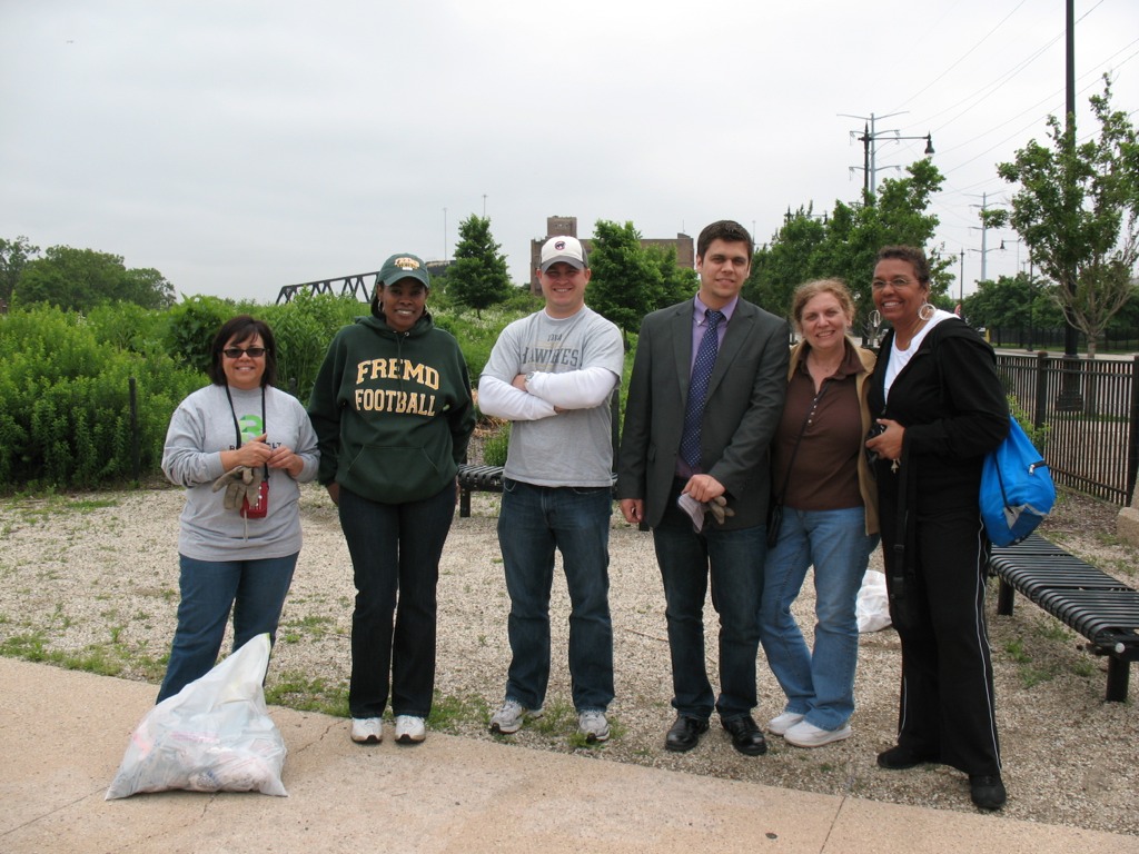
PLS 392 students help clean up Canal Origins Park before our walking tour of this urban parkland along the Chicago River, June 2011 (photo by M. Bryson)
We began our afternoon by meeting at Canal Origins and, before starting our walking tour of this 2002 riverfront parkland, picking up several bags’ worth of litter along Ashland Avenue near the park’s entrance. (Thanks to my students for pitching in like troopers!) Canal Origins provides impressive views of the present-day juncture of the Chicago River’s South Branch and Bubbly Creek, and commemorates the origin of the I&M Canal, which was constructed from 1836 to 1848. Use of the canal peaked in 1882 (when over a million tons of cargo were transported), but construction of Sanitary & Ship Canal in the late 19th century spelled the eventual demise of the I&M, as did the advent of railroad transport in the latter third of the 1800s.
The old canal, though, has made a comeback the during the last 30 years though the establishment of the I&M Canal Heritage Corridor by Congress in 1984 by Congress, which celebrates and promotes the Canal as natural resource, wildlife corridor, recreation destination, and source of cultural memory and historical preservation. Here at this area of Chicago, the canal is filled in and is covered by Interstate 55. Visitors to the park can see it only in their imaginations.
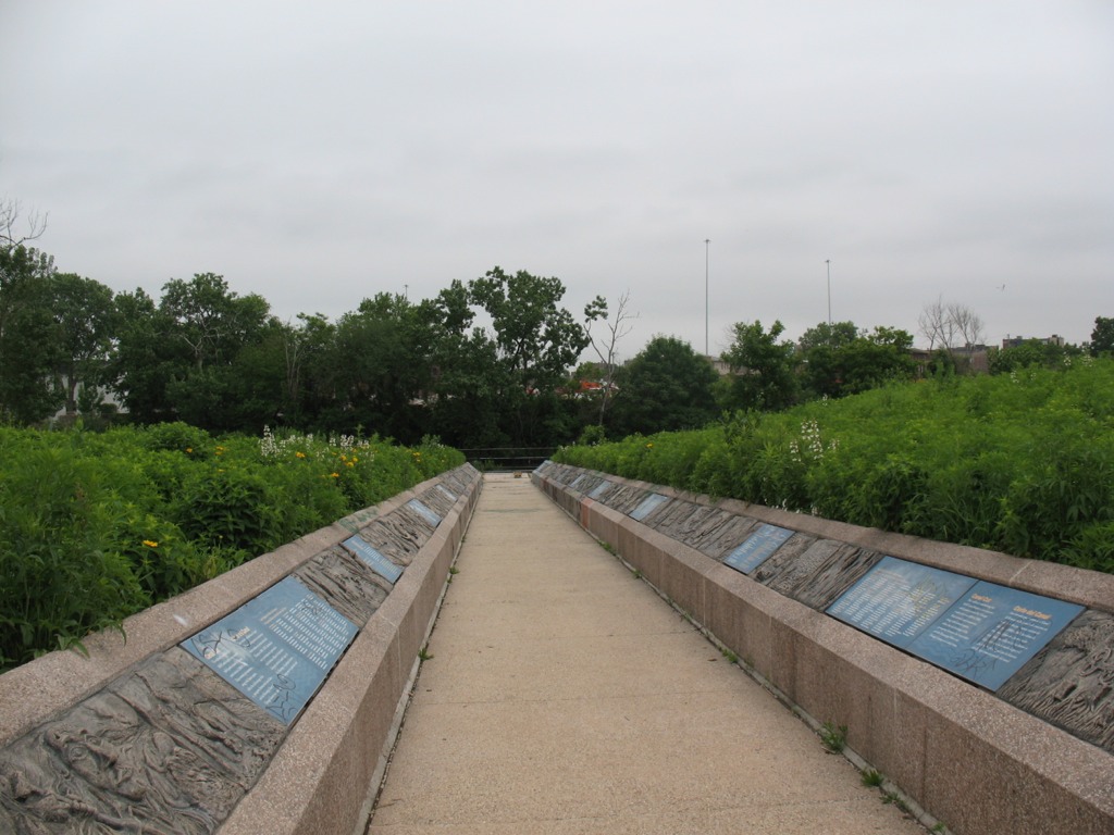
This walkway from the entrance of Canal Origins Park leading to the river symbolizes the canal’s walls, and features artwork by Chicago high school students. Unfortunately, now the displays are heavily tagged with graffiti (photo by M. Bryson)
To the west, the South Branch soon morphs into the Sanitary and Ship Canal, begun in 1892 and completed in 1900. This canal marked the permanent reversal of the Chicago River for improved sanitation (via dilution) and navigation, and continues to be used heavily to this day for commercial transportation. North of the S&S Canal is the filled-in waterway formerly known as the West Fork of the South Branch, which flowed southwestward until it ended at the Continental Divide separating the two watersheds that meet here in the Chicago region (those of the Mississippi River and the Great Lakes). Here was located Mud Lake, between Kedzie (to the east) and Harlem (to the west), which earlier voyageurs could paddle across in wet years to travel between the Chicago and Des Plaines Rivers. The Chicago Portage National Historic Site is at Harlem Avenue, north of the canal, and it commemorates the history of the portage made via Mud Lake. The Stickney Wastewater Treatment plant, the world’s largest, now sits where the fickle waters of Mud Lake once were.
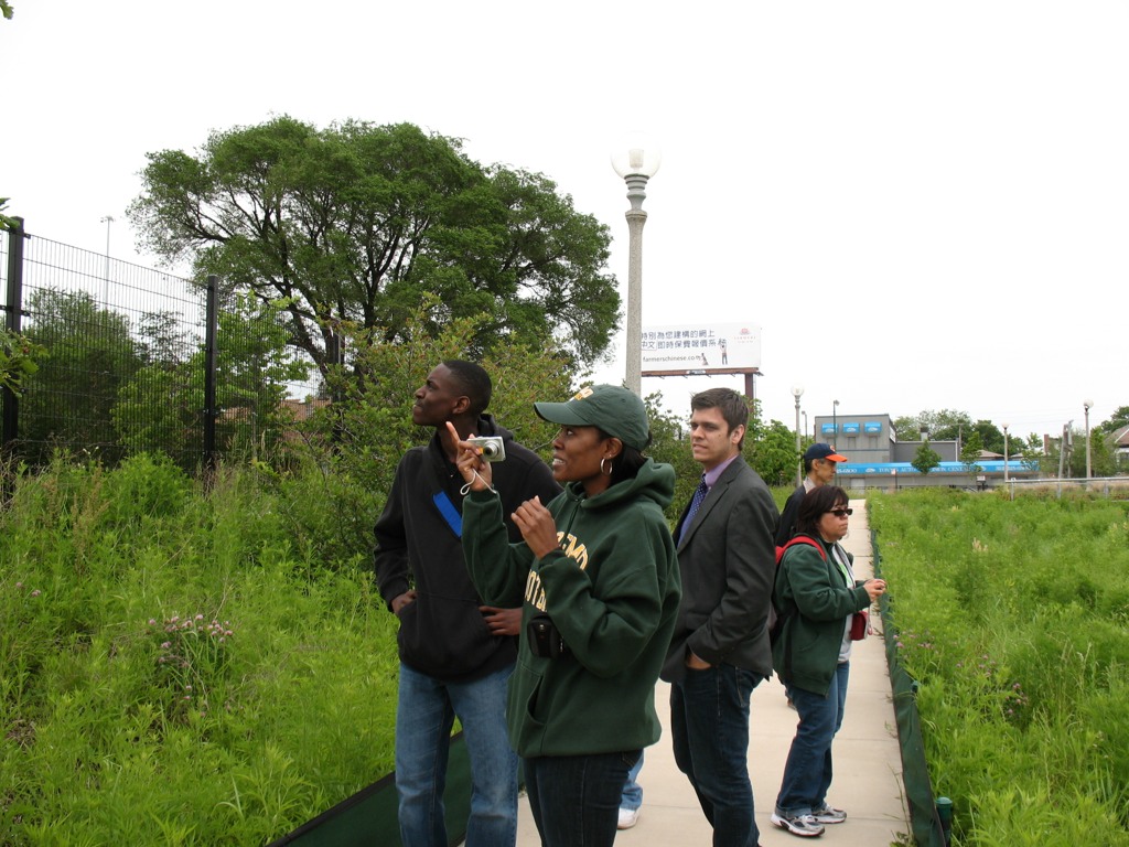
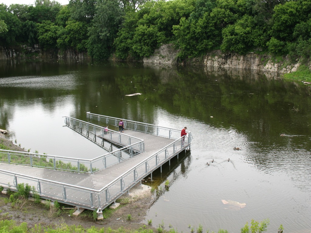
After touring Canal Origins Park, we walked a few blocks south to the Ashland stop of the CTA Orange Line, where suburban students enjoyed the novelty of an L ride one stop to the north to Halsted Street, where we disembarked and walked a couple of blocks south to Stearns Quarry Park.
RU students walk the trails at Stearns Quarry Park in Chicago’s Bridgeport neighborhood, June 2011 (photo by M. Bryson)
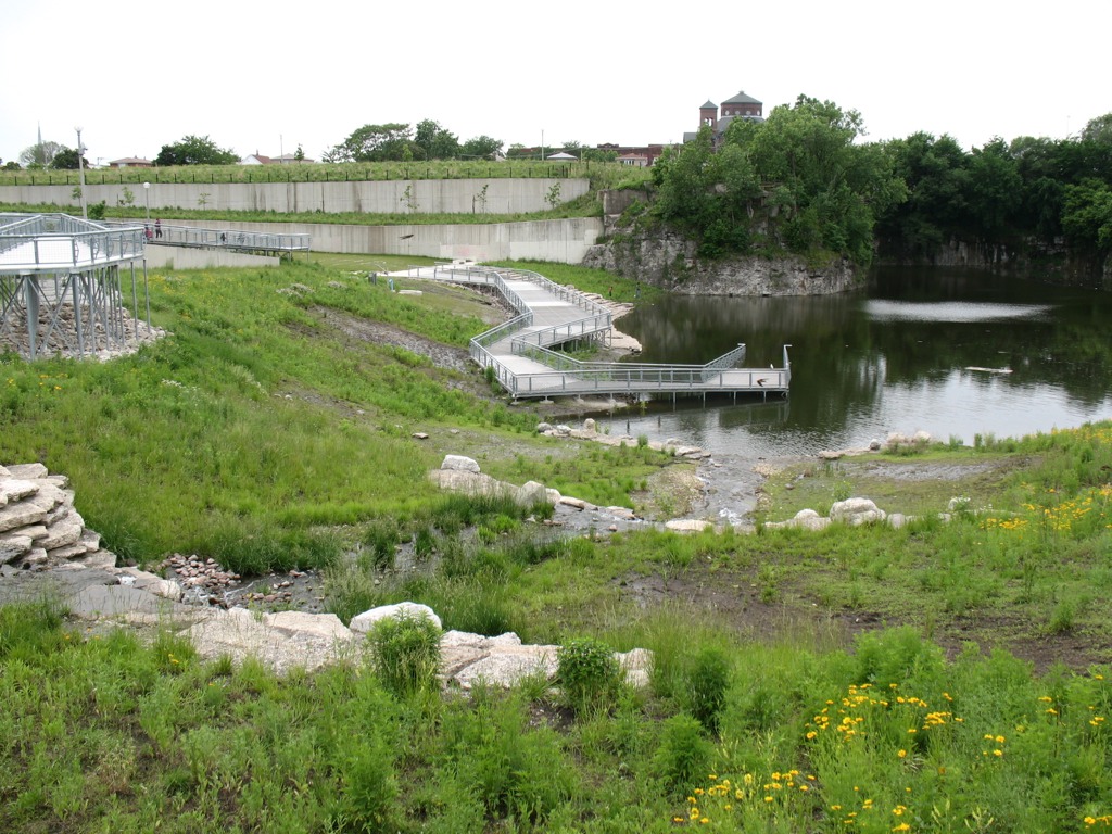
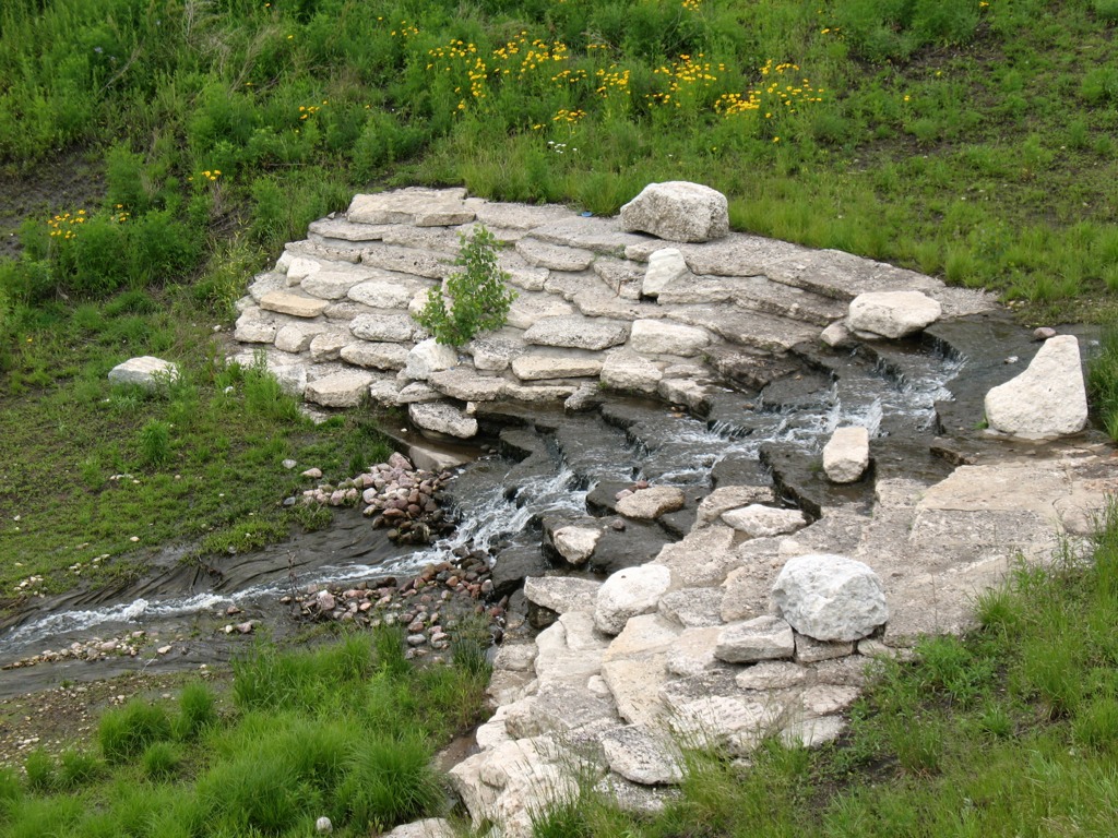
This extraordinary urban greenspace finished in 2009 is a cutting-edge example of city park design with nature in mind. Its meandering walking trails provide a different kind of view as one walks along, from the terraced wetlands that filter water circulated between the park’s fishing pond to its entrance fountain; to the old walls of the limestone quarry, which operated here from the late 1830s to 1970, when the site became a landfill; to the neighboring churches and houses of the Bridgeport neighborhood; to the dramatic scene of the Loop’s skyline, as viewed from the grassy-topped mound of the park. Throughout the park, native vegetation provides natural beauty, efficient water retention, and ample wildlife habitat — and many other sustainable design features make this truly a 21st century parkland.
A view of the terraced wetlands in Stearns Quarry (photo by M. Bryson)A closer view of the one of the wetland’s terraces; red-winged blackbirds and barn swallows were in abundance here (photo by M. Bryson)A view of the stocked fishing pond at the bottom of the quarry, as well as the its limestone walls — a most unusual sight within the city of Chicago (photo by M. Bryson)
Those seeking an off-the-beaten-path Chicago experience should consider visiting Stearns Quarry Park, which is easily accessible via the CTA (Orange Line and #8 bus) as well as car, with free street parking available next to the park. An excellent audio tour is provided by the Chicago Park District, as well.
The mound at Stearns Quarry Park affords impressive views of Chicago’s downtown skyline, only a few miles to the northeast (photo by M. Bryson)
This coming fall semester, SUST 220 Water will be offered for the first time at RU’s Schaumburg Campus. The 12-week course will run in a unique “hybrid” format combining four Saturday meetings (from 10am to 4pm) with online interaction via the course Blackboard site during the intervening weeks. This weekend/hybrid schedule not only makes the course accessible to students in the suburbs as well as the city, it provides us with the opportunity to pursue some interesting water-focused field trips to instructive sites in the region, such as the Chicago River (which just received this good news about its future water quality) and the Des Plaines River Wetland Demonstration Project (just to mention a couple of places I have taken past classes).
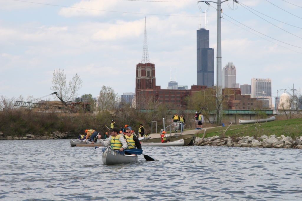
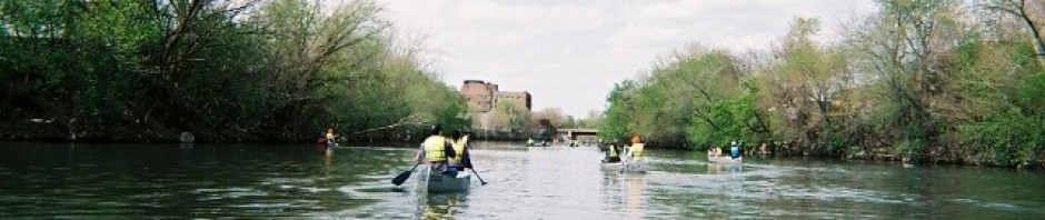
RU students & faculty canoe the Chicago River, May 2009 (photo by B. Hunt)
Course Profile / Registration Info
SUST 220 Water, section L30 (Schaumburg Campus) / Fall 2011
Meeting dates: Sept 10th, Oct 8th, Oct 29th, and Dec 3rd
Pre-req: English 101
Online interaction required through RU Online / Blackboard
Recommended but not required is an excellent text I used last year in the augural section of SUST 220 — The Atlas of Water, by Maggie Black and Jannet King (Univ of CA Press, 2nd ed., 2009).
If you are interested in enrolling in SUST 220 this coming fall, please contact your academic advisor, and feel free to get in touch with me if you want to learn more about the course. Enrollment is limited, so plenty of personal attention from yours truly is guaranteed. And if you’ve never tried an online course before, taking a hybrid course such as this is a great way to “test the waters,” since students will have ample opportunity to interact with me and each other face-to-face, as well as get help/support with the online component if need be.
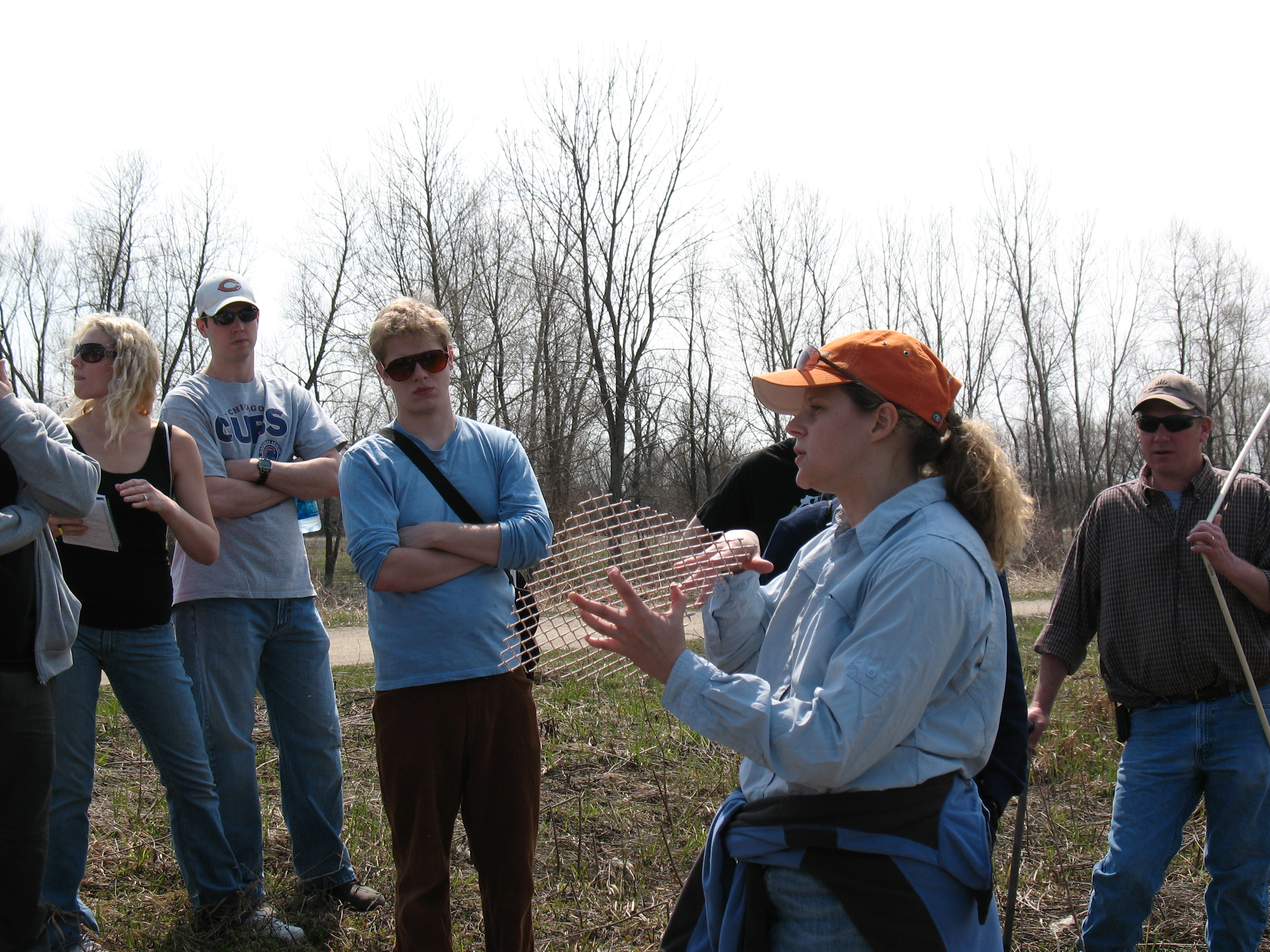
Wetlands Research Inc. ecologist Jill Kostel talks about the restoration work underway at the Des Plaines River Wetland Project, April 2009 (photo by M. Bryson)
Like to know more? Below is a preview of the kinds of topics we’ll investigate in SUST 220.
Water, the Stuff of Life
Without water there is no life. Without clean water, human and animal life is vulnerable to catastrophic disease. How, despite population growth and industrial production, can we ensure clean supplies of water for humans and wildlife? This course evaluates water quality and water sustainability issues through the analysis of local, regional, and global issues and case studies.
Consider, for example, the connections between local and regional water issues here in the Chicago area. Chicagoans have the luxury of living on the shores of the world’s greatest repository of fresh surface water, the Great Lakes, a position we regrettably abuse by withdrawing several hundred million gallons of Lake Michigan water every day simply to flush our sewage downstream to Peoria and all points south. By contrast, most communities in northeastern Illinois that lie outside the Great Lakes basin draw their water from surface streams or underground aquifers, sources that are vulnerable to over-use and pollution. According to the 2009 report “Before the Wells Run Dry” by the Chicago-based Metropolitan Planning Council and Openlands, the long-term sustainability of fresh water in Illinois requires much better conservation of these finite resources and improved long-term water supply planning.
Canoeing highly polluted Bubbly Creek, aka the South Fork of the Chicago River's South Branch (photo by L. Bryson)
A global perspective on water availability reveals far more disturbing realities. The earth is a planet defined by an abundance of water, of which almost 98 percent is salty or brackish. Just over two percent is fresh, and more than two-thirds of that water is locked up in ice sheets, glaciers, and permafrost. Thus, only a tiny fraction of the earth’s water is available to us for drinking, bathing, flushing toilets, growing crops, etc. That finite resource is imperiled by the unsustainable trends of pollution, overuse, waste, and lack of access. In developing countries, about 90 percent of sewage is dumped into rivers without any treatment. Worldwide, polluted rivers transport toxins and excess nutrients to coastal areas, where biological “dead zones” result; from 1995 to 2007, the number of such oceanic dead zones increased by 30 percent. Depending where you look, overconsumption or scarcity is the defining problem. Citizens of the US accustomed to readily available freshwater consume about 100 gallons day per household, on average; while globally, nearly two billion people lack ready access to clean water.
Key concepts and themes addressed in SUST 220 include the science and policy of ensuring a safe water supply; water conservation strategies, particularly in urban areas; wastewater treatment and watershed management; and wetlands ecology, restoration, and management. Students will develop a thorough understanding of the water cycle and its relation to the sustainability of water systems; understand and assess the importance of water as an environmental as well as cultural resource; learn to define, measure, and sample water quality in a variety of contexts using simple yet effective field-based water chemistry sampling techniques; and evaluate contemporary water management and policy issues, particularly those affecting the waterways of the Chicago region as well as the Great Lakes ecosystem.