Chicago mayor Rahm Emanuel’s recent proposal to jack up city water rates is guaranteed to make most Chicago residents grouse. After all, Chicagoans have been used to cheap and plentiful water for decades. Not too long ago, water fountains in the city’s parks used to run continuously from Memorial Day to Labor Day, perhaps because installing push-button valves was too much trouble — or because water was considered to be practically free. Moreover, most residents and businesses didn’t even have water meters regulating their water usage. Talk about an open tap!
Those days are about over, thankfully, because from a sustainability standpoint, Chicago’s longtime water profligacy is almost as embarrassing as its inability to implement an effective solid waste recycling program or its propensity for dumping non-disinfected wastewater into its rivers and canals.
So while most citizens will grumble about the rate increases on the horizon, forward-thinking institutions like the Center for Neighborhood Technology are singing a different tune:
The decision was unveiled in the city budget proposal for 2012 to the Chicago City Council today. Among the new initiatives it puts forward is an increase in the annual fee for water and sewer services. The water fee for property owners would increase by 25 percent next year and would begin to charge institutions, such as CNT, for water services that have historically received those services for free.
CNT’s Vice President of Policy Jacky Grimshaw served on the mayoral transition committee that recommended it to him. “Equitable and accurate rates for usage is essential for both system efficiency and managing long-term operational costs associated with water services in the City,” the transition document states.
As a leader and proponent of stormwater management techniques, such as green infrastructure, CNT and its Water program staff look forward to working with the mayor to ensure innovative, sustainable stormwater management measures are a significant part of the City’s water infrastructure modernization effort.
On Thursday, Oct. 13th, I took some time away from my normal professorial duties to attend a lunchtime forum entitled “Chicago’s Water: Protecting Our Precious Resource,” sponsored by the Chicago Council on Science and Technology. The event was held in the 18th floor “Wolf Point Ballroom” in the Holiday Inn Chicago Mart Plaza, literally right off that parking lot that sits on Wolf Point. Floor to ceiling views of the Chicago River and the skyline made for a dramatic setting for the event and the ensuing conversation about the history and future of water management in Chicago.
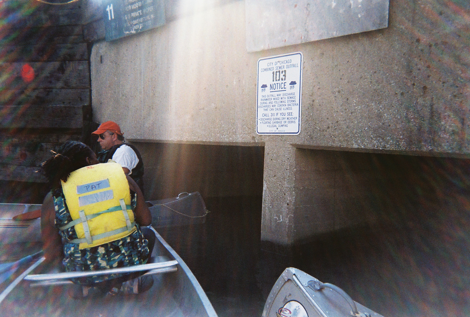
Combined Sewage Outfall on the Chicago River, in the Loop (M. Bryson)
I couldn’t help but notice the remarkably clear view of the Combined Sewage Outfall (CSO) location where my students and I rafted up our canoes the previous weekend in the Loop and discussed the impact of stormwater overflows of untreated wastewater on the ecology of the Chicago River. It was both odd and inspiring to view that location from up high, only a few days later.
This exceptionally interesting forum featured a keynote address by Debra Shore, an Metropolitan Water Reclamation District commissioner who, unlike most commissioners past and present, actually has a long track record in environmental conservation and advocacy. She is one of the drivers of the recent turnaround in MWRD policy with respect to the disinfection of wastwater. Shore’s presentation highlighted the history of Chicago’s development and its relation to the river, the technological changes that have been wrought upon the latter, the key issues facing us in the 21st century (water quality, Asian Carp, hydrological separation, etc.), and a broad question at the end: “Can Chicago become Nature’s Metropolis for the 21st Century?” In the latter, she implied that how we manage the river will be a large part of the answer to that question.
One key theme that repeatedly came up during the forum’s dialogue was the notion of separating the watersheds as a way to improve water conservation and prevent invasive species (notably the carp) from entering the GLs. Surprisingly, none of the engineers on the panel or in the audience claimed that such a separation was technically impossible, or even too costly to attempt. What they repeatedly cited was the need for the political will and creation of effective avenues of communication and collaboration to do it. If that happened, then the technology could be brought to bear productively. This view was even espoused by Dick Lanyon, the longtime engineer for and then manager of the MWRD who retired in 2010 and who was at this meeting (coincidentally, I sat next to him and got to bend his ear for several minutes after the program). Lanyon is a key source about water management in the Chicago region in Peter Annin’s 2006 book, The Great Lakes Water Wars .
Another issue that was discussed was the status of the current studies underway to assess the feasibility and impacts of hydrological separation. The Army Corps of Engineers’ study was cited several times, favorably, despite it’s rather slow projected timeline that has raised the pique of neighboring Great Lakes states; and Tinka Hyde, the EPA rep, noted that USEPA was collaborating with the Corps on this process.
One vision of how the hydrology of the Chicago Region might be transformed by re-separating the Great Lakes and Mississippi River watersheds (Milwaukee Journal-Star)
Those interested in following up on the status of the GLC’s planning process, as well as learning more about the environmental and ecological prospects of hydrologically separating the Great Lakes and Mississippi River watersheds can read more about it here and/or attend a public webinar on Oct. 24th for the GLC’s Chicago Area Waterway Study.
Wolf Point, the Chicago River in downtown Chicago (M. Bryson)
Such a vantage point affords a unique perspective on the ways in which we use and abuse water, and suggests that we need science, policy, and active citizen engagement to forge a more sustainable future for this much-maligned yet storied river.
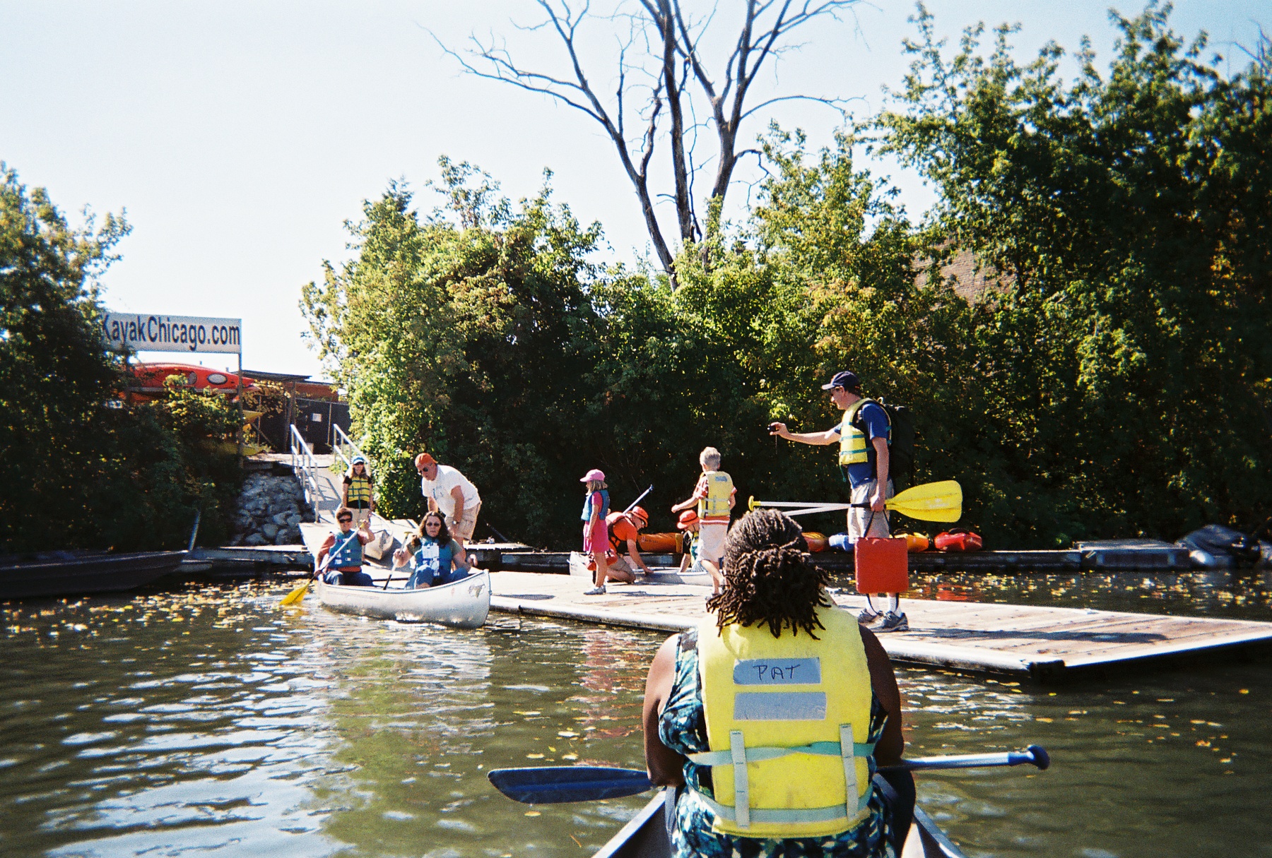
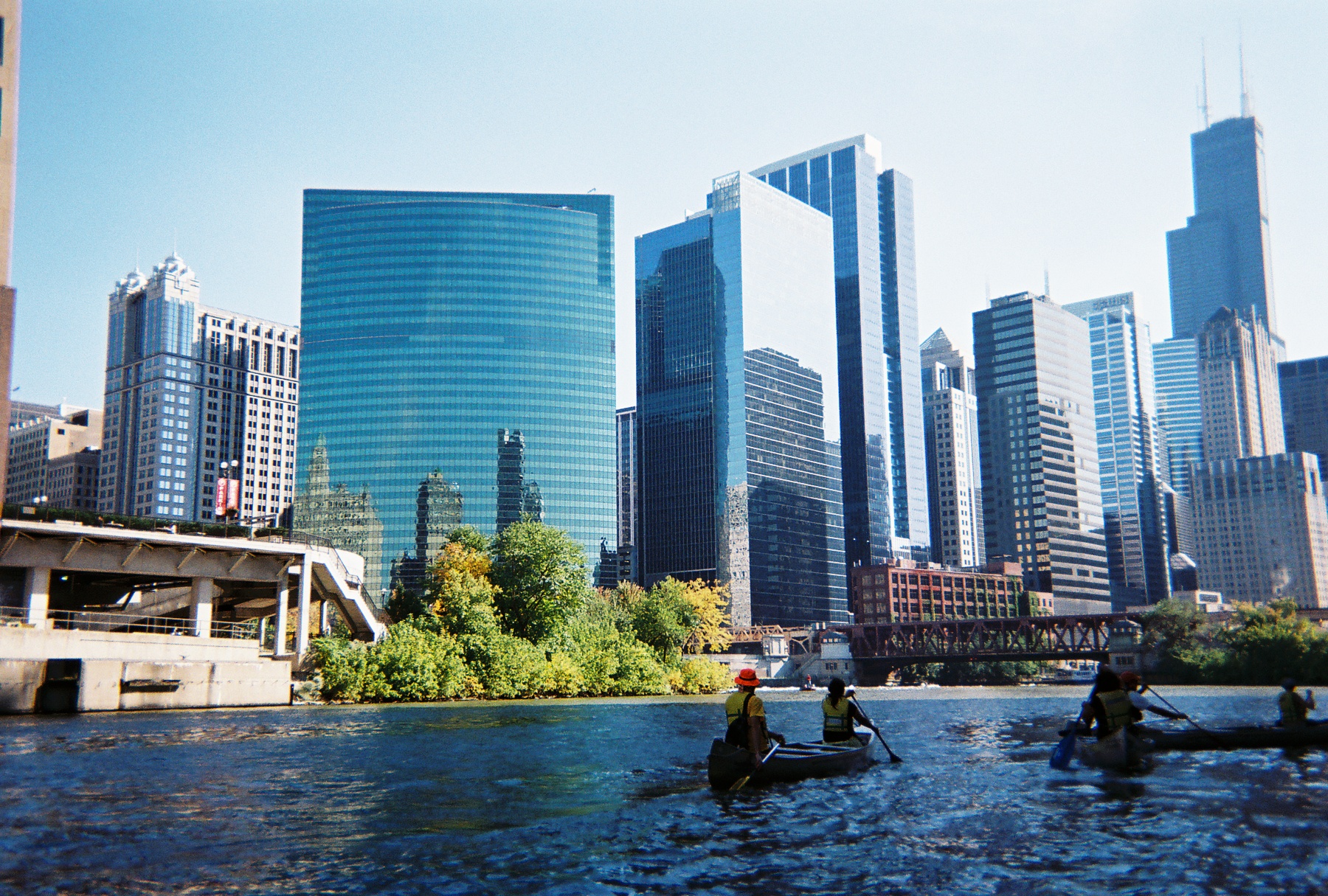
On Saturday, October 11th, students in my SUST 220 Water and PLS 391 Seminar in Natural Science classes at Roosevelt University took a canoe trip with me on the North Branch of the River, from Goose Island on the near-North Side of the city to Wolf Point in the heart of Chicago’s Loop — the place where the North Branch meets the South Branch, and ground zero in the history of Chicago’s development from a frontier town to a world metropolis. Our trip was led by expert river guides with the Friends of the Chicago River organization, which has long advocated for the conservation of the river and helped raise its public profile since the late 1970s.
Launching canoes at the North Avenue Turning Basin (M. Bryson)
This was the fourth such trip I’ve taken with my RU students since the spring of 2009, the previous three trips taking place on Bubbly Creek, a notoriously-polluted tributary of the South Branch that for many decades absorbed the waste from the Chicago Stockyards. These field experiences give us a chance to explore urban nature first-hand and think about
how water moves through those ecosystems and sustains their biotic communities;
what kinds of pressures urban or suburban development exert upon these ecosystems;
the impact of such pressures on water quality, flooding, etc.;
conservation and/or restoration strategies that can improve the quality and sustainability of these aquatic ecosystems;
the significance of water quality to the overall sustainability of urban systems, both in terms of nature and people.
Our trip began at a canoe/kayak launch site at the turning basin at North Avenue, the widest spot along the entire Chicago river system. We proceeded down the North Branch, which runs along the west bank of Goose Island — itself a fascinating place in Chicago’s geographic and cultural history that was made an island when industrialist (and later Chicago’s first mayor) William Ogden had a canal dug to the east to excavate clay for brickmaking and to increase the area’s industrial waterfrontage.
A barge near the Morton Salt Company distribution facility, one of the many industries on the North Branch (M. Bryson)
Once home to Irish immigrants who kept geese and other livestock on their property, Goose Island has seen successive waves of industry and residential development over the decades; in this sense, it is a microcosm of Chicago’s own dynamic development as an industrial city. Since the late 1990s and early 2000s, it has become a thriving Planned Manufacturing District.
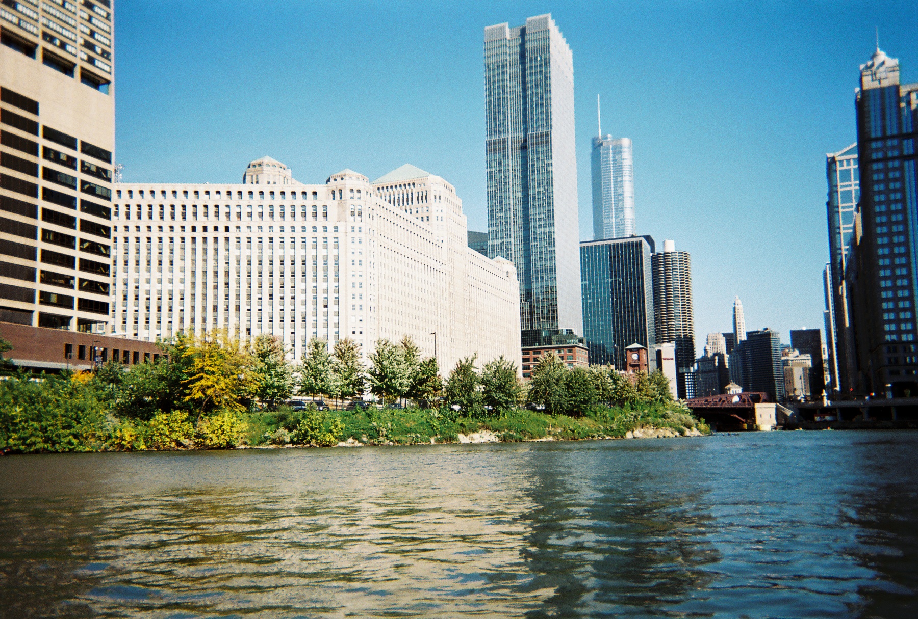
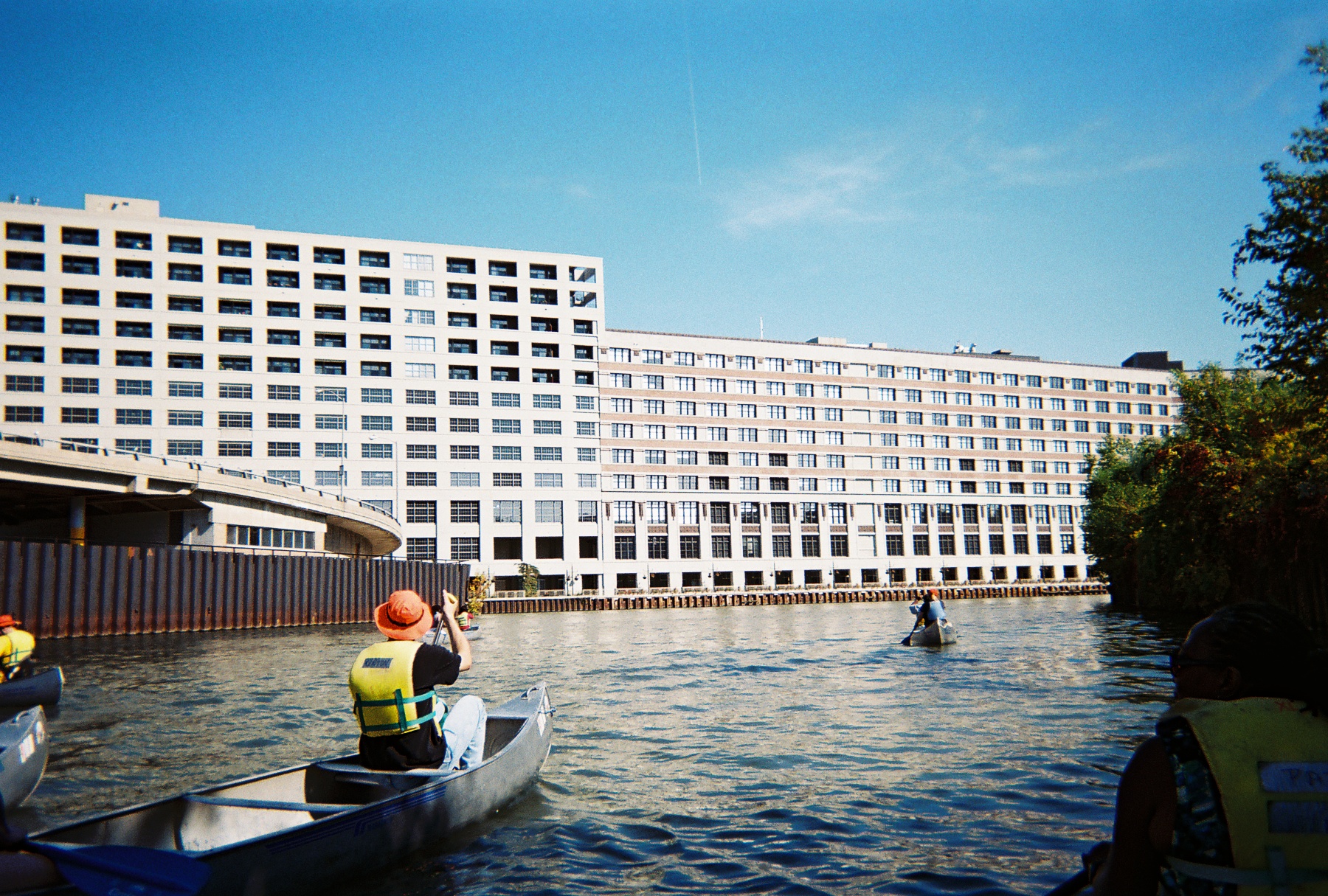
As we paddled southward toward Chicago’s Loop and passed the southern tip of goose Island, we learned to keep well to the right of the river channel to avoid the many tour boats and private craft that ply these waters. The presence of many diverse watercraft on the river testifies to its importance as a cultural and recreational amenity as well as tourist attraction — all of which have positive economic impacts for the city. The water here offers stunning views of bridges, factories, residential developments, and other waterfront properties — such as the massive Montgomery Ward catalog warehouse built in 1908 — which together constitute a colorful tapestry of the urban landscape.
The 2.3 million-square-foot Montgomery Ward warehouse (M. Bryson)
The presence of urban wildlife in the river corridor, including numerous Canadian geese and Mallard duck sightings as well as evidence of beaver activity, highlight the river’s identity as a living ecosystem and value as wildlife habitat. This green face of the river was particularly evident in the North Branch Canal (east of Goose Island), through which we paddled on our way back from Wolf Point.
Those ecological musings are complicated by consideration of the many Combined Sewage Outfalls (CSOs) that exist along the riverbank, outlets that frequently release untreated sewage directly into the river in times when precipitation exceeds a certain threshold (about a half-inch, depending upon size of the area experiencing rainfall). These outfalls are not confined to industrial sections of the river; 265 of them occur all along the length of the Chicago Area Waterway System (CAWS),
Combined Sewage Outfall on the Chicago River, in the Loop (M. Bryson)
including this industrial yet scenic stretch of the North Branch and at the confluences of the North and South Branches in the Loop. Paddling near such an outflow is a disquieting and disturbing experience, as it brings one face-to-face with the question, “where does our waste go when we flush our toilets?” The answer: right here, quite often.
Indeed, the fecal coliform test we performed later at our canoe launch site confirmed the presence of (though did not quantify) coliform bacteria colonies in the water, which are indicators of fecal coliform — despite the fact that it had not rained in several days prior to our trip. Students also performed a variety of other water quality tests for physical and chemical variables such as temperature, turbidity (cloudiness), pH, hardness, dissolved oxygen, nitrate, phosphate, and chlorine. (You can view a summary of our results here as a pdf.)
Such a profile gives us a snapshot of the water quality at a given moment in time. In this case, overall quality was deemed fair to decent by such measures as temperature, pH, and dissolved oxygen; but elevated nitrate and phosphate levels (nutrients that result from industrial and urban pollution that can cause algal blooms and subsequent oxygen depletion) as well as the water’s fairly turbid nature and the definitive presence of coliform bacteria show there is much room for improvement. Had it rained that day or the previous day, many of these chemical indicators would’ve been measurably worse. Fortunately, the Metropolitan Water Reclamation District (MWRD) has recently moved to begin planning a final stage of disinfection for treated wastewater at two of its treatment plants, a move that will certainly lessen the chronic bacterial contamination of the water.
Heading south into downtown Chicago on the river; Wolf Point and the skyline (M. Bryson)
Paddling a polluted urban waterway is decidedly much different than journeying along a pristine stream in an uninhabited wilderness. But it may be an unparalleled way to way to experience a city’s landscape and to contemplate the complex processes of urban ecology represented by the movement of water with that landscape.
This October marks a couple of fascinating and educational events related to water. These would make excellent field trip alternatives for students in my PLS 391 or SUST 220 classes this fall, as well as interesting forums for anyone interested in the sustainability of Chicago’s water supply and the flooding issues impacting Illinois communities along the Mississippi River.
On Thursday, Oct. 13th, the Chicago Council for Science and Technology will present a luncheon panel discussion entitled “Chicago’s Water: Protecting Our Precious Resource.” From the program’s promo:
Invasive species have destroyed the balance of the Great Lakes ecosystem and threaten further environmental and economic hardship. The Chicago River is still a conduit for periodic releases of raw sewage and suffers from the scars of an unregulated industrial past. Climate change may create more severe storms, exacerbating flooding problems in the region. Hundreds of millions of gallons of water are withdrawn from Lake Michigan every day, used once, and discharged into the waterways. Water supplies are diminishing in the suburbs. Commissioner Debra Shore of the Metropolitan Water Reclamation District will highlight the urgency and scale of these problems and the need for a grand vision of water management. Also, a panel of experts representing different point of views will discuss the potential roles played by government, industry, academia and private citizens to better manage and sustain our water resources.
On Friday, Oct. 21st, the College of Du Page in Glen Ellyn, IL, will host the Mississippi River Basin Flood of 2011 Symposium from 9am to 2:30pm. The day’s program features expert speakers and multimedia presentations on past Mississippi River floods as well as detailed analysis of the 2011 flood event, with scheduled sessions on flood-producing weather patterns, flood monitoring technology, flood mitigation, and floodplain map development. For more detailed information on this free event, see the official flier (pdf) from the CoD Department of Earth Sciences.
The Chicago River has been in the news quite a bit these last few months, and for a waterway long treated as a transportation corridor and sewage receptacle, its future is looking brighter — even as city officials, water quality experts, wastewater treatment engineers, and environmental activists admit there’s a long, long way to go. Today on public radio WBEZ’s local affairs radio show, Eight Forty-Eight, the Chicago River was a main topic of conversation between host Alison Cuddy and Henry Henderson of the Natural Resources Defense Council. Henderson was the first head of Chicago’s Department of Environment, an agency that ironically may come under the chopping block in Mayor Rahm Emanuel’s recent plans to address major budget shortfalls. (A prospect which illustrates that even as progress can be make on one environmental front, two steps back can occur on another.)
Also see this article by the Chicago Tribune’s environmental reporter Michael Hawthorne for more details on the various plans for the river and the proposed locations for the boathouses — one of which is planned for a new park located near the mouth of Bubbly Creek, one of the historically most polluted sections of the river.
Such developments are well-timed for my SUST 220 Water class this semester at Roosevelt, since we’re planning a canoe trip on the North Branch of the Chicago River from Goose Island to Wolf Point on October 8th with Friends of the Chicago River. Expect a report on that urban nature adventure!
Every semester I take my Roosevelt University undergraduate students on field trips — hands-on learning experiences that allow us to put some of the academic ideas we’ve studied into practice, work together in teams, and create a sense of community. That’s especially important in online classes, where virtual interaction is intense and sustained, but face to face action is rare or nonexistent.
This fall at RU’s Schaumburg Campus, my Sustainability Studies 220 Water course’s hybrid format (a combination of occasional Saturday sessions plus weekly online interaction) is ideal for scheduling field trips to likely sites of interest. Normally I would wait until one-third of the way through the semester before venturing on a trip with a group of students — but since SUST 220 had a long Saturday campus session to kick off the semester and early September is usually a good time to be outside in the Chicago area, we decided to get right to it.
Busse Woods (M. Bryson)
So after two hours of morning lecture and discussion on September 10th and meeting each other for the first time, my students and I enjoyed a picnic lunch in the campus courtyard and then headed over to Busse Woods, one of the largest holdings within the Cook County Forest Preserve system (at 3,700 acres), for field-based introduction to water quality sampling techniques.
Busse Woods, aka the Ned Brown Forest Preserve, is a massive and multi-functional piece of green infrastructure in the northwest suburban region, a culturally significant recreation site for the many communities it serves, and a fascinatingly complex mosaic of northern Illinois ecosystems — riverine, woodland, wetland, and prairie. The preserve directly borders the suburbs of Rolling Meadows, Arlington Heights, Elk Grove Village, and Schaumburg; but within a short drive or even bike ride are numerous other communities, including Palatine, Prospect Heights, Mount Prospect, Des Plaines, Wood Dale, Itasca, Roselle, Hoffman Estates, and Inverness. People in these suburbs and beyond converge on Busse Woods year-round to boat, bike, hike, rollerblade, picnic, fly model airplanes, visit the elk herd (yes, elk!), and more, making it one of the most-heavily used forest preserve units in Cook County. Fortunately, the preserve’s sheer size and diverse offerings of groves, parking areas, meadows, and trails enable it to accommodate all this activity and still provide much needed open space for the region and the chance of someone to roam within an extensive natural area. The Cook County Forest Preserve and the Friends of Busse Woods actively work on conservation and restoration projects in the preserve.
Just to the southeast is O’Hare Airport, which at approximately the same size as the preserve represents a completely different way of using land — the concrete and asphalt “hardscape” of O’Hare strongly contrasts with the verdant landscape of Busse Woods. Besides recreational opportunities and open space for its human visitors, Busse harbors a significant amount of regional biodiversity:
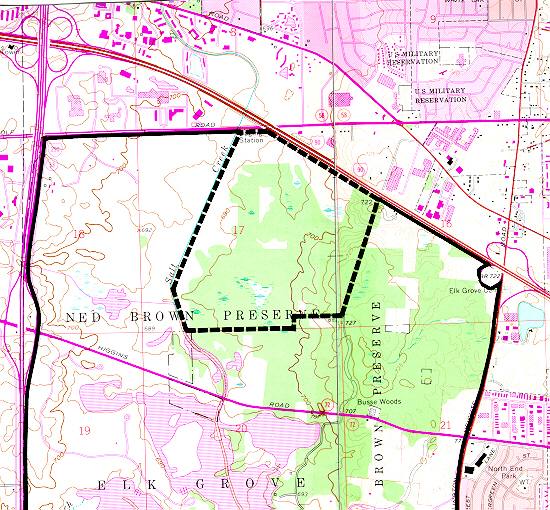
Busse Forest Nature Preserve Topo Map (USGS)
the 440-acre Busse Forest Nature Preserve, located in the northeast section of the Forest Preserve unit, is not only a state-designed nature preserve (the third one so dedicated, in 1965) but also a National Natural Landmark. This protected area harbors bottomland flatwoods, extensive wetlands, and upland forest, some of which are in the process of restoration.
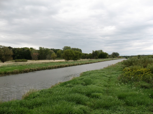
Salt Creek, looking south from the northern edge of Busse Woods Forest Preserve (M. Bryson)
Busse Woods is home to a couple of significant water features including Salt Creek, which was the first stop on our trip. After hiking through a forest-and-wetland path along the northern border of the woods, we came to the Golf Road overpass of Salt Creek, where the river south into the preserve before it empties into Busse Lake, a sprawling artificial reservoir created by a dam structure at the south end of the preserve. Using a couple of different water quality field testing kits, we sampled the creek and measured a range of physical/chemical water quality indicators: chlorine, copper, dissolved oxygen, hardness, iron, nitrate, pH (acidity), phosphate, temperature, turbidity, and total coliform bacteria. In doing so, we not only took the ecological pulse of Salt Creek at one point in time, we also learned how to use our sampling equipment, compared test results from different measurement procedures, assessed the possible sources of error in our data collection, and analyzed the impact of the surrounding landscape upon the water quality of Salt Creek.
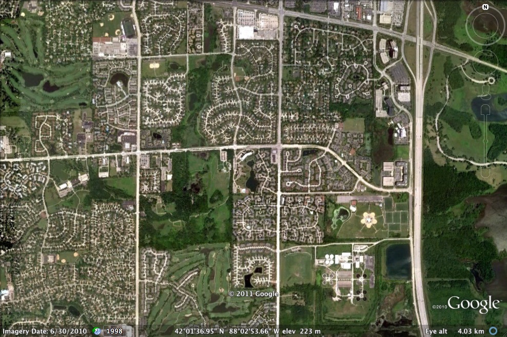
The entire Busse Woods preserve is a significant green space within the Salt Creek Upper Watershed, as it receives stormwater run-off from the eastern half of Schaumburg via the main channel of Salt Creek as well as the Creek’s West Branch. That tributary is important for another reason, as it flows through the heart of Schaumburg before passing around the periphery of the John Egan Wastewater Treatment plant of the Metropolitan Water Reclamation District.
Satellite view of Schaumburg's east side, showing the West Branch of Salt Creek and the John Egan Treatment Plant at lower right (Google Earth)
The Egan plant’s treated effluent is piped into the West Branch, which then flows east under I-290 to empty into the South Pool of Busse Reservoir. Partly for that reason, we chose to sample water from the shoreline of the South Pool as our second sampling site of the day. (Interestingly, the data from that site were quite comparable to those we gathered much farther north at Salt Creek.)
In this sense, then, Busse Lake is a giant detention pond for stormwater run-off from several suburban communities (either directly or via Salt Creek) and treated wastewater from Schaumburg. As such, it is a flood control structure for Salt Creek, which runs south/southeast out of the preserve and drains several western suburban communities before joining the Des Plaines River near Brookfield.
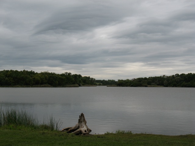
The south pool of Busse Lake (M. Bryson)
Effective water retention in Busse Lake means reduced flooding in downstream communities, though the persistence of flooding in the western suburbs means the reservoir as currently configured is only a partial solution. Nevertheless, the larger forest preserve complex of wetlands, prairies, and woodlands — of which the lake is but a part — act like a giant sponge for the surrounding towns and villages, absorbing precipitation and run-off from a wide area and releasing it slowly to the atmosphere and to Salt Creek.
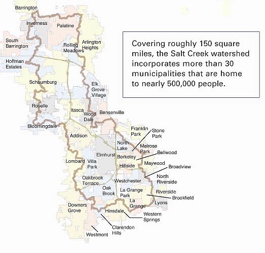
Map of Salt Creek's watershed (Salt Creek Watershed Network)
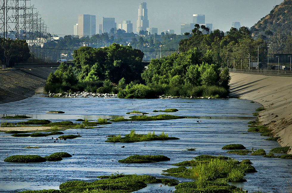
For the first time in decades, people in Los Angeles this month were able to paddle along the much-maligned and concrete-encased Los Angeles River without breaking the law. It was, if you’ll pardon the pun, a watershed moment — both for the river, which is making a comeback in the eyes of the general public as well as elected officials; and for the greater Los Angeles community, which is slowly coming to grips with the fact that it has a potentially dynamic natural resource threading its way through neighborhoods that are starved for high quality green space.
The LA River in 2010 (photo by Mark Boster of the LA Times)
Even the U.S. Corps of Engineers, the same outfit that tamed the flood-prone river in the 1930s by building levees and a concrete channel for the formerly wild LA river, is coming on board. This past month’s float down the Sepulveda Basin section of the river included civic officials as well as Mark Toy, District Commander of the Corps of Engineers. As reported by the LA Timeson 9 August 2011,
Los Angeles is urban territory, and this 1.5-mile trip is arrow-straight, flanked by the San Diego and Ventura freeways and strewn with discarded bicycles, shopping carts, trash and, occasionally, the carcasses of rodents.
It is also home for 212 species of birds, including yellow warblers, hooded orioles and the federally endangered least Bell’s vireo.
In July, U.S. Army Corps of Engineers District Commander Col. Mark Toy issued the license allowing the Los Angeles Conservation Corps to operate the program along a soft-bottom stretch of the river between Balboa and Burbank boulevards, about 17 miles northwest of downtown Los Angeles.
On Monday, his participation in the program’s inaugural “ceremonial paddle” was viewed by environmentalists as an important juncture in the history of the river that was tamed and polluted in the 1930s by the corps’ concrete walls and 12,000 storm drains.
“For more than a century, the U.S. Army Corps of Engineers has built walls between people and their rivers here in Los Angeles and nationwide,” said David Beckman of the Natural Resources Defense Council. “So to have the corps’ district commander metaphorically jumping over that wall and into a boat is symbolic and potentially very important.”
Toy shrugged off such accolades, saying, “This is a team effort, and I’m proud to be a part of it. What we learn from the program this year will help shape the future of the river.”
The recent resurgence of interest in the LA River, spurred by river enthusiasts and environmental advocates, exemplifies an important axiom in relation to urban streams. If people start using them for recreation, they suddenly become more important, no matter their state of abuse or degradation. And such usage, in turn, spurs efforts to clean up the rivers in order to benefit from their important functions as green corridors.
This has long been the case with the Chicago River, which has experienced a remarkable resurgence in recent decades since the formation of the non-profit river advocacy group Friends of the Chicago River in the 1970s. Now canoe races are held along various stretches of the river, schoolchildren and adults come to the water to learn about aquatic ecology and urban conservation, and the city has poured millions of dollars into building attractive riverwalks and improving water quality — all testament to the fact that the river is a cultural amenity and economic resource.
Yet even Chicago has a long, long way to go before its channelized, reversed, and polluted waterways regain their ecological health and biodiversity. The mere name of the transformed south branch of the river — the Sanitary and Ship Canal — indicates its primary identity as a transportation conduit and sewage conveyance channel, rather than as a living river. But the Metropolitan Water Reclamation District’s recent decision to plan for disinfecting the treated wastewater it releases into the Chicago Area Waterway System (CAWS) is a landmark step in working toward the river’s ecological improvement and reshaping that identity which dates from the late 19th century.
It looks like LA, with the Corps of Engineers’ recent foray on the river and the building public interest in exploring its hidden reaches, is taking initial steps down a similar path. The ultimate goal: to treat urban rivers like living ecosystems, which they are, instead of mere tools for flood control, shipping, and wastewater management.
Environmental reporter Michael Hawthorne of the Chicago Tribune has published a series of excellent articles this month about the state of water quality in Chicago and the suburbs. These detail the detected presence of lead, chromium, hormones, vinyl chloride, herbicides, antibiotics, and other contaminants — some of which are regulated by the EPA, others of which are not. He also reports on the latest developments in the Crestwood IL water scandal in which village officials knowingly laced their Lake Michigan municipal water supply with vinyl chloride-polluted well water for over 20 years.
This past Saturday, June 11th, students in my PLS 392 Seminar in Humanities online summer course at Roosevelt University took an “urban landscapes” field trip to Chicago’s near Southwest Side, where we visited two city parklands: Canal Origins Park on South Ashland Avenue, and Stearns Quarry (aka Palmisano) Park on Halsted Street. This afternoon field trip was a chance for us to discuss the history and ecology of these locations and their relation to Chicago’s urban landscape, as well as think about the visual aesthetics of these areas, the integration of nature and culture in urban environments, the importance of parks to city communities, and how such areas can serve as windows into the rich history of Chicago.
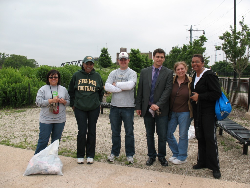
PLS 392 students help clean up Canal Origins Park before our walking tour of this urban parkland along the Chicago River, June 2011 (photo by M. Bryson)
We began our afternoon by meeting at Canal Origins and, before starting our walking tour of this 2002 riverfront parkland, picking up several bags’ worth of litter along Ashland Avenue near the park’s entrance. (Thanks to my students for pitching in like troopers!) Canal Origins provides impressive views of the present-day juncture of the Chicago River’s South Branch and Bubbly Creek, and commemorates the origin of the I&M Canal, which was constructed from 1836 to 1848. Use of the canal peaked in 1882 (when over a million tons of cargo were transported), but construction of Sanitary & Ship Canal in the late 19th century spelled the eventual demise of the I&M, as did the advent of railroad transport in the latter third of the 1800s.
The old canal, though, has made a comeback the during the last 30 years though the establishment of the I&M Canal Heritage Corridor by Congress in 1984 by Congress, which celebrates and promotes the Canal as natural resource, wildlife corridor, recreation destination, and source of cultural memory and historical preservation. Here at this area of Chicago, the canal is filled in and is covered by Interstate 55. Visitors to the park can see it only in their imaginations.
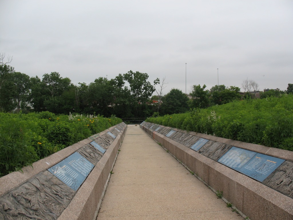
This walkway from the entrance of Canal Origins Park leading to the river symbolizes the canal’s walls, and features artwork by Chicago high school students. Unfortunately, now the displays are heavily tagged with graffiti (photo by M. Bryson)
To the west, the South Branch soon morphs into the Sanitary and Ship Canal, begun in 1892 and completed in 1900. This canal marked the permanent reversal of the Chicago River for improved sanitation (via dilution) and navigation, and continues to be used heavily to this day for commercial transportation. North of the S&S Canal is the filled-in waterway formerly known as the West Fork of the South Branch, which flowed southwestward until it ended at the Continental Divide separating the two watersheds that meet here in the Chicago region (those of the Mississippi River and the Great Lakes). Here was located Mud Lake, between Kedzie (to the east) and Harlem (to the west), which earlier voyageurs could paddle across in wet years to travel between the Chicago and Des Plaines Rivers. The Chicago Portage National Historic Site is at Harlem Avenue, north of the canal, and it commemorates the history of the portage made via Mud Lake. The Stickney Wastewater Treatment plant, the world’s largest, now sits where the fickle waters of Mud Lake once were.
After touring Canal Origins Park, we walked a few blocks south to the Ashland stop of the CTA Orange Line, where suburban students enjoyed the novelty of an L ride one stop to the north to Halsted Street, where we disembarked and walked a couple of blocks south to Stearns Quarry Park.
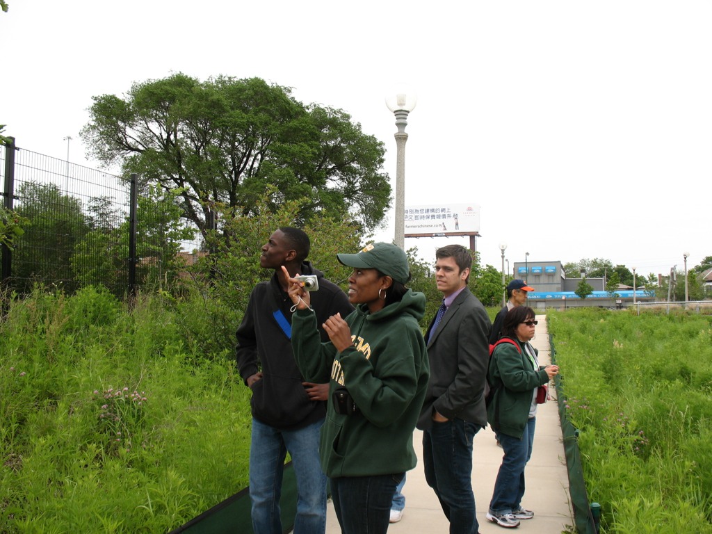
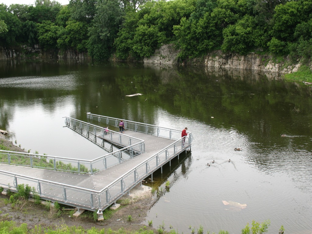
RU students walk the trails at Stearns Quarry Park in Chicago’s Bridgeport neighborhood, June 2011 (photo by M. Bryson)
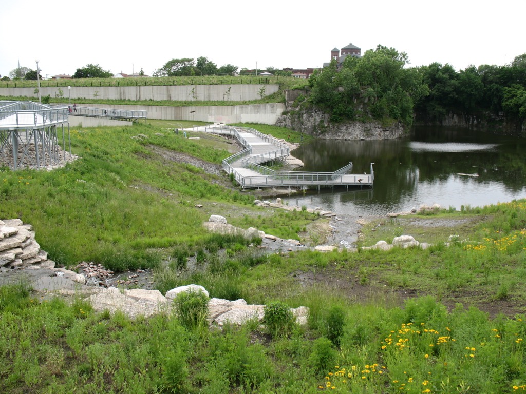
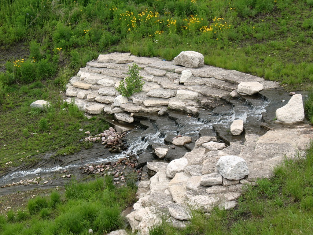
This extraordinary urban greenspace finished in 2009 is a cutting-edge example of city park design with nature in mind. Its meandering walking trails provide a different kind of view as one walks along, from the terraced wetlands that filter water circulated between the park’s fishing pond to its entrance fountain; to the old walls of the limestone quarry, which operated here from the late 1830s to 1970, when the site became a landfill; to the neighboring churches and houses of the Bridgeport neighborhood; to the dramatic scene of the Loop’s skyline, as viewed from the grassy-topped mound of the park. Throughout the park, native vegetation provides natural beauty, efficient water retention, and ample wildlife habitat — and many other sustainable design features make this truly a 21st century parkland.
A view of the terraced wetlands in Stearns Quarry (photo by M. Bryson)A closer view of the one of the wetland’s terraces; red-winged blackbirds and barn swallows were in abundance here (photo by M. Bryson)A view of the stocked fishing pond at the bottom of the quarry, as well as the its limestone walls — a most unusual sight within the city of Chicago (photo by M. Bryson)
Those seeking an off-the-beaten-path Chicago experience should consider visiting Stearns Quarry Park, which is easily accessible via the CTA (Orange Line and #8 bus) as well as car, with free street parking available next to the park. An excellent audio tour is provided by the Chicago Park District, as well.
The mound at Stearns Quarry Park affords impressive views of Chicago’s downtown skyline, only a few miles to the northeast (photo by M. Bryson)
This coming fall semester, SUST 220 Water will be offered for the first time at RU’s Schaumburg Campus. The 12-week course will run in a unique “hybrid” format combining four Saturday meetings (from 10am to 4pm) with online interaction via the course Blackboard site during the intervening weeks. This weekend/hybrid schedule not only makes the course accessible to students in the suburbs as well as the city, it provides us with the opportunity to pursue some interesting water-focused field trips to instructive sites in the region, such as the Chicago River (which just received this good news about its future water quality) and the Des Plaines River Wetland Demonstration Project (just to mention a couple of places I have taken past classes).
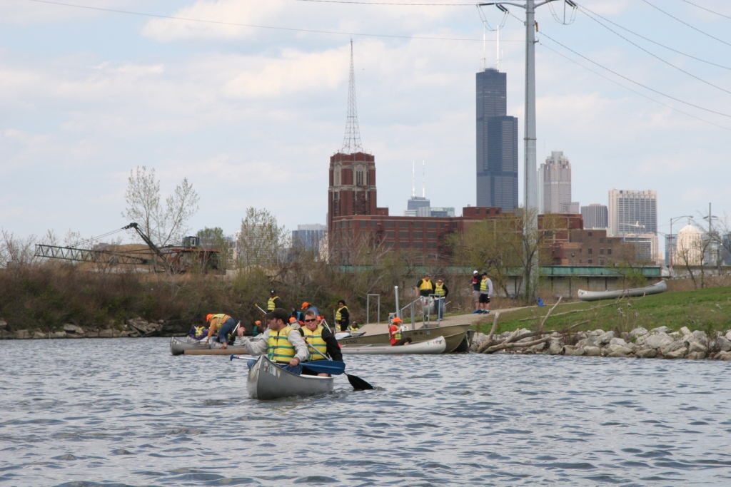
RU students & faculty canoe the Chicago River, May 2009 (photo by B. Hunt)
Course Profile / Registration Info
SUST 220 Water, section L30 (Schaumburg Campus) / Fall 2011
Meeting dates: Sept 10th, Oct 8th, Oct 29th, and Dec 3rd
Pre-req: English 101
Online interaction required through RU Online / Blackboard
Recommended but not required is an excellent text I used last year in the augural section of SUST 220 — The Atlas of Water, by Maggie Black and Jannet King (Univ of CA Press, 2nd ed., 2009).
If you are interested in enrolling in SUST 220 this coming fall, please contact your academic advisor, and feel free to get in touch with me if you want to learn more about the course. Enrollment is limited, so plenty of personal attention from yours truly is guaranteed. And if you’ve never tried an online course before, taking a hybrid course such as this is a great way to “test the waters,” since students will have ample opportunity to interact with me and each other face-to-face, as well as get help/support with the online component if need be.
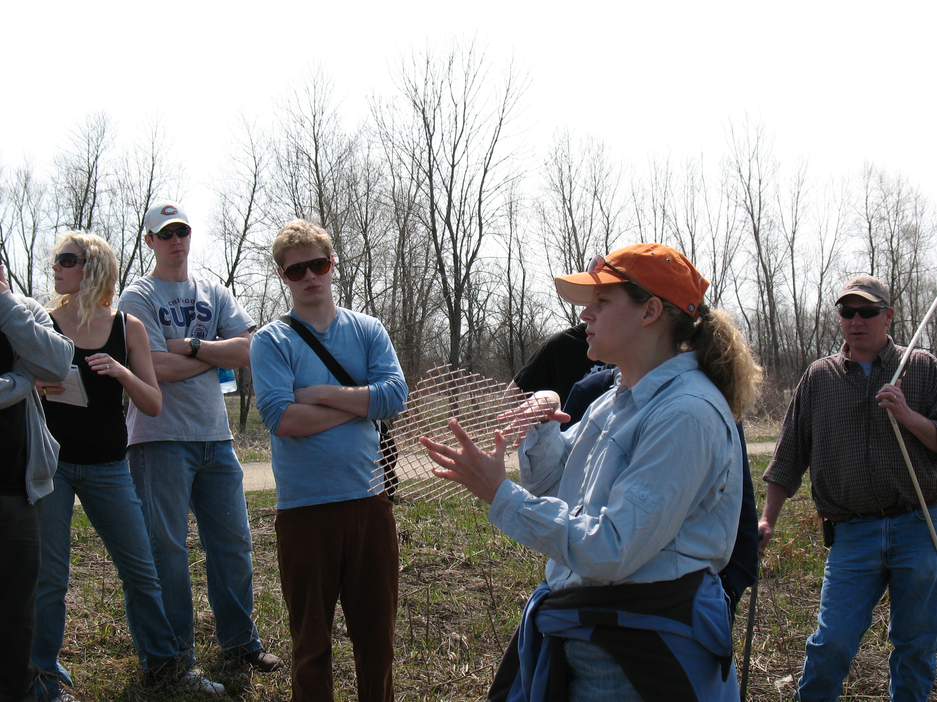
Wetlands Research Inc. ecologist Jill Kostel talks about the restoration work underway at the Des Plaines River Wetland Project, April 2009 (photo by M. Bryson)
Like to know more? Below is a preview of the kinds of topics we’ll investigate in SUST 220.
Water, the Stuff of Life
Without water there is no life. Without clean water, human and animal life is vulnerable to catastrophic disease. How, despite population growth and industrial production, can we ensure clean supplies of water for humans and wildlife? This course evaluates water quality and water sustainability issues through the analysis of local, regional, and global issues and case studies.
Consider, for example, the connections between local and regional water issues here in the Chicago area. Chicagoans have the luxury of living on the shores of the world’s greatest repository of fresh surface water, the Great Lakes, a position we regrettably abuse by withdrawing several hundred million gallons of Lake Michigan water every day simply to flush our sewage downstream to Peoria and all points south. By contrast, most communities in northeastern Illinois that lie outside the Great Lakes basin draw their water from surface streams or underground aquifers, sources that are vulnerable to over-use and pollution. According to the 2009 report “Before the Wells Run Dry” by the Chicago-based Metropolitan Planning Council and Openlands, the long-term sustainability of fresh water in Illinois requires much better conservation of these finite resources and improved long-term water supply planning.
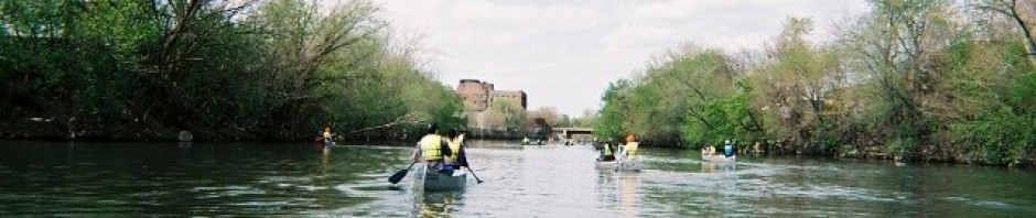
Canoeing highly polluted Bubbly Creek, aka the South Fork of the Chicago River's South Branch (photo by L. Bryson)
A global perspective on water availability reveals far more disturbing realities. The earth is a planet defined by an abundance of water, of which almost 98 percent is salty or brackish. Just over two percent is fresh, and more than two-thirds of that water is locked up in ice sheets, glaciers, and permafrost. Thus, only a tiny fraction of the earth’s water is available to us for drinking, bathing, flushing toilets, growing crops, etc. That finite resource is imperiled by the unsustainable trends of pollution, overuse, waste, and lack of access. In developing countries, about 90 percent of sewage is dumped into rivers without any treatment. Worldwide, polluted rivers transport toxins and excess nutrients to coastal areas, where biological “dead zones” result; from 1995 to 2007, the number of such oceanic dead zones increased by 30 percent. Depending where you look, overconsumption or scarcity is the defining problem. Citizens of the US accustomed to readily available freshwater consume about 100 gallons day per household, on average; while globally, nearly two billion people lack ready access to clean water.
Key concepts and themes addressed in SUST 220 include the science and policy of ensuring a safe water supply; water conservation strategies, particularly in urban areas; wastewater treatment and watershed management; and wetlands ecology, restoration, and management. Students will develop a thorough understanding of the water cycle and its relation to the sustainability of water systems; understand and assess the importance of water as an environmental as well as cultural resource; learn to define, measure, and sample water quality in a variety of contexts using simple yet effective field-based water chemistry sampling techniques; and evaluate contemporary water management and policy issues, particularly those affecting the waterways of the Chicago region as well as the Great Lakes ecosystem.