There are many times when I give thanks for having the wonderful job of being a professor — and today is one such day. I’m writing this update from a motel room in Chesterton, Indiana, where I’m attending a writer’s/artist’s conference (with my two children in tow) sponsored by the Center for Humans and Nature, an environmental humanities organization which is leading the development of a book project / art exhibit scheduled for 2014 entitled City Creatures.
As a contributing author to this project, I’m lucky enough to be a part of this retreat to the amazing and inspiring landscape of the Indiana Dunes National Lakeshore, one of the most ecologically significant places in the Midwest and the closest national parkland to Chicago. Our goal is to think of ways in which humans relate to, connect with, and/or learn from non-human animals in the Chicago metro region — precisely the kind of “urban nature” questions my students and I have been grappling with the first two weeks of our summer humanities seminar on “Representations of the Urban Landscape.” Talk about a happy coincidence of timing!
Yesterday afternoon, before taking a leisurely hike in the Calumet River marshlands of the Dunes, I heard a remarkable presentation by Ron Engel, a theologian, social activist, writer, and conservationist who lives in the Dunes community of Beverly Shores with his wife, Joan — herself a gifted writer and fellow conservationist. For four decades, Ron and Joan have dedicated themselves to protecting the Dunes from further industrial/commercial encroachment, advocated for their continued conservation and restoration, and documented their historical and cultural significance to the region. Ron is the author of the well-received book, Sacred Sands: The Struggle for Community in the Indiana Dunes (1983), which is sadly out of print but available at local libraries.
Today we gather again for a morning of discussion, brainstorming, and essay planning — the goal of which is to create a book and accompanying art exhibit that explores our human relationships with and connections to the non-human animals we encounter in a variety of urban settings within the Chicago Region: backyards, parklands, industrial sites, rivers and lake shoreline, etc. Then we’ll take another hike through the rich Dunes landscape to learn more about the complex cultural and natural history of this place — and how they are intricately intertwined.
It’s good to meet people this way — interacting, conversing, exploring . . . all with a common goal in mind. Yes, we could’ve planned and brainstormed this project solely by email and conference call. But I’m glad the project’s organizers, Gavin Van Horn and David Aftandilian, set up this retreat — a rare opportunity for many of us to take time out from our busy lives and collaborate face to face in a deep and meaningful way.
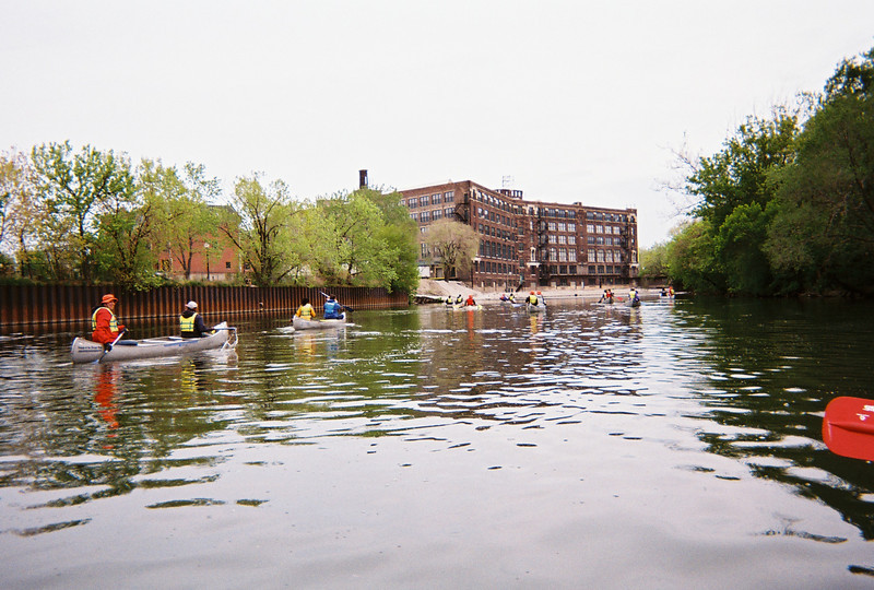
This past Sunday, 29 April 2012, students from my SUST 350 Service & Sustainability class joined staff and student interns from Growing Power‘s Chicago Lights Urban Farm for a canoe trip on Bubbly Creek, aka the South Fork of the South Branch of the Chicago River. This was the second of two field trip experiences for RU undergrads and Growing Power Youth Corps job interns who have been working together in the Spring of 2012 at the Chicago Lights Urban Farm. (The first was a road trip to Growing Power’s original farm site on Milwaukee’s Northwest Side.)
Paddling south on Bubbly Creek (M. Bryson)
Led by Friends of the Chicago River, this outdoor adventure introduced RU undergrads and Cabrini-Green teens and young adults to river ecology, wastewater policy, Chicago history, and urban biodiversity — not to mention the no-less-important skills of teamwork and good paddling technique. Most of the day’s participants had limited to no canoeing experience prior to our adventure; but they learned quickly with the help of a pre-launch paddling lesson by our Friends of the Chicago River guides, and by the end of our 2.5 mile journey had proven themselves adept at handling a canoe on one of America’s most infamous urban waterways. Talk about baptism by fire . . . er, wastewater effluent!
This industrialized and heavily polluted channel on Chicago’s South Side got its name years ago from the methane gas that bubbled up from the bacterial decomposition of organic waste on the creek’s bottom. Bubbly Creek was the notorious dumping ground for the Chicago Stockyards for decades. Things were so bad in 1909 that a chicken was photographed walking across the sludgy surface of the river.
Paddling south on Bubbly Creek; to the right (west) are 34th Street and the Iron Street Farm (M. Bryson)
The South Fork’s revolting environmental history inspired me to take urban sustainability seminar students to the waterway as our capstone field trip back in May of 2009 — and I’ve been canoeing Bubbly Creek with my students ever since.
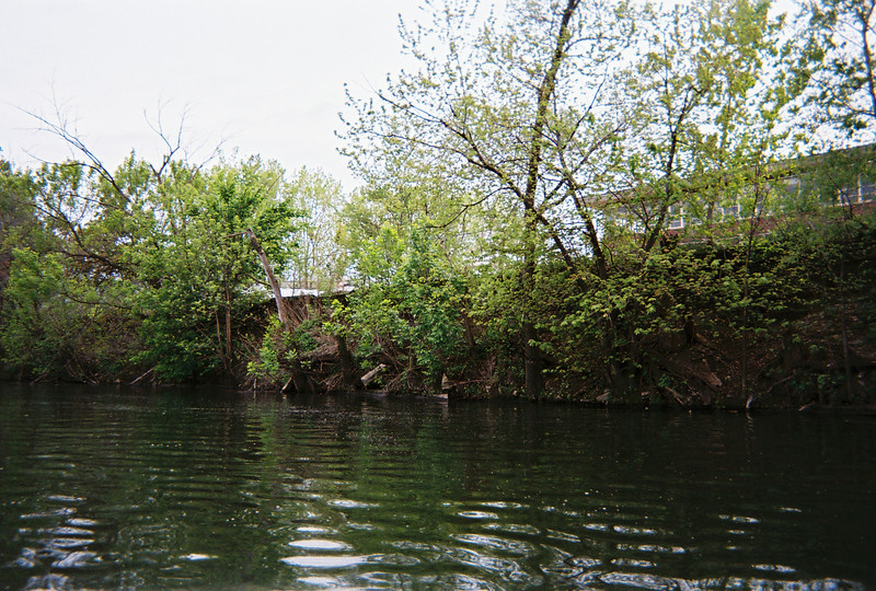
The mild spring weather, sluggish current, and lack of boat traffic made for exceptional paddling down the one-and-a-quarter-mile length of Bubbly Creek this past Sunday. Our view was one of arresting images and stark contrasts. Along some stretches, vegetation reclaimed the industrial riverbank. Elsewhere, pipes stuck out from concrete or steel embankments, water from area street-level drains trickling from their openings — a hint of the deluge that would ensue were it to rain. We floated slowly and quietly under massive railroad and highway bridges, the dim roar of traffic far above us.
Near the headwaters of Bubbly Creek; on our right is the massive Racine Avenue Pumping Station. Each of its eight pipes is 5 feet in diameter. This station pumps wastewater from this area of Chicago southwest to the MWRD's Stickney wastewater treatment plant -- the largest such facility in the world. In times of significant rainfall, these pumps reverse and pump untreated combined sewage into Bubbly Creek, where the water levels quickly rise three feet. (M. Bryson)
Visible evidence of pollution was everywhere — old plastic garbage bags hanging from trees; floating bottles and cans; the occasional used condom (nicknamed “Chicago River Whitefish” by jaded river veterans); and the infamous bubbles, still percolating up from the murky depths. At times the faint stench of sewage drifted over us.
Yet, we also saw encountered wildlife, including Canada geese, Mallard ducks, a juvenile red-tailed hawk, and a green heron (one of the three heron species native to Illinois). Tree swallows swooped over the water, hunting for insects, and red-winged blackbirds and white-throated sparrows sang lustily from the brush riverbanks. Although we didn’t see any that day, beavers are known to be active along the creek, despite its persistent pollution. Such observations provided a dramatic ecology lesson: while Bubbly Creek is still in rough shape, it has come a long way from its earlier environmental desecration.
A significant moments of our trip occurred as we paddled southward along an imposing, rusted metal retaining wall on the east bank of the river; to the west was a more vegetated riparian zone that ended at a chain link fence.
Malcolm, a longtime Growing Power Youth Corps intern on his first canoeing adventure, points to the Iron Street Farm with his paddle (M. Bryson)
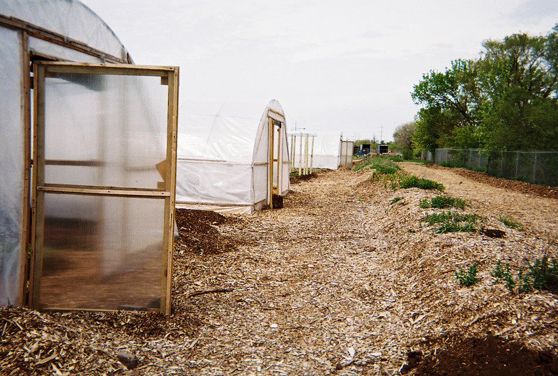
The view itself was unremarkable, save for the fact that we knew what was on the other side of that fence, mostly hidden from view on the high bank: the Iron Street Farm, one of Growing Power’s urban farming operations in Chicago that occupies several acres of former industrial land just west of Bubbly Creek at the intersection of Iron and 34th Streets. With a large building that has been adapted and re-purposed for integrated indoor urban agriculture (aquaponics and vermicomposting) and a bike repair facility, as well as extensive grounds for several hoop houses and even more composting bins, Iron Street Farm represents a sophisticated 21st-century post-industrial refashioning of a 19th century industrial landscape.
Iron Street Farm, as seen from Bubbly Creek (M. Bryson)
And what of the connections between the water of the creek and the food growing enterprise along its west bank? They are many and various, as we discussed while “rafting up” our canoes at the southern terminus of Bubbly Creek, where we contemplated the urban ecology of stormwater runoff and combined sewage overflows while floating in the shadow of the massive Racine Avenue Pumping Station. Every drop of water that falls on the compost-enriched soil of Iron Street Farm not only is utilized by edible plants in food production, but also is diverted from the sewer system of the city, thus reducing the total amount of surface run-off that results (in times of sufficient precipitation) in the release of untreated sewage into Bubbly Creek and the many other channels of the Chicago Area Waterway System.
Hoop Houses at Iron Street Farm; Bubbly Creek is just past the fence to the right (M. Bryson)
Beyond this systematic analysis, though, was a more emotional revelation about urban waterways that I felt may have occurred, tacitly but undeniably, amongst us on our trip — one that runs counter to the fears of the uninitiated that scary creatures lurk in the deeps, or that urban rivers are degraded beyond reclamation. Given the chance to experience a river, up close and personal, people of all ages respond to its rough and imperfect charms.
If we can learn to love and value the likes of Bubbly Creek — if we can see that a channelized, polluted, and long-neglected waterway has the potential to become, well, a river again — then just about anything’s possible.
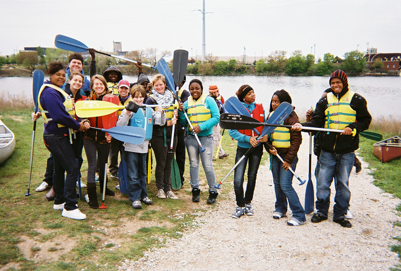
Ivory (foreground) and Deja, two of the Growing Power Youth Corps interns who work at the Chicago Lights Urban Farm (M. Bryson)Our group combined folks from Roosevelt University's SUST 350 Service & Sustainability class, Growing Power staff and Youth Corps interns, and guides from Friends of the Chicago River (M. Bryson)
This coming spring semester I will be offering the inaugural section of SUST 350 Service and Sustainability at the Chicago Campus. The specific course theme is Urban Farming, Community Development, and Social Justice.
Title/number: SUST 350 Service and Sustainability (section L10)
Semester offered: Spring 2012 (initial offering)
Campus: Chicago
Day/time: Wed 3-5:30pm
Pre-req: UWR
Text: Lorraine Johnson, City Farmer: Adventures in Urban Food Growing (Greystone, 2010, paper, ISBN 9781554655190) — on order at the RU bookstore
SUST majors and minors may take this class to fulfill an upper-level SUST requirement, but 350 also is open to students at large who need a general education course or desire elective credit.
Introduction to the Course
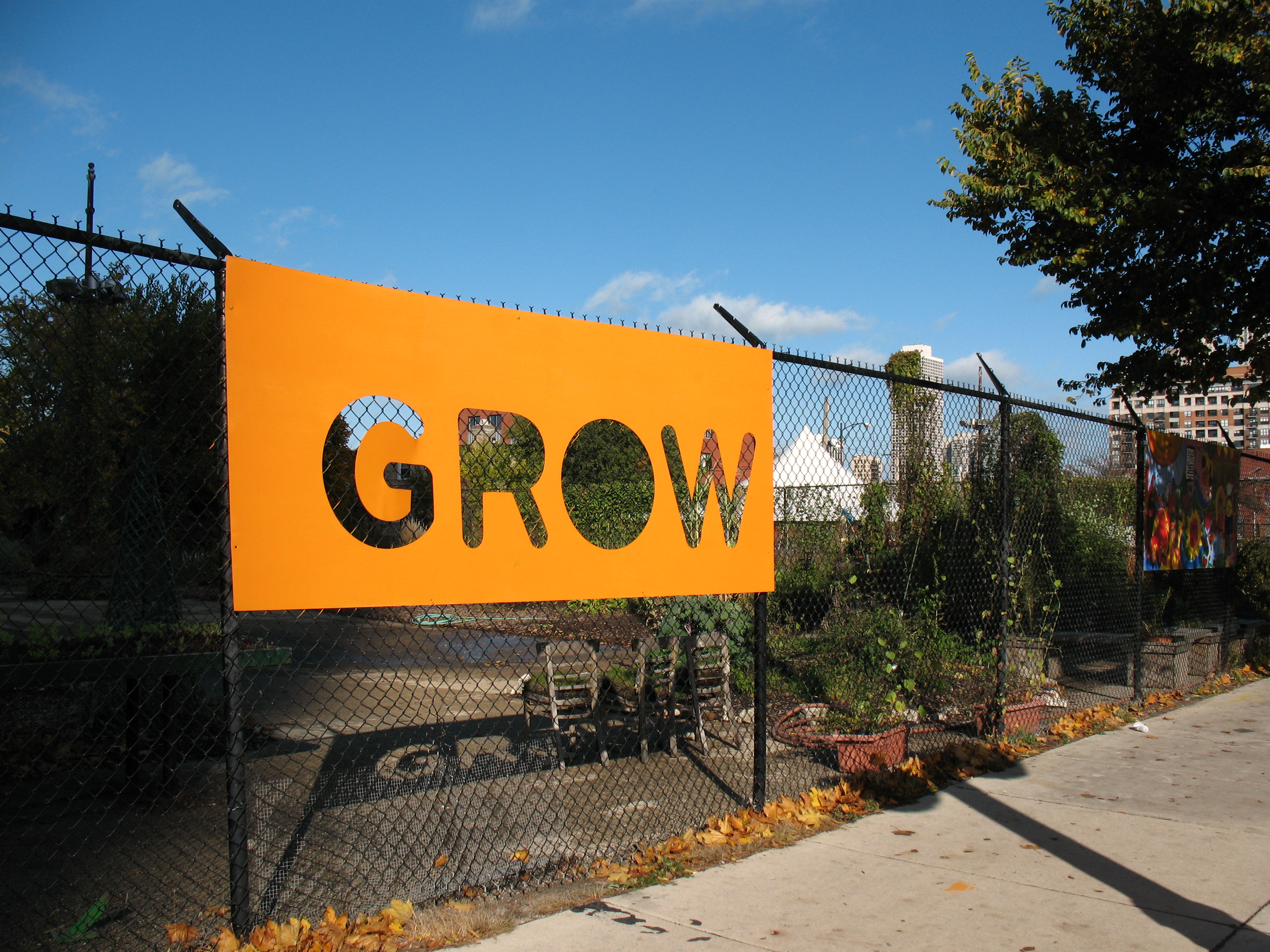
SUST 350 focuses on one of sustainability’s “Three Es” — social Equity — within the broad context of Environmental stewardship and Economic development. Students will learn about one of the most important components of sustainability — food production and consumption — in the context of urban neighborhoods and ecosystems.
Chicago Lights Urban Farm (M. Bryson)
By doing hands-in-the-dirt labor at Chicago Lights Urban Farm on the city’s near-North Side, students will gain direct knowledge of contemporary organic/urban agricultural systems as well as learn about pressing urban social justice issues such as food deserts, gentrification, pollution, environmental racism, and persistent poverty. Initial class meetings through February will be at RU’s Chicago Campus, while subsequent class meetings will take place at the farm.
Once established at the farm site in mid-March, Roosevelt students will work side-by-side with Cabrini-Green neighborhood youth in a unique reciprocal learning opportunity. Participants in the Chicago Lights Youth Corps program (14-21 age range) work as job trainees at the farm 9 hours/week during the school year and 20 hours/week during the summer.
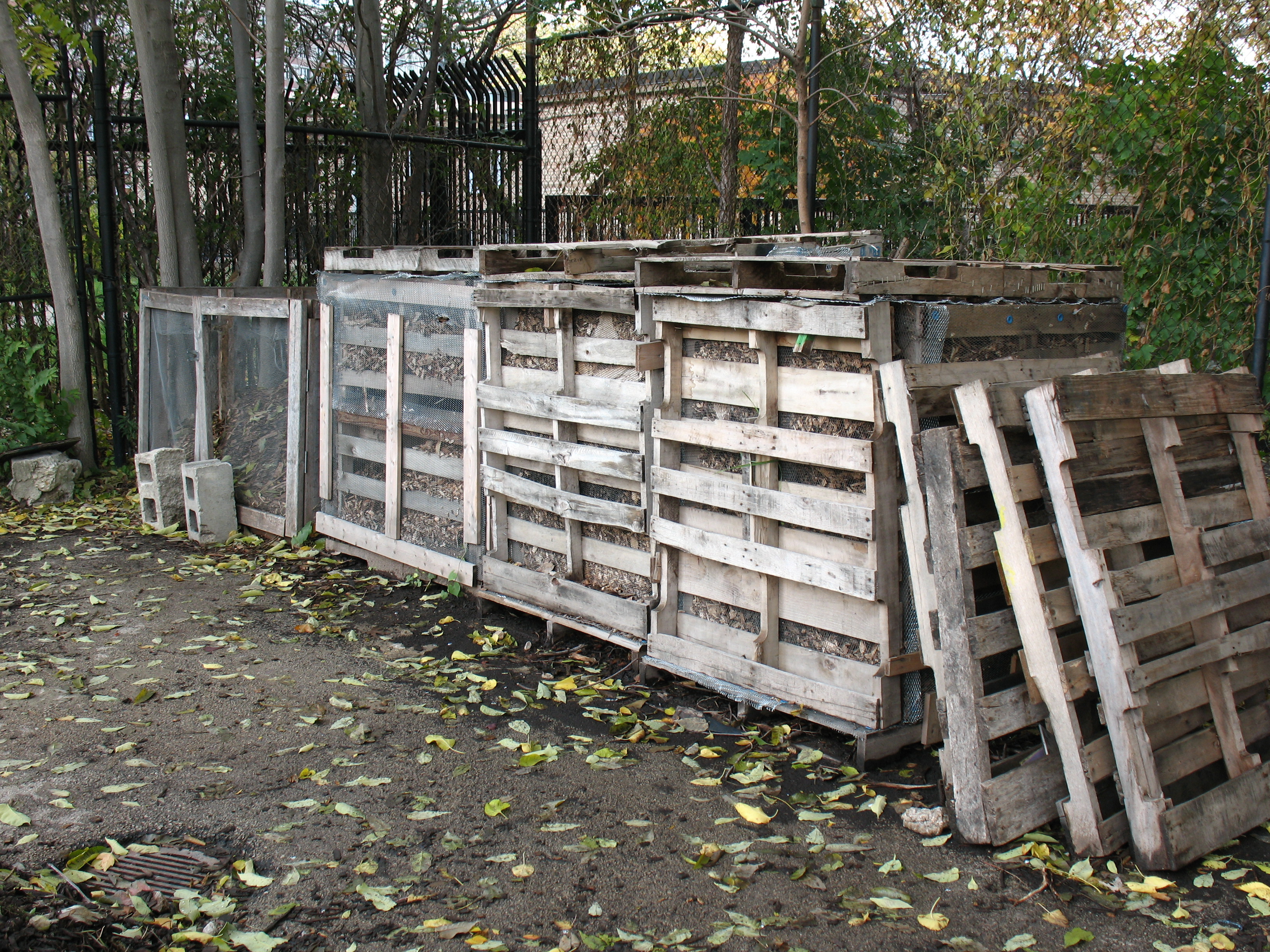
Compost Bins at the Chicago Lights Urban Farm (M. Bryson)
They acquire skills in urban agricultural production (composting, soil management, seedbed planning, hydroponics, organic pest management, harvesting, etc.) and economy (packaging, marketing, distribution, and sales). To the extent that Roosevelt students are newcomers to these activities, they will be learning skills from the Youth Corps kids as well as from the urban farming experts.
An urban farm is about food, but so much more besides. The Cabrini-Green community is an economically stressed neighborhood that has gone through dramatic and wrenching changes as high-rise public housing has been demolished, residents have been displaced within and without the community, and gentrification proceeds at a rapid pace — even as crime and poverty persist. Here, an urban farm is a source of freshly grown, organic produce; a training ground for local youth in need of practical job skills; a stop valve in the Cradle-to-Prison pipeline; a gathering place for people of all ages in the community for physical exercise, informal education, and social events (such as the annual Fall Harvest Festival held on-site); a demonstration site for sustainable agricultural techniques; a model of economic development on a local, sustainable scale; and a means of reconnecting urban folk to the natural world. More generally, in urban areas starved for jobs, green space, safe outdoor gathering places, and fresh quality food, these small-scale farms productively and powerfully address the need for social equity and progressive change.
Partner Organizations: Chicago Lights Urban Farm and Growing Power
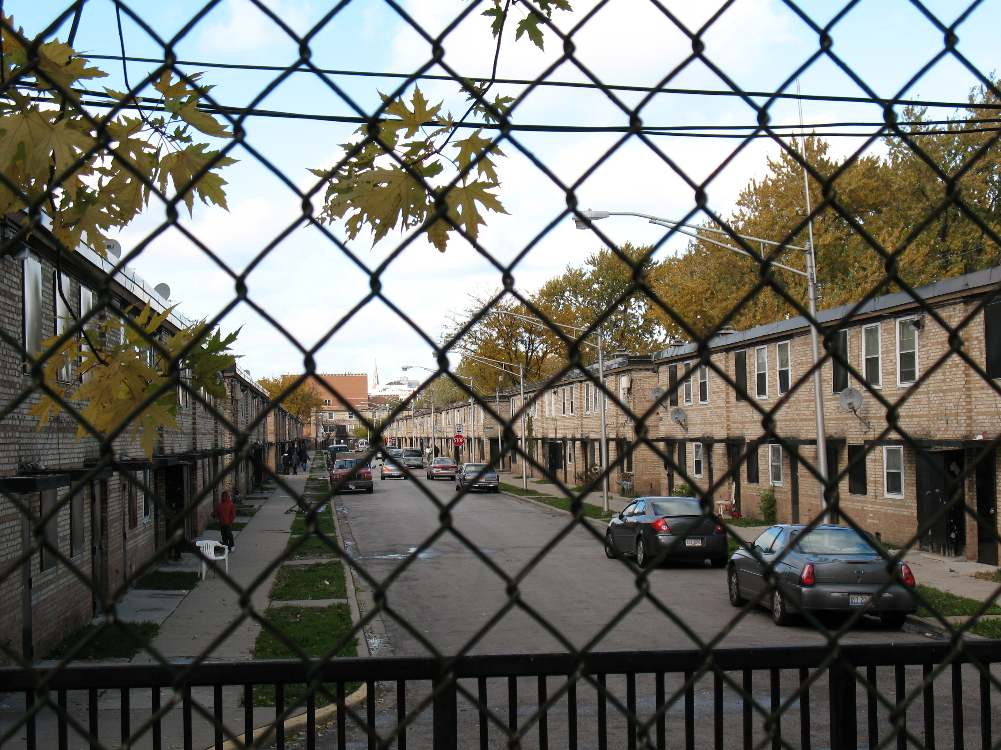
The Chicago Lights Urban Farm is one wing of the Chicago Lights Community Outreach Organization on Chicago’s near-North Side, and is located at 444 W. Chicago Avenue, the south end of the Cabrini-Green neighborhood.
Cabrini-Green row houses as seen from the north edge of the Chicago Lights Urban Farm (M. Bryson)
Formerly known as the Chicago Avenue Community Garden, it began in 2003 as a modest collection of raised-bed planters covering the cracked blacktop of an abandoned basketball playground. Since then, the farm has expanded and diversified its operations with the help of Growing Power, a nationally-recognized urban farm initiative based in Milwaukee that has established satellite operations in several Chicago neighborhoods (including Cabrini-Green, Altgeld Gardens, Grant Park South, and Bridgeport). The mission of the farm is to “empower . . . youth and community residents in the Cabrini-Green neighborhood to have increased economic opportunities through access to organic produce, nutritional education, and work force training” (Chicago Lights “Urban Farm”).
Field Trips in Urban Ecology
SUST 350 Service and Sustainability provides an ideal context for field-based learning experiences that connect progressive social/environmental action to sustainable community development. While the Chicago Lights Urban Farm itself is a quintessential example of such a field experience, a selection of well-planned day trips to other sites will broaden that learning experience for RU students as well as provide a rare opportunity for the farm’s Youth Corps participants to leave the confines of their home neighborhood, see other parts of the region they have little to no familiarity with, deepen their understanding of urban ecology, and personally connect with the varied and surprisingly engaging forms of the region’s urban nature. In this expression of reciprocal learning, RU undergrads and Youth Corps students will be learning together in the context of adventurous new experiences, a process necessitating team-work and producing a profound sense of personal accomplishment.
Planned field trips tentatively include a tour of urban farms sites in Chicago, the Growing Power flagship farm in Milwaukee, the South Branch of the Chicago River, and/or the Indiana Dunes. See this page for accounts of recent student field trips in my SUST courses.
Wolf Point, the Chicago River in downtown Chicago (M. Bryson)
Such a vantage point affords a unique perspective on the ways in which we use and abuse water, and suggests that we need science, policy, and active citizen engagement to forge a more sustainable future for this much-maligned yet storied river.
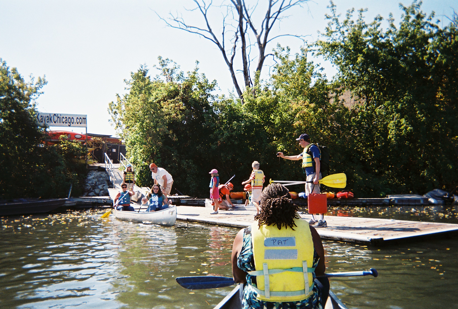
On Saturday, October 11th, students in my SUST 220 Water and PLS 391 Seminar in Natural Science classes at Roosevelt University took a canoe trip with me on the North Branch of the River, from Goose Island on the near-North Side of the city to Wolf Point in the heart of Chicago’s Loop — the place where the North Branch meets the South Branch, and ground zero in the history of Chicago’s development from a frontier town to a world metropolis. Our trip was led by expert river guides with the Friends of the Chicago River organization, which has long advocated for the conservation of the river and helped raise its public profile since the late 1970s.
Launching canoes at the North Avenue Turning Basin (M. Bryson)
This was the fourth such trip I’ve taken with my RU students since the spring of 2009, the previous three trips taking place on Bubbly Creek, a notoriously-polluted tributary of the South Branch that for many decades absorbed the waste from the Chicago Stockyards. These field experiences give us a chance to explore urban nature first-hand and think about
how water moves through those ecosystems and sustains their biotic communities;
what kinds of pressures urban or suburban development exert upon these ecosystems;
the impact of such pressures on water quality, flooding, etc.;
conservation and/or restoration strategies that can improve the quality and sustainability of these aquatic ecosystems;
the significance of water quality to the overall sustainability of urban systems, both in terms of nature and people.
Our trip began at a canoe/kayak launch site at the turning basin at North Avenue, the widest spot along the entire Chicago river system. We proceeded down the North Branch, which runs along the west bank of Goose Island — itself a fascinating place in Chicago’s geographic and cultural history that was made an island when industrialist (and later Chicago’s first mayor) William Ogden had a canal dug to the east to excavate clay for brickmaking and to increase the area’s industrial waterfrontage.
A barge near the Morton Salt Company distribution facility, one of the many industries on the North Branch (M. Bryson)
Once home to Irish immigrants who kept geese and other livestock on their property, Goose Island has seen successive waves of industry and residential development over the decades; in this sense, it is a microcosm of Chicago’s own dynamic development as an industrial city. Since the late 1990s and early 2000s, it has become a thriving Planned Manufacturing District.
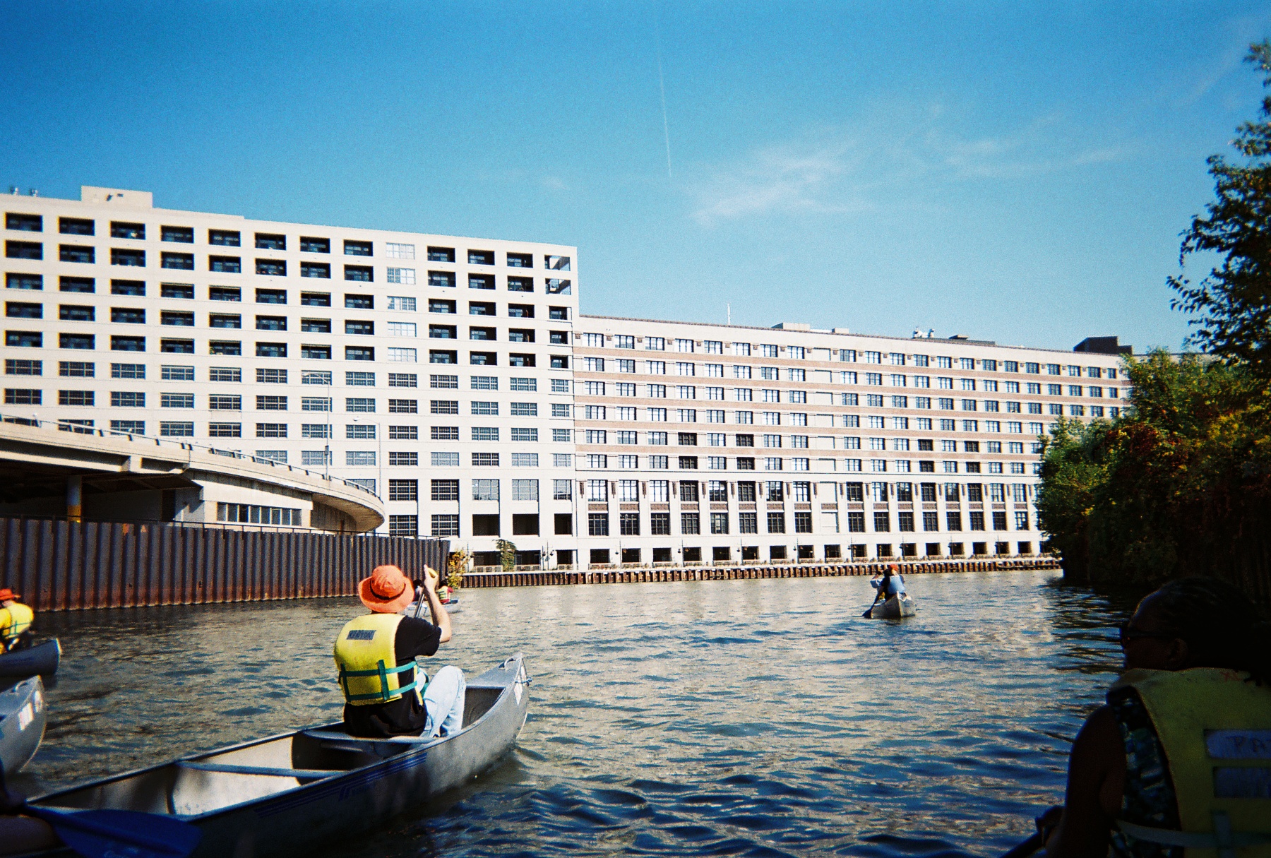
As we paddled southward toward Chicago’s Loop and passed the southern tip of goose Island, we learned to keep well to the right of the river channel to avoid the many tour boats and private craft that ply these waters. The presence of many diverse watercraft on the river testifies to its importance as a cultural and recreational amenity as well as tourist attraction — all of which have positive economic impacts for the city. The water here offers stunning views of bridges, factories, residential developments, and other waterfront properties — such as the massive Montgomery Ward catalog warehouse built in 1908 — which together constitute a colorful tapestry of the urban landscape.
The 2.3 million-square-foot Montgomery Ward warehouse (M. Bryson)
The presence of urban wildlife in the river corridor, including numerous Canadian geese and Mallard duck sightings as well as evidence of beaver activity, highlight the river’s identity as a living ecosystem and value as wildlife habitat. This green face of the river was particularly evident in the North Branch Canal (east of Goose Island), through which we paddled on our way back from Wolf Point.
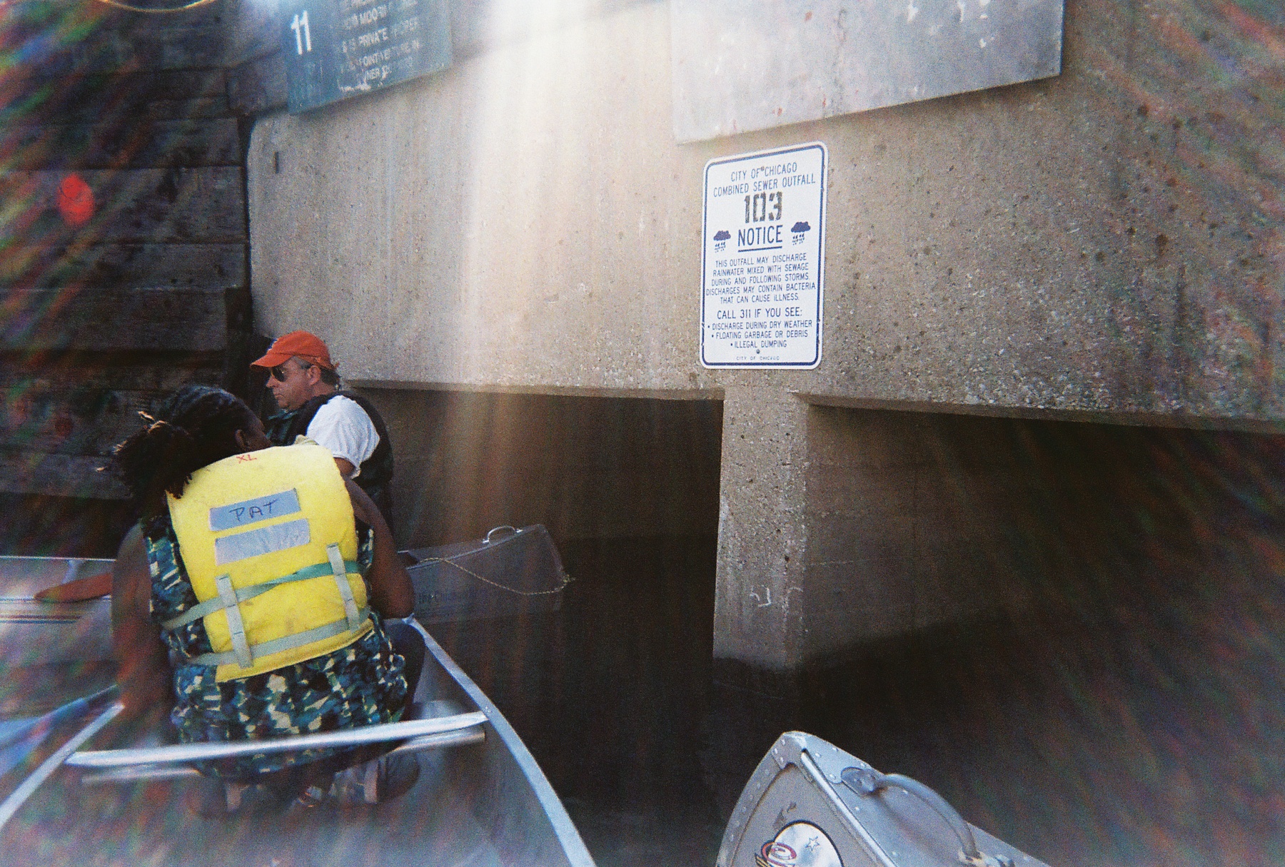
Those ecological musings are complicated by consideration of the many Combined Sewage Outfalls (CSOs) that exist along the riverbank, outlets that frequently release untreated sewage directly into the river in times when precipitation exceeds a certain threshold (about a half-inch, depending upon size of the area experiencing rainfall). These outfalls are not confined to industrial sections of the river; 265 of them occur all along the length of the Chicago Area Waterway System (CAWS),
Combined Sewage Outfall on the Chicago River, in the Loop (M. Bryson)
including this industrial yet scenic stretch of the North Branch and at the confluences of the North and South Branches in the Loop. Paddling near such an outflow is a disquieting and disturbing experience, as it brings one face-to-face with the question, “where does our waste go when we flush our toilets?” The answer: right here, quite often.
Indeed, the fecal coliform test we performed later at our canoe launch site confirmed the presence of (though did not quantify) coliform bacteria colonies in the water, which are indicators of fecal coliform — despite the fact that it had not rained in several days prior to our trip. Students also performed a variety of other water quality tests for physical and chemical variables such as temperature, turbidity (cloudiness), pH, hardness, dissolved oxygen, nitrate, phosphate, and chlorine. (You can view a summary of our results here as a pdf.)
Such a profile gives us a snapshot of the water quality at a given moment in time. In this case, overall quality was deemed fair to decent by such measures as temperature, pH, and dissolved oxygen; but elevated nitrate and phosphate levels (nutrients that result from industrial and urban pollution that can cause algal blooms and subsequent oxygen depletion) as well as the water’s fairly turbid nature and the definitive presence of coliform bacteria show there is much room for improvement. Had it rained that day or the previous day, many of these chemical indicators would’ve been measurably worse. Fortunately, the Metropolitan Water Reclamation District (MWRD) has recently moved to begin planning a final stage of disinfection for treated wastewater at two of its treatment plants, a move that will certainly lessen the chronic bacterial contamination of the water.
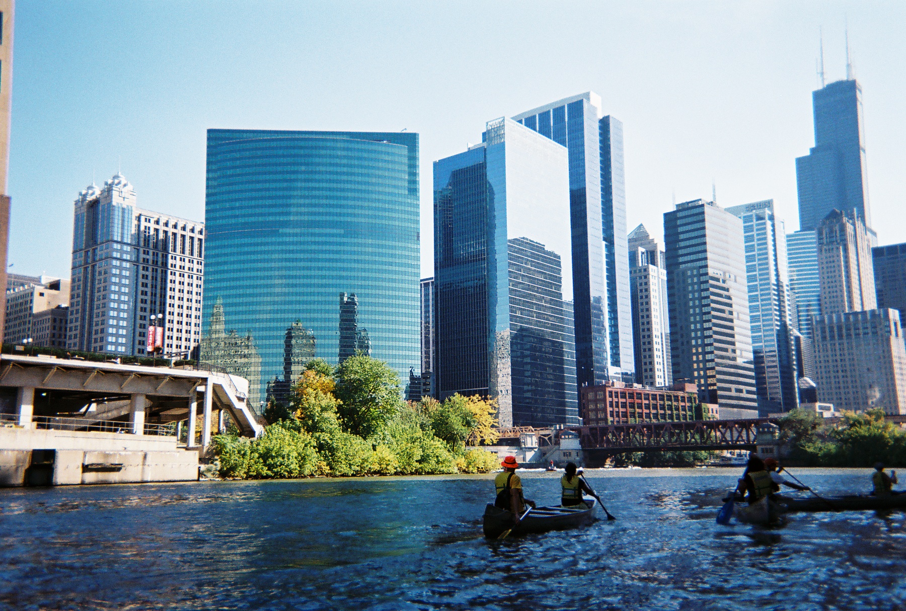
Heading south into downtown Chicago on the river; Wolf Point and the skyline (M. Bryson)
Paddling a polluted urban waterway is decidedly much different than journeying along a pristine stream in an uninhabited wilderness. But it may be an unparalleled way to way to experience a city’s landscape and to contemplate the complex processes of urban ecology represented by the movement of water with that landscape.
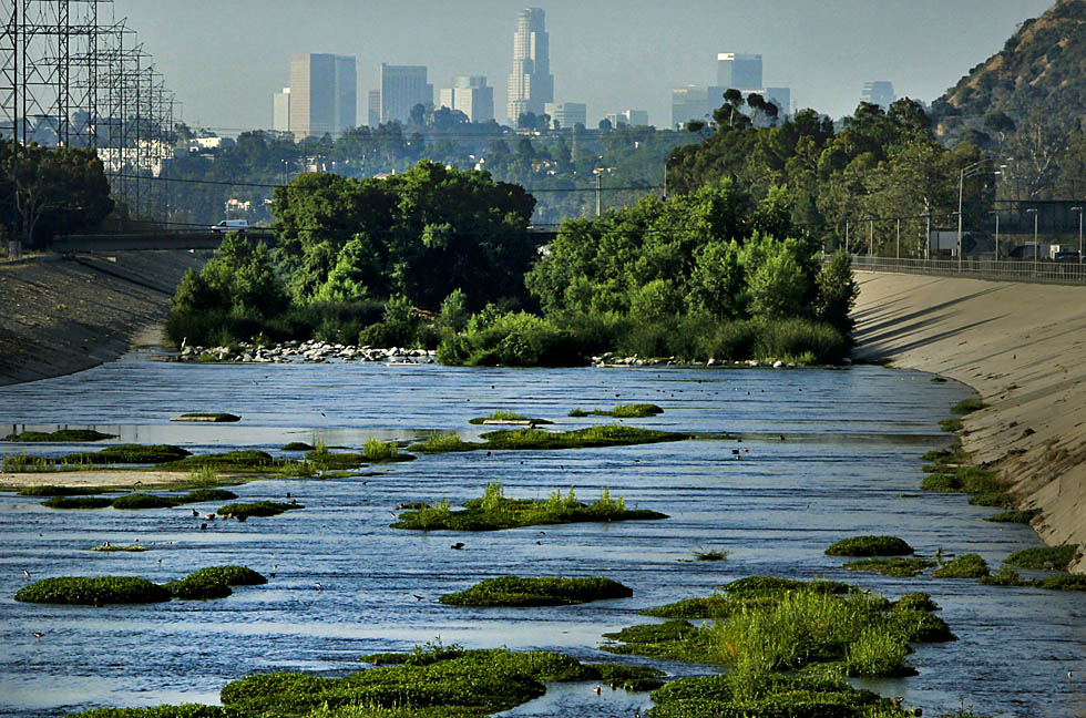
For the first time in decades, people in Los Angeles this month were able to paddle along the much-maligned and concrete-encased Los Angeles River without breaking the law. It was, if you’ll pardon the pun, a watershed moment — both for the river, which is making a comeback in the eyes of the general public as well as elected officials; and for the greater Los Angeles community, which is slowly coming to grips with the fact that it has a potentially dynamic natural resource threading its way through neighborhoods that are starved for high quality green space.
The LA River in 2010 (photo by Mark Boster of the LA Times)
Even the U.S. Corps of Engineers, the same outfit that tamed the flood-prone river in the 1930s by building levees and a concrete channel for the formerly wild LA river, is coming on board. This past month’s float down the Sepulveda Basin section of the river included civic officials as well as Mark Toy, District Commander of the Corps of Engineers. As reported by the LA Timeson 9 August 2011,
Los Angeles is urban territory, and this 1.5-mile trip is arrow-straight, flanked by the San Diego and Ventura freeways and strewn with discarded bicycles, shopping carts, trash and, occasionally, the carcasses of rodents.
It is also home for 212 species of birds, including yellow warblers, hooded orioles and the federally endangered least Bell’s vireo.
In July, U.S. Army Corps of Engineers District Commander Col. Mark Toy issued the license allowing the Los Angeles Conservation Corps to operate the program along a soft-bottom stretch of the river between Balboa and Burbank boulevards, about 17 miles northwest of downtown Los Angeles.
On Monday, his participation in the program’s inaugural “ceremonial paddle” was viewed by environmentalists as an important juncture in the history of the river that was tamed and polluted in the 1930s by the corps’ concrete walls and 12,000 storm drains.
“For more than a century, the U.S. Army Corps of Engineers has built walls between people and their rivers here in Los Angeles and nationwide,” said David Beckman of the Natural Resources Defense Council. “So to have the corps’ district commander metaphorically jumping over that wall and into a boat is symbolic and potentially very important.”
Toy shrugged off such accolades, saying, “This is a team effort, and I’m proud to be a part of it. What we learn from the program this year will help shape the future of the river.”
The recent resurgence of interest in the LA River, spurred by river enthusiasts and environmental advocates, exemplifies an important axiom in relation to urban streams. If people start using them for recreation, they suddenly become more important, no matter their state of abuse or degradation. And such usage, in turn, spurs efforts to clean up the rivers in order to benefit from their important functions as green corridors.
This has long been the case with the Chicago River, which has experienced a remarkable resurgence in recent decades since the formation of the non-profit river advocacy group Friends of the Chicago River in the 1970s. Now canoe races are held along various stretches of the river, schoolchildren and adults come to the water to learn about aquatic ecology and urban conservation, and the city has poured millions of dollars into building attractive riverwalks and improving water quality — all testament to the fact that the river is a cultural amenity and economic resource.
Yet even Chicago has a long, long way to go before its channelized, reversed, and polluted waterways regain their ecological health and biodiversity. The mere name of the transformed south branch of the river — the Sanitary and Ship Canal — indicates its primary identity as a transportation conduit and sewage conveyance channel, rather than as a living river. But the Metropolitan Water Reclamation District’s recent decision to plan for disinfecting the treated wastewater it releases into the Chicago Area Waterway System (CAWS) is a landmark step in working toward the river’s ecological improvement and reshaping that identity which dates from the late 19th century.
It looks like LA, with the Corps of Engineers’ recent foray on the river and the building public interest in exploring its hidden reaches, is taking initial steps down a similar path. The ultimate goal: to treat urban rivers like living ecosystems, which they are, instead of mere tools for flood control, shipping, and wastewater management.
Nature within the urban landscape is simultaneously close at hand and hidden from view — a paradox of proximal obscurity. Yet its myriad forms and manifestations are as diverse in kind as their human denizens. City parks, community gardens, nature centers, green rooftops, restoration sites, golf courses, back yards, alleys, vacant lots, landscaped public spaces, plus the resident non-human biota in all its riotous diversity and plenitude — all these and more comprise urban nature.
Photo by Ryan Hodgson-Rigsbee
Despite the ubiquity and fascinating heterogeneity of urban nature, it remains largely invisible to and thus unappreciated by many city dwellers. We are much more likely to assume nature exists “out there,” away from our cities and suburbs — especially in remote depopulated places characterized by the well worn but still compelling aesthetics of the beautiful or the sublime. Our culture assumes that city, country, and wilderness are distinct landscape types with clear regional boundaries, and an implicit corollary to that is that the city is unnatural. The fact that urban green spaces are often compromised and degraded by pollution, development, or overuse only underscores that point. Yet the recent coinage of the seemingly oxymoronic phrase “urban wilderness” signals that ecologists, artists, environmental advocates, and citizens have begun to re-envision the role of nature within metropolitan landscapes.
Just about any American city could serve as a fruitful setting for analyzing the character and significance of urban nature; indeed, such analyses are best done with the specificity of a particular locale in mind. Consider, then, Chicago. The Windy City’s natural and cultural histories are not only long-studied and well-documented, but also inextricably linked with how we’ve thought about, confronted, transformed, abused, and (of late) restored the natural environment of urban areas. From its beginnings as a marshy trading post on the banks of the Chicago River, to its amazing expansion as an industrial power during the 19th and 20th centuries, to its profound reshaping of the physical landscape in that process, to its ascension as a global city in the 21st century that strives to be environmentally progressive — Chicago is an ideal laboratory in which to study the diverse manifestations of nature in urban spaces.
The Chicago River (photo by Ryan Hodgson-Rigsbee)
This nature is almost always hybrid in character, a product of human action (whether deliberate or not) even when appearing “natural” in outward form. Chicago, the self-proclaimed City in a Garden, has spent the better part of its brief existence unapologetically bending nature to its will, from the audacious engineering feat of raising the grade level of its streets and buildings in the mid-19th century in order to install a proper sewer system, to the subsequent development of lakefront parklands atop countless tons of landfill, to the famous reversal of the Chicago River’s current.
This interconnection of the made and the natural can be read in the landscape . . . if one observes carefully and knows where to look. Such is the ongoing quest of photographer and urban explorer Ryan Hodgson-Rigsbee, who investigates and documents the Chicago cityscape on foot, by bicycle, and aboard a kayak. Hodgson-Rigsbee’s growing body of photographs are a stunning visual echo of the urban nature writings of Leonard Dubkin (1905-1972), a journalist and self-taught naturalist who chronicled his explorations of and observations about Chicago’s urban landscape in the middle decades of the twentieth century, and who found a surprising biotic diversity within otherwise unremarkable settings such as vacant lots, railroad buffer zones, or residential yards. Even more importantly, Dubkin advocated the need for human connection to the wildlife — and patchwork of wild lands — that remained close at hand, within the city’s borders, an implicit theme of some of Hodgson-Rigsbee’s landscapes.
The splendid diversity of nature in Chicago can be categorized in many ways, one of which consists of a simple binary: official and unofficial. The former includes the green spaces purposefully designed and designated for human use (parklands of all kinds) as well as the conservation of natural resources (forest preserves, wetland conservation sites, prairie restoration areas). These areas comprise the official version of Chicago’s urban nature — the sort that is featured on the city’s website and which collectively is an incredibly important and irreplaceable resource for the interaction of people with the natural world. The “unofficial countryside” of Chicago, though — to use a phrase from the English naturalist-writer Richard Mabey — is the hardscrabble, unexpected, and often uncared-for everything else. It is this which drew the eye of Dubkin in the last century, and which is now framed by the camera of Hodgson-Rigsbee.
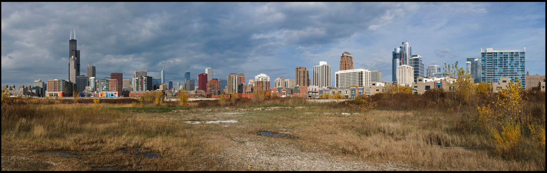
Chicago Loop, as seen from the southwest within The Brownlands (photo by Ryan Hodgson-Rigsbee)
Incredibly, part of this land was once water. The South Branch of the Chicago River wound its way through the area, bending eastward toward Lake Michigan before meandering back west and resuming its southerly course. This D-shaped curve of the river’s channel proved inconvenient for shipping and an impediment to street transportation improvements; so the river here was straightened and channelized in the late 1920s, a water infrastructure project of great scale, expense, legal complexity, and civic ballyhoo, for the reordered urban landscape was supposed to usher in an era of unprecedented economic development for this industrialized area of the city.
These plans never quite materialized, for the through streets on this “reclaimed” land were never completed. The Brownlands thus remain mostly vacant and part of Chicago’s unofficial countryside. Long owned by a railroad well into the late twentieth century, the land was sold to speculative developers in the late 1990s and has changed hands a few times since, though the goal of these recent landowners has not changed. They envision, predictably but unimaginatively, an ambitious riverfront development project of fashionable residences and upscale retail establishments. Fortunately, the mammoth expense of such a project has kept it in limbo, and the Brownlands persist in 2011 as a wide-open space of non-native brush and invasive weeds, patches of prairie grasses which hint at the land’s pre-settlement ecological legacy, informal pathways and abandoned gravel roads, discarded vehicles and miscellaneous machinery, and furtive human visitors who brave the fenced barriers and No Trespassing signs to explore, camp, photograph, bird, even live in the Brownlands.
An example of a contemporary frontier-like space in the middle of America’s third-largest city, the Brownlands simultaneously evoke the past technological transformation of Chicago’s landscape and the present human yearnings for off-the-grid experiences with an unmediated nature. They also hearken to an uncertain future in which yet another large-scale development project may dramatically alter what is now an open space in the shadow of Chicago’s Loop with remarkable restoration and recreation potential.
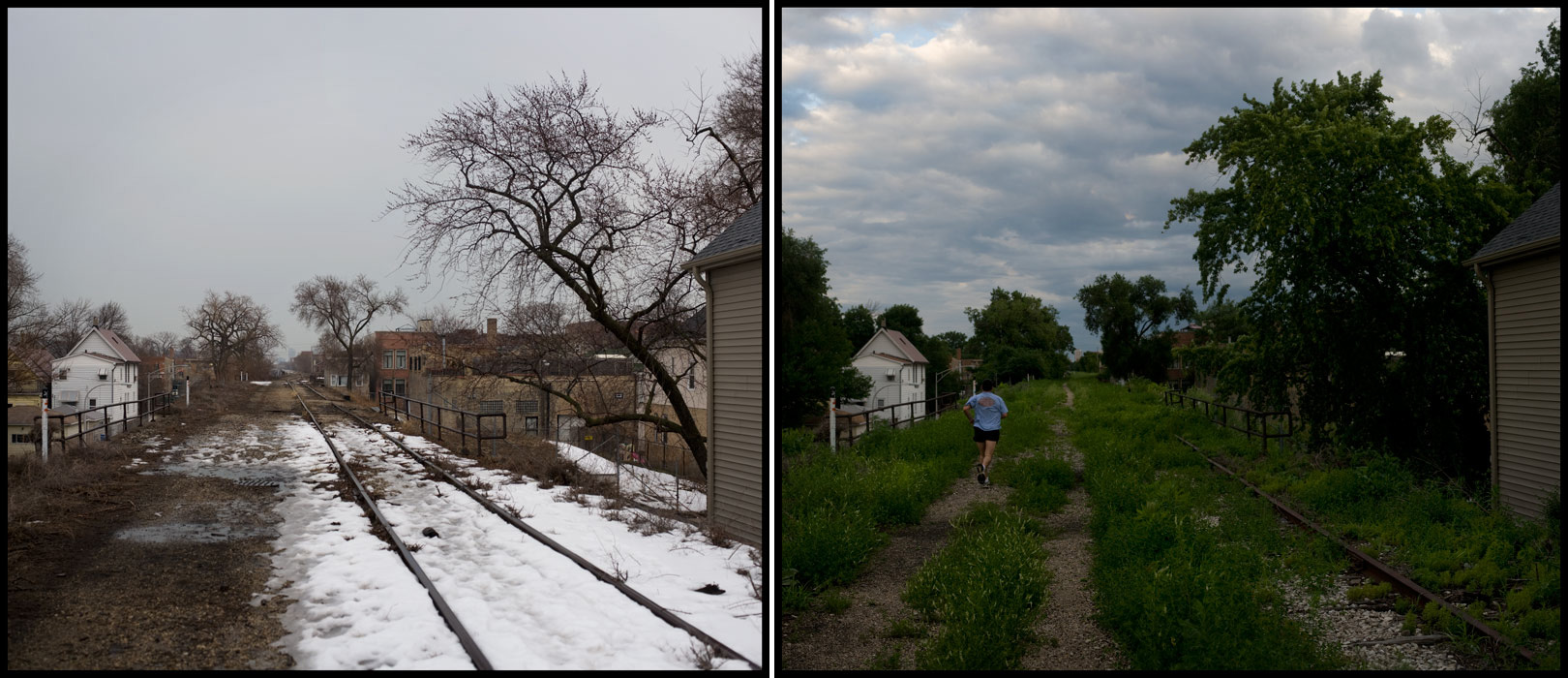
Another significant hybrid place where nature and the built environment converge is the Bloomingdale Trail, an abandoned elevated train line that runs for nearly three miles on the city’s near-North Side. A grassroots non-profit organization, Friends of the Bloomingdale Trail, is in the process of raising funds to convert the defunct railway into an elevated greenway/trail, citing the recently developed High Line linear park in Manhattan as model and inspiration. Currently the project enjoys the backing of some influential politicians (including the outgoing mayor, Richard M. Daley, a noted environmental progressive), but needs to raise upwards of $60 million to finance construction in hopes of completing the Trail by 2016.
Bloomingdale Trail, on Chicago's North Side (photo by Ryan Hodgson-Rigsbee)
Beyond the politics and economics of its development, this proposed parkland is notable for the ways in which it will perform multiple functions and tie together the built and natural landscapes with the city’s diverse human denizens in mind. Part greenway, part commuter route, part public art tableau, part recreational space, the Bloomingdale Trail illustrates how urban space can be re-imagined to embody sustainable transportation alternatives for everyone from children walking to their neighborhood schools to cyclists commuting from their homes to nearby elevated train stations on the CTA Blue Line. Besides these immediate practical benefits, though, the Trail exemplifies the many nature/culture hybrid spaces in Chicago that are in various stages of transition from an old “brown” urban infrastructure of steel and asphalt to a new “green” infrastructure of recreational trails, native plant communities, and ecology-minded landscapes. What is common to this and similar projects in Chicago and other cities is that they do not simply happen because they are good ideas; they require immense amounts of human and financial capital to conceptualize and bring to fruition, even when the political winds are favorable.
The Brownlands and the Bloomingdale Trail are but two examples of Chicago’s unofficial countryside that exists apart from the formally designated parklands, forest preserves, and other green spaces of the city. These and other hybrid spaces are amalgams of nature and culture, places that dramatize the earth’s vulnerability to human alteration even as they show us the resilience and adaptability of plant and animal life within the constraints imposed by brick, steel, and concrete. For the artist, they present a nearly inexhaustible subject for representing the complexities and paradoxes of nature in the city.
An excerpt from this essay was published as the introductory text to While Wandering: Chicago, a book a photographs by Ryan Hodgson-Rigsbee (Urban Nature Media, 2011).
The fourth biennial Wild Things conference will take place all day tomorrow at the University of Illinois at Chicago. This day-long conference brings together the region’s best experts, hardest working professionals, most dedicated volunteers and anyone interested in nature. Technical presentations and interactive workshops explore the latest in natural areas conservation, wildlife protection and monitoring, and sustainability. The conference is organized in “tracks” designed for everyone from newcomers to experts. There is special focus on empowering citizen scientists, stewards and advocates with information, networking and good ideas. Among the speakers scheduled are Roosevelt Professors Mike Bryson and Carl Zimring, as well as a keynote address by Aldo Leopold expert Curt Meine.
Keynote Presentation Curt Meine
Green Fire: The Legacy of Aldo Leopold in the Chicago Region (includes a preview of a new film about Leopold)
Curt Meine will discuss the powerful role of famed conservationist Aldo Leopold in the birth and evolution of ecosystem conservation. Meine will highlight Leopold’s legacy as seen in the people, ecosystems, and history-making conservation initiatives of the Chicago area. He will also present a selection from the first full documentary film about Leopold, which is premiering this spring. Curt is a conservation biologist and writer based in Prairie du Sac, Wisconsin. A new edition of his 1988 book Aldo Leopold: His Life and Work has just been published by the University of Wisconsin Press. Curt currently serves director for conservation biology and history with the Center for Humans and Nature; senior fellow with the Aldo Leopold Foundation; and research associate with the International Crane Foundation.
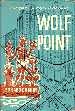
As a literary critic, one recognizes the rare privilege in discovering an obscure yet talented writer — whether someone living or from the distant past — and reintroducing that person to a contemporary readership. Such was my opportunity a few years ago when I came across a book by Leonard Dubkin (1905–72) in a used bookstore in Chicago’s Rogers Park neighborhood. That serendipitous finding was the seed of a research project on Dubkin, a self-taught naturalist and longtime Chicago journalist, which culminated this month in the publication of my essay, “Empty Lots and Secret Places,” in the Winter 2011 issue of Interdisciplinary Studies of Literature and the Environment. As I write in the article’s introduction:
Dubkin [was] an urban naturalist and Chicago writer who immersed himself in Chicago’s natural history long before the recent rediscovery of urban environments by literary critics and nature writers. Like the [small city] park that commemorates him, Dubkin has been easy to overlook. Although he penned several books on nature in the city, wrote a widely read nature column for Lerner Newspapers in Chicago for many years, and published frequently in major national newspapers such as the Chicago Tribune and New York Times, Dubkin today is a virtual unknown.
Yet the recent resurgence of interest in the environmental issues and history of urban areas in general and the Chicago region in particular makes Dubkin’s work important. His writings are a rich historical document of urban nature as well as a detailed exploration of one person’s engagement with the “wild” elements of the city: plants, birds, insects, mammals, and various representatives of the human population. Dubkin has much to say not just to Chicagoans interested in their city’s environment or to aficionados of nature writing, but to all who are engaged in the conservation, preservation, restoration, and representation of urban nature. He speaks, as well, to city and suburban dwellers who feel alienated from an idealized nature they imagine exists only “out there,” away from urban sprawl and congestion.
Dubkin’s essays and books extol the value of the commonplace and mundane for exploring biological adaptation and ecological complexity, illustrate the rewards of patient observation of and direct experience with natural phenomena, and explore the inescapable interconnection of humanity and nature in the urban landscape.
I frequently teach selections from Dubkin’s books in my humanities seminar at Roosevelt University, and students respond enthusiastically to his work. While my essay is the first scholarly treatment of Dubkin’s work, short excerpts from his books have been included in two recent literary anthologies: Terrell Dixon’s City Wilds: Essays and Stories about Urban Nature (2002) and Joel Greenberg’s Of Prairie, Woods, and Water: Two Centuries of Chicago Nature Writing (2008). These books not only signal the growing interest in the genre of urban environmental writing, but also illustrate the significance of Dubkin’s work within national literary contexts as well as the environmental history of the Chicago region.
Appreciations and thanks go to Terrell Dixon, professor of English at the University of Houston and colleague in the Association for the Study of Literature and Environment, who back in 2005 strongly encouraged me to follow my interest in Dubkin’s writings. Roosevelt University supported my work with a faculty research and professional development leave in the spring of 2007. Last but far from least, Chicago Jewish News journalist and editor Pauline Dubkin Yearwood granted me two interviews and access to a treasure trove of her father’s documents and letters that greatly informed and inspired my research.
 Yesterday afternoon, before taking a leisurely hike in the Calumet River marshlands of the Dunes, I heard a remarkable presentation by Ron Engel, a theologian, social activist, writer, and conservationist who lives in the Dunes community of Beverly Shores with his wife, Joan — herself a gifted writer and fellow conservationist. For four decades, Ron and Joan have dedicated themselves to protecting the Dunes from further industrial/commercial encroachment, advocated for their continued conservation and restoration, and documented their historical and cultural significance to the region. Ron is the author of the well-received book, Sacred Sands: The Struggle for Community in the Indiana Dunes (1983), which is sadly out of print but available at local libraries.