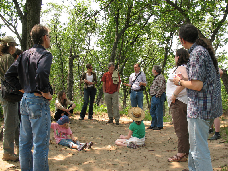
Saturday, Sept. 8th, was the first day of class for my Fall 2012 Sustainability Studies 220 Water seminar at Roosevelt University. Instead of staying inside our classroom all day, though, we took advantage of excellent late-summer weather here in Chicago to take an urban river parklands adventure to Chicago’s North Side. From RU’s campus in downtown Chicago, we caught the Brown Line L train to a quiet and charmingly at-ground-level station near the end of the line (Francisco, in case you’re curious), where we walked through a quiet residential neighborhood just south of Lawrence Avenue to the entrance of Ronan Park. This is one of several parklands that border the North Branch of the River as it winds its way south through the city.
The North Branch of the Chicago River, as seen from the Ronan Park Bird Sanctuary trail (M. Bryson)
We met up with naturalist-educators Mark Hauser and Claire Snyder from the environmental organization Friends of the Chicago River, who led us on a hike through the community-established Bird Sanctuary in Ronan Park — a charming linear greenspace that hugs the river and provides excellent wildlife habitat as well as soil stabilization with a lush landscape of native grasses and wildflowers as well as trees.
Hiking along the Ronan Park trail, through its restored Bird Sanctuary along the west bank of the river. (M. Bryson)
Immediately north of Ronan Park, we entered West River Park, a multi-use parkland which provides numerous recreation activities as well as open space and excellent public access to the river. Prominent here is the confluence of the North Branch, which heads north for several miles out of the city and toward the Wisconsin border; and the North Shore Channel, a canal that was dug between 1907 and 1910 to provide a connection between Lake Michigan and the North Branch, thus increasing the flow and improving the water quality of the latter.
This confluence is an excellent place to examine the water quality of the river, for we were able to take a chemical and biological profile above and below the dam/spillway on the North Branch, which is just upstream from the North Shore Channel’s mouth. We measured key chemical indicators such as temperature, turbidity, pH, dissolved oxygen, nitrate, and phosphate; and wading into the river with D-nets to scrape up mud in search of macroinvertebrates (worms, leeches, crawfish, snails, damselfly nymphs, etc.).
In West River Park, north of Argyle Ave, looking north toward the dam/spillway on the North Branch. This wide area is the confluence of the N. Branch (which heads upstream to the upper left of this photo) and the North Shore Channel, built between 1907 and 1910 to provide an influx of Lake Michigan water (from Wilmette) for the North Branch. (M. Bryson)
Above the dam, where the water travels downstream from the North Branch’s long journey southward through forest preserves and residential areas in the northern suburbs and North Side of the city, the water quality rated a “D” according to our chemical profile, mainly due to high suspended solids, high phosphates levels from polluted stormwater runoff, and low dissolved oxygen concentrations. Here our biological profile was slightly better (rated as “fair”) since we found a decent diversity of organisms, some of which are not highly pollution tolerant.
Sampling the macro-invertebrates living in the sediment and along the margins of the river, north of the spillway. This provides a biological sample of the river’s biodiversity and water quality, since different species of macro-inverts have different tolerance levels for pollution. (M. Bryson)
Downstream of the dam, the chemical analysis results were a little better (“C-“), since the spillway served to oxygenate the water and significantly raise the dissolved oxygen value, which is critical for aquatic life to flourish. This was despite somewhat higher nitrate levels, which likely result from the wastewater effluent inputs to the Channel north of here, at the MWRD’s O’Brien wastewater treatment plant just north of Howard St.
The spillway is a great place for fishing, whether you’re a human or one of three heron species we saw that day (great blue, green, and black-crowned night). (M. Bryson)
Both the North Branch and North Shore Channel are impacted by polluted stormwater runoff in the city and suburbs (which includes excess pesticides and chemical fertilizers applied to residential and commercial lawn properties, as well as from the ten golf courses within 20 miles of our sampling site); normal wastewater effluent discharges (where treated water nevertheless contains high bacterial levels, since effluent is not yet disinfected in a final stage of treatment, as in all other major US cities); and periodic combined sewage overflow (CSO) events, which occur when during a rainstorm the sewage system reaches capacity and untreated wastewater is released into the waterways to prevent sewage system back-ups into people’s homes.
Beyond learning to use the water sampling equipment and calculating a quick chemical and biological profile of the For images and notes from our trip, this trip allowed us to examine the way people interact with the river in an urban parkland, as well a discuss the river’s history of transformation here in Chicago. For more images from our day, see this annotated slideshow of photos; and check out the data from our sampling work at the link below.
This past week saw some great news this week for citizens of the greater Chicago region as well as southeast Wisconsin. The US Dept of the Interior has announced the approval of the Hackmatack National Wildlife Refuge, a constellation of planned open spaces and conservation areas that will link existing green spaces in NE Illinois and SE Wisconsin. It will be the closest wildlife refuge to the Chicago area, and is a future boon for regional ecotourism, land preservation planning, and sustainable economic development.
The map above depicts the original study area of the proposed refuge. According to the USFWS Division of Conservation Planning, it “includes the refuge Study Area boundary in black plus conservation lands currently owned by the State of Illinois, the State of Wisconsin, counties in both states, non-governmental organizations, land conservancies, and private individuals. Because land ownership is dynamic, some existing conservation lands may not be shown and some areas may have changed in status since this data were obtained.”
This somewhat more schematic map below, which was distributed widely via the media, shows the now-authorized boundaries of the new refuge, and clearly depicts the donut-shaped collection of open space and protected lands (including future conservation areas) that straddles the Illinois-Wisconsin state border.
What makes the Hackmatack Refuge unique within the longstanding national wildlife refuge system is its close proximity to a major metropolitan area (and therefore millions of potential visitors per year) and the fact that it will be composed of a mosaic of present and future protected landscapes, rather than a single contiguous parcel of federal land. For more information on the scope and significance of Hackmatack, see this news article from the Daily Herald, the Friends of Hackmatack website, and US Fish & Wildlife Service’s official webpage for the Hackmatack National Wildlife Refuge.
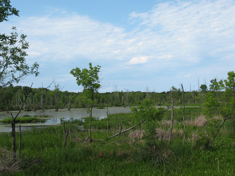
A marsh within the Calumet River watershed in the Indiana Dunes National Lakeshore
I’ve never been invited to a writer’s retreat before (not to mention a writers and artists retreat), and despite long anticipation and careful planning for this one, I almost didn’t get to go to this one when my spouse took ill and the kids needed tending. Thank goodness for CHN retreat organizer and all-around problem-solver Gavin Van Horn’s wisdom and quick decision-making, as he called me up and said, “Bring the girls along.”
I’m glad I did, as we had a terrific time — and I’m grateful to Gavin’s wife Marcie, who generously and graciously volunteered to watch my children during the times when I was occupied with fellow participants in wonderful discussions about our forthcoming City Creatures project.
For me the retreat had a number of highlights. Some of them were formal, in the sense that they were on the planned agenda — like the splendid hike through the wetlands of the Great Calumet Marsh on Friday led by Ron and Joan Engel, who escorted us along some of their favorite biodiversity-rich trails in the Dunes back-country; the lovely reception hosted by the Engels at their beautiful home in Beverly Shores (which surely has the best home study/library I’ve ever seen); the delightful dinner at Sage restaurant in Chesterton; and the “soundwalk” excursion we took in Gary on the grounds of the Paul Douglas Environmental Learning Center at the western end of the National Lakeshore.
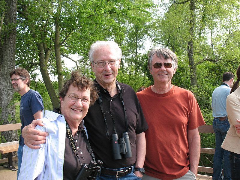
Joan and Ron Engel, with Steve Packard
But the less-scripted elements of the retreat held many delights, as well. I became pals with a conservationist and writer I much admire, Stephen Packard, who rode in my car from field site to field site, and delighted my children with his funny stories, endless questions, and brilliant bird call imitations. At one point on our way to the soundwalk field trip, I deliberately got us lost (no, really!) so I could listen to the end of a story that involved “mucking about” a salt marsh on Cape Cod; the ensuing delay was worth it. I met some old friends but also made a bunch of new ones among a group of immensely talented and utterly fascinating people. And I learned a lot about what our collective project is aiming for, and had time and encouragement to think about how my small contribution fits into the bigger picture.
Lea Schweitz holds an opossum mandible
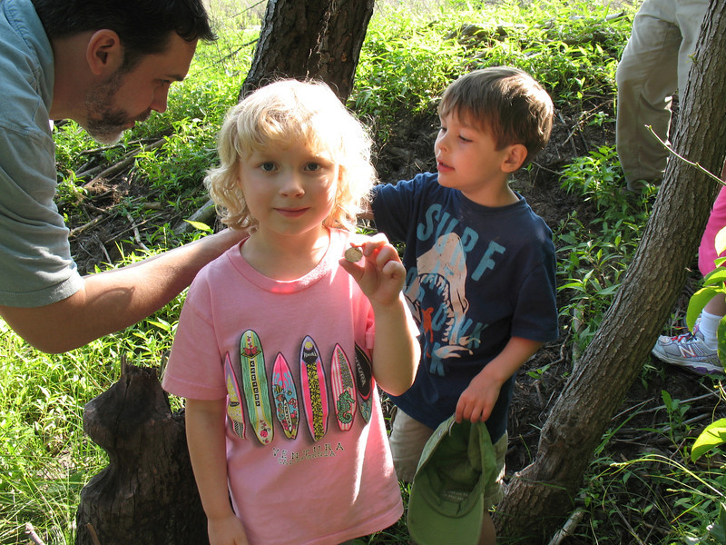
My two girls, Lily (age 10) and Esmé (age 5), had fun cavorting with Gavin’s 5-year-old son Hawkins, and they got a kick out of our field hikes, too. During our marsh walk, we had several great kid discoveries: Steve Sullivan found the mandible of an opossum; Steve Packard found some eggshell fragments, still soft and pliable, from a turtle; and we all admired a large beaver lodge and the abundant nearby evidence of busy-ness on the part of this intrepid wetland mammal and fellow water engineer.
On our Saturday morning hike, I was initially concerned that my chatterbox children would fill the “soundscape” with their songs, stories, and sisterly bickering and thus necessitate my hanging back from the group. Turns out I greatly underestimated them. Lily hiked ahead with the grown-ups, while Esmé and I lollygagged with the renowned naturalist and writer Joel Greenberg, who happily pointed out flowers and identified bird calls for us. Esmé got a nosebleed for no apparent reason, but rather than crying or complaining, she just asked me for tissues until it stopped, and kept trudging along behind Joel and looking at everything he noted.
At a rest stop on our soundwalk, listening to the marsh and woods
The best part of that wonderful hike was when we ascended a hill about two-thirds of the way along the circuitous trail we were following, and stopped for a long listen. Here in the Dunes there’s lot of sand, of course, and this summit we were on was like a big sandbox. As we naturally formed a circle to listen, observe, and talk quietly about what we were experiencing, the girls just played quietly in the sand.
We watched them, too, and I couldn’t help but think about how our project — about connecting with nature and, more specifically, the non-human animals within the urban and suburban environment of the Chicago region — is also, ultimately, about nurturing an ethic of stewardship and love of nature in our children.
Esmé holds a piece of turtle eggshell; Gavin shows another to Hawkins
It had been way too long since I had been to the Dunes. This was a splendid excuse to return to that special landscape, and to introduce my kids to some of its treasures. It was also an inspiring way to begin our work on City Creatures.
I’m looking forward to future gatherings with these new friends and colleagues. I wonder what critters, or the leavings thereof, we’ll come across on our ensuing explorations?
Since I’m discussing transportation this week in my SUST 210 Sustainable Future online class at Roosevelt University, I thought it most appropriate to use my bike to commute to work. Some of our sources I’m analyzing with my students speak directly to the need for active/alternative transportation modes, and how such systems relate to urban design and community structure.
I am not a “hard core” cyclist who buys fancy gear and takes 100-mile rides through the countryside; nor am I an urban bike renegade who likes to blow through any intersection at as high a speed as possible. I consider myself very much an average-ability and safety-minded cyclist of modest endurance, someone who doesn’t mind putting on warm clothes and biking to the train station or to a local destination in cold weather or a drizzle. In the Netherlands, I would be in good company; here in the US, that probably puts me within 0.5% of Americans.
My first decision yesterday: should I really take my bike, or should I drive? I had to go to Joliet’s Barnes and Noble bookstore way out by the Louis Joliet Westfield Mall, a destination located about 6 miles from my house and on a very busy road (US Route 30). Then I had to go to the public library to work, then back home. It would be a long trip, and I had a lot to do that day. Did I really have time for all that? And what about carrying my notes and computer on my back, plus the presents I would be purchasing at the bookstore?
It was cold, 28 degrees F, but sunny and not too windy — and I decided to try it. After all, biking would keep my GHG emissions down to zero, plus I’d get some much-needed February exercise. The extra time from biking would be more than repaid by the free workout I’d be getting! My rationalization complete, I tapped into my somewhat extensive personal knowledge of safe Joliet street/trail routes, and headed off. Here is a map of the route I took.
Note the out-of-the-way path I took to get to the bookstore, a 6.1 mile trip that could’ve been much shorter had I traveled directly. But Route 30 is a busy and dangerous road, and I prefer to avoid hi-traffic streets. There are no bike lanes on Rt. 30. In fact, there are no bike lanes anywhere in Joliet. So I took a quiet E-W residential route to a N-S rails-to-trails path on Joliet’s West Side, then headed north along the trail. That linked up with another trail, one within the Will County Forest Preserve’s Rock Run Marsh. Consequently, even though I was in a highly developed part of Joliet’s West Side, much of my ride was bucolic, and all of it was safe and quiet, except for crossing busy arterial streets. This is a route I’ve ridden with my kids many times. You can see water, trees, cattails, and prairie grasses; you can hear and see a lot of birds. It’s a nice way to travel.
That left me with a short job on Route 30 to get to the bookstore, which actually was OK. Once there, I was able to relax while listening to Miles Davis on the store radio, surrounded by books (itself a delight), and with good access to a bathroom and the BN cafe, which has free wi-fi. Life was good!
My ride to the public library was shorter, but on a busy N-S road on Joliet’s West Side. Lots of room for cars, but no dedicated bike lane here. As noted above, there no bike lanes in the city of Joliet, a real flaw in the town’s transportation infrastructure. Despite this deficiency, parts of town are very bike-able because of a plethora of quiet residential streets, some of which cut through town in helpful ways. However, this network is very limited, and known only to people who seek out such knowledge.
Back to my journey to the library: Essington Road had a good sidewalk, so I used that as well as the street to head south to my destination. Upon reading the Rock Run Forest Preserve trailhead, I left the street and rode a paved trail the rest of the way to the library, which sits on the eastern edge of the preserve and has beautiful views of its woods and marshlands. It is always uplifting to my spirits to come here, and sometimes I take a short break from working at the library to take a stroll in the woods or along the marsh’s edge.
So, my commute to work was about 9.5 miles, according to Google maps (which lets you map out bike routes, by the way), plus the 3.5 miles home after my library session (13 miles total). My total commuting time for this workday was 30min + 18min + 20min for the three legs of the commute, or 68min total. This compares most favorably with my door-to-door commute to the Schaumburg Campus (120min in the car) or my train commute to downtown Chicago (1hr 45min each way, door-to-door, or 3.5 hours total).
Guess how many bikes I saw on my cycling route yesterday? None. I did see several people walking or working in their yards, and all of us greeted each other with a pleasant hello. (I don’t do that while driving; do you?) I also saw hundreds of cars. I can’t recall if I saw a PACE bus, which probably means I didn’t.
Last week we finally made the transition from autumn to winter, after weeks of unseasonable warmth that gave us a brown holiday season and made small children throughout the Chicago region wonder if it would ever snow again.
A "crick" that feeds into Hickory Creek; Pilcher Park, Joliet IL (M. Bryson)
When last week’s storm blew in, I was lucky enough to be deep in a wooded wilderness — rather than stuck in snarled traffic or confined to a windowless office, where we think of snow as irritating or irrelevant, rather than the miracle it is. But I wasn’t on a fancy ski trip at a remote Colorado resort, or snowshoeing in the northern woods of Michigan’s Upper Peninsula; I was right here in Joliet, Illinois, in the middle of a perfectly ordinary weekday.
As I dropped my younger daughter off for pre-school at the Nature Center in Joliet’s Pilcher Park last Thursday morning, the snow began to fall, gently and steadily. The children gathered to start their day in the woods, all bundled up with thick mittens and noisy snow-pants and stout boots, their sense of joy infectious. Instead of lining up quietly as usual, they whooped and ran, skidded and flopped, embracing the snow with the full passion of childhood.
I was inspired, both by the kids’ delightful gamboling and the utter beauty of the woodland scene before me. Normally I leave the park and work dutifully answering email and meeting writing deadlines at the nearby downtown library or Jitters Coffee House before returning to retrieve my four-year-old naturalist. But that day I ignored my to-do list and took a winter ramble in the park as the wet snow coated my glasses and clung to my beard.
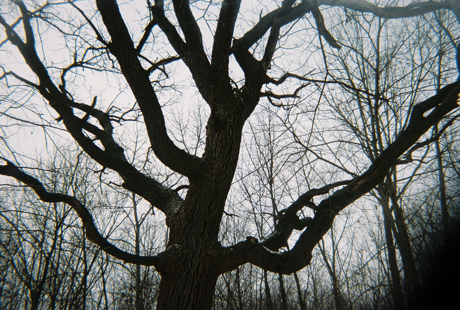
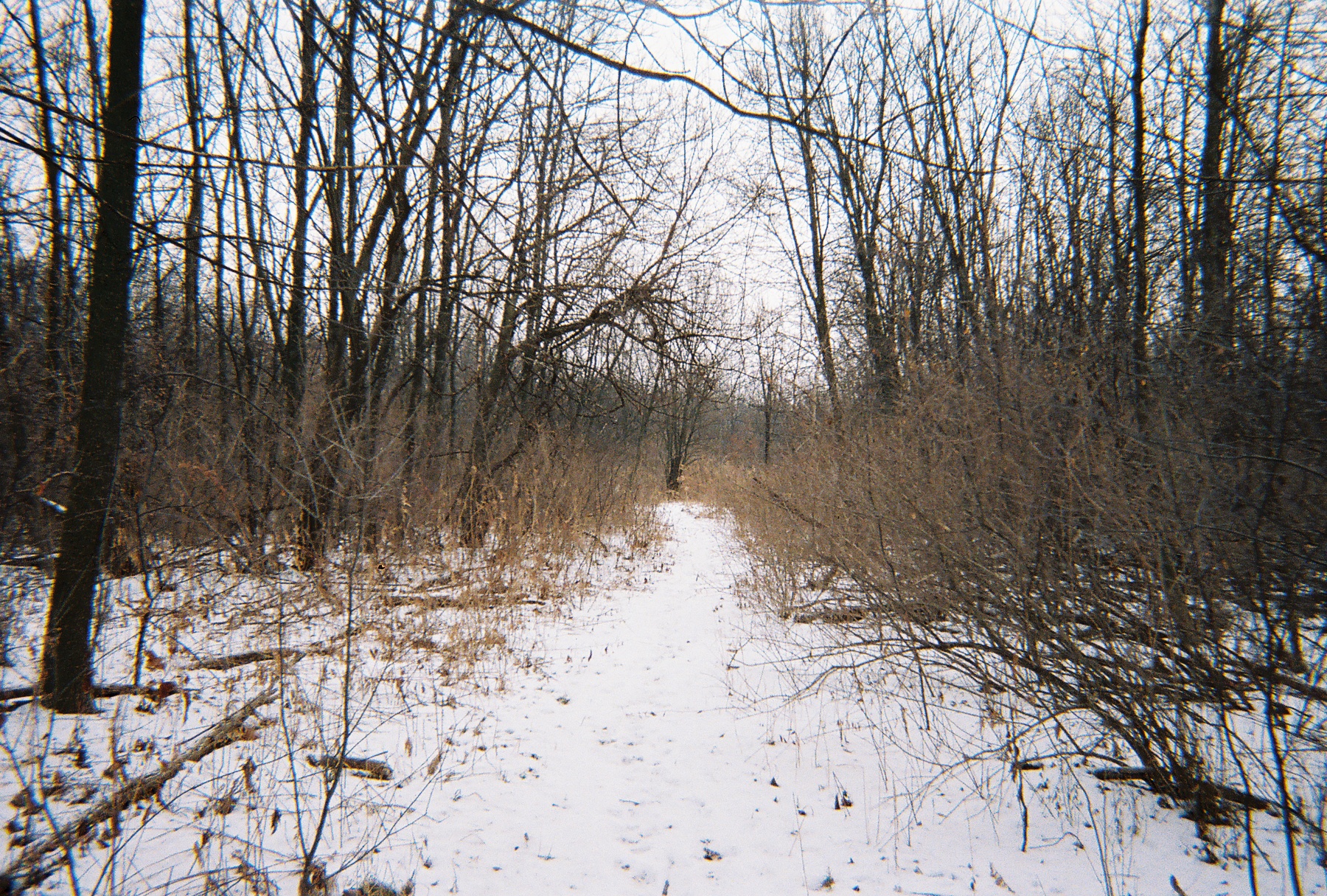
I am particularly fond of the Outer Loop trail, which winds through the northernmost and most remote section of Pilcher Park, a hill-and-valley landscape of towering trees and meandering creeks. Though beautiful in any season, the forest now displayed stunning visual complexity: every branch, twig, seed pod, dried stem, and piece of leaf litter was coated with snow; every textured surface outlined in delicate white.
Soon I came to my favorite spot in the park, an overlook marked by a low stone wall. Here one has a commanding view of a broad wooded valley from a sixty-foot-high bluff. The only sounds were the ticking of snow upon my coat, the cheep of a lone sparrow, and the distant whistle of the Rock Island train.
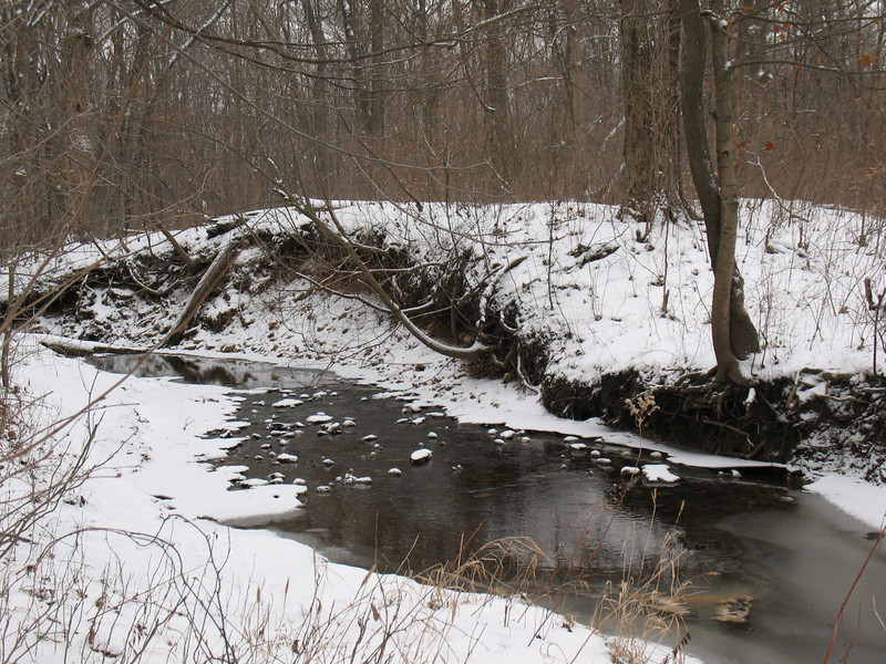
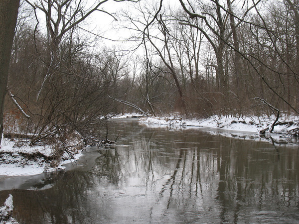
Looping my way back, I meandered along Hickory Creek, which defines the park’s southern border. Few things beguile more than a flowing stream in a snowy woodland, its rippling music foretelling of colder days ahead — when the restless water turns to ice, and the river sleeps with the woods.
Winter in Pilcher Park: Hickory Creek, 19 Jan 2012 (M. Bryson)
In such places, liberated from human noise and litter by the gathering snowfall, one may comprehend the value and special magic of urban wilderness — the wild close at hand, even here in our cities and suburbs.
Yes, winter is here again, with its short days, slower rhythms, cold nights . . . and, at long last, snow. It’s good to see it back.
A version of this essay was published as “Winter Is Back, and It’s Good To See” in my monthly op-ed column for the Joliet Herald-News on 19 January 2012. Download a pdf of Pilcher Park’s Trails to see the park’s extensive trail network for hiking and nature exploration. See more photos of Hickory Creek and Pilcher Park here.
A year and a half ago, I wrote an op-ed column in the Joliet Herald-News (reprinted later on this blog) about an obscure tract of urban forest in Joliet called Teale Woods. Heretofore an overgrown and litter-strewn city woodland, the place nevertheless possessed an air of mystery and enchantment.
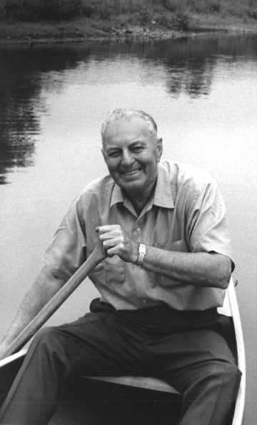
No doubt my fascination with this humble woodland was partly due to its namesake, Edwin Way Teale (1899-1980), a Joliet native and one of America’s foremost nature writers and photographers during the 20th century. A skilled naturalist and brilliant observer of plants, animals, and human nature alike, Teale’s eloquent descriptions of the natural world included not just remote wilderness areas, but everyday landscapes familiar to us all — backyards, farms, even urban spaces.
Edwin Way Teale
I like to think Teale would’ve found much here to appreciate and value. He had a knack of seeing wonderful things — whether a locally rare bird species making its spring migration, or a beautifully-patterned lichen on the rough bark of an oak tree. Such treasures abound if we take the time to notice them, even in ecologically compromised patches of urban nature.
Not long after my March 2010 article appeared, the Will County Forest Preserve District revealed a Preserve Improvement and Management Plan (pdf) to convert Teale Woods into a 15-acre recreational space, and then solicited public input on their ideas. I was one of seven people to provide written comments that summer, and I urged the WCFPD to avoid over-developing the site and keep the woodland as natural in appearance as possible, in accordance with the spirit of conservation espoused by Teale in his decades of writing about and advocating on behalf of the environment. This fall, the Forest Preserve completed $100,905.50 worth of work building a 0.3-mile paved trail and clearing a large lawn area at the trail head. It’s fair to say, then, that I have a vested interest in the results of these labors.
I should emphasize at this point that I unequivocally support the Forest Preserve’s untiring efforts in acquiring open space, providing outdoor recreation opportunities, educating citizens, and restoring native ecosystems. The WCFPD is the driving force for environmental conservation in Will County as well as a major contributor to its citizens’ quality of life. I have deep respect and sincere appreciation for the work of the Forest Preserve and the many preserve units my family and I visit and enjoy regularly.
Nevertheless, I feel that the development of Teale Woods has missed the mark.
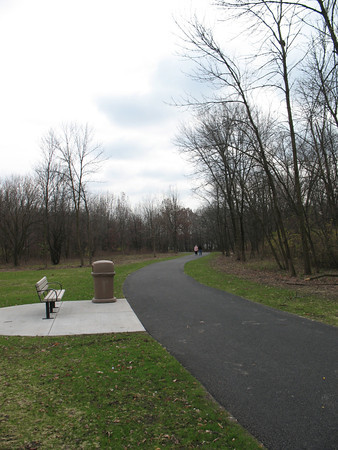
In place of the narrow footpath that once afforded intimacy with the woods is a winding stretch of 10-foot-wide pavement that resembles a road more than a trail. Such an “improvement” feels like overkill within such a small tract of land, where scale is important and every square yard of green space counts.
Bench and path at Teale Woods (M. Bryson)
While it’s supposed to be accessible, parts of the path are so steeply sloped that it’s frankly hard to imagine a person in a non-motorized wheelchair being able to traverse it comfortably. Nor is the path well-suited for biking, for unlike many other preserve trails elsewhere in Will County the trail is extremely short (just a third of a mile) and goes literally nowhere: from the Center/Theodore intersection down to traffic-choked Route 53/Broadway, well north of the existing trail segment within Joliet’s Broadway Greenway. The contrast of this stubby and isolated trail with the continuous trail networks throughout the Rock Run and Theodore Marsh preserves on the far West Side is striking, to say the least.
Just as disappointing is the unattractive and poorly-placed bench on an incongruous concrete pad near the public access at Theodore and Center Streets. Marooned within an enlarged lawn area that was bulldozed of shrubs and small trees, this uninviting “rest stop” has a decidedly uninspiring view of a garbage can and the blacktopped path.
Bench and grassy meadow at Teale Woods, November 2011 (M. Bryson)
The cleared meadow may have been populated formerly by scrubby non-native plants of little ecological value, but I’m not sure the open space as currently conceived is much better. What’s lost now is the visual buffer the imperfect woods provided along busy Theodore Street, which also effectively shielded the preserve from nearby traffic noise. Now the clearing merely feels exposed and lonely, and of dubious value as a recreational space. For what? one is inspired to ask. Instead, I’d advocate using this area as a prairie restoration site, as has been done on many other Preserve holdings.
Teale Woods is still a valuable green space in the heart of Joliet’s urban core. But in sacrificing modest and aesthetically-sensitive design for the dubious recreational values of a road-like trail and a turfgrass field, its stewards have compromised the forest’s fundamental character.
The old path at Teale Woods, winter 2011 (M. Bryson)
I’m not exactly sure what Edwin Way Teale would think of the woods and the changes that have occurred these last few months. But I seriously doubt he’d be much impressed.
This is a revised and expanded version of my regular op-ed column that appears today as “Improvements” Strip Forest of Its Greenery (Sunday 18 December 2011) in the Joliet Herald-News. More information on the Will Country Forest Preserve District’s development plan for Teale Woods can be found here. You can view some photos of the preserve’s transformation and its finished state from this fall.
Every semester I take my Roosevelt University undergraduate students on field trips — hands-on learning experiences that allow us to put some of the academic ideas we’ve studied into practice, work together in teams, and create a sense of community. That’s especially important in online classes, where virtual interaction is intense and sustained, but face to face action is rare or nonexistent.
This fall at RU’s Schaumburg Campus, my Sustainability Studies 220 Water course’s hybrid format (a combination of occasional Saturday sessions plus weekly online interaction) is ideal for scheduling field trips to likely sites of interest. Normally I would wait until one-third of the way through the semester before venturing on a trip with a group of students — but since SUST 220 had a long Saturday campus session to kick off the semester and early September is usually a good time to be outside in the Chicago area, we decided to get right to it.
Busse Woods (M. Bryson)
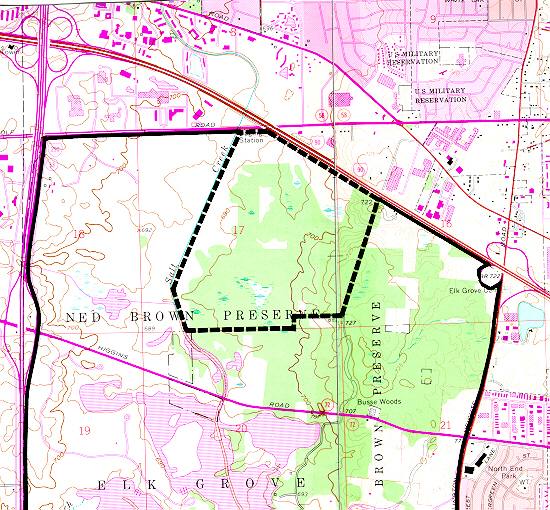
So after two hours of morning lecture and discussion on September 10th and meeting each other for the first time, my students and I enjoyed a picnic lunch in the campus courtyard and then headed over to Busse Woods, one of the largest holdings within the Cook County Forest Preserve system (at 3,700 acres), for field-based introduction to water quality sampling techniques.
Busse Woods, aka the Ned Brown Forest Preserve, is a massive and multi-functional piece of green infrastructure in the northwest suburban region, a culturally significant recreation site for the many communities it serves, and a fascinatingly complex mosaic of northern Illinois ecosystems — riverine, woodland, wetland, and prairie. The preserve directly borders the suburbs of Rolling Meadows, Arlington Heights, Elk Grove Village, and Schaumburg; but within a short drive or even bike ride are numerous other communities, including Palatine, Prospect Heights, Mount Prospect, Des Plaines, Wood Dale, Itasca, Roselle, Hoffman Estates, and Inverness. People in these suburbs and beyond converge on Busse Woods year-round to boat, bike, hike, rollerblade, picnic, fly model airplanes, visit the elk herd (yes, elk!), and more, making it one of the most-heavily used forest preserve units in Cook County. Fortunately, the preserve’s sheer size and diverse offerings of groves, parking areas, meadows, and trails enable it to accommodate all this activity and still provide much needed open space for the region and the chance of someone to roam within an extensive natural area. The Cook County Forest Preserve and the Friends of Busse Woods actively work on conservation and restoration projects in the preserve.
Just to the southeast is O’Hare Airport, which at approximately the same size as the preserve represents a completely different way of using land — the concrete and asphalt “hardscape” of O’Hare strongly contrasts with the verdant landscape of Busse Woods. Besides recreational opportunities and open space for its human visitors, Busse harbors a significant amount of regional biodiversity:
Busse Forest Nature Preserve Topo Map (USGS)
the 440-acre Busse Forest Nature Preserve, located in the northeast section of the Forest Preserve unit, is not only a state-designed nature preserve (the third one so dedicated, in 1965) but also a National Natural Landmark. This protected area harbors bottomland flatwoods, extensive wetlands, and upland forest, some of which are in the process of restoration.
Salt Creek, looking south from the northern edge of Busse Woods Forest Preserve (M. Bryson)
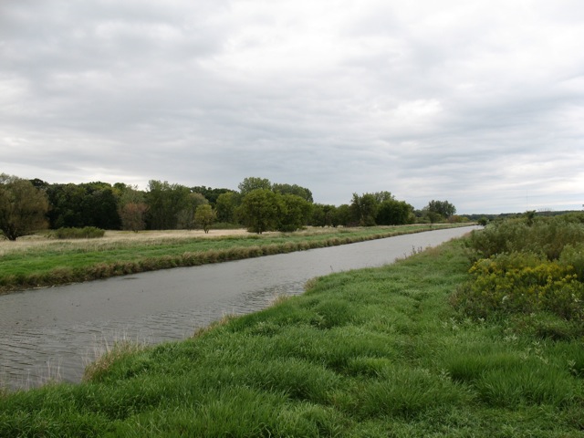
Busse Woods is home to a couple of significant water features including Salt Creek, which was the first stop on our trip. After hiking through a forest-and-wetland path along the northern border of the woods, we came to the Golf Road overpass of Salt Creek, where the river south into the preserve before it empties into Busse Lake, a sprawling artificial reservoir created by a dam structure at the south end of the preserve. Using a couple of different water quality field testing kits, we sampled the creek and measured a range of physical/chemical water quality indicators: chlorine, copper, dissolved oxygen, hardness, iron, nitrate, pH (acidity), phosphate, temperature, turbidity, and total coliform bacteria. In doing so, we not only took the ecological pulse of Salt Creek at one point in time, we also learned how to use our sampling equipment, compared test results from different measurement procedures, assessed the possible sources of error in our data collection, and analyzed the impact of the surrounding landscape upon the water quality of Salt Creek.
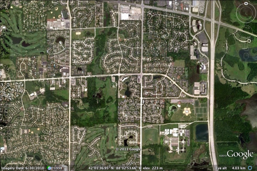
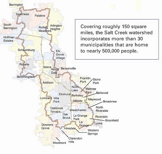
The entire Busse Woods preserve is a significant green space within the Salt Creek Upper Watershed, as it receives stormwater run-off from the eastern half of Schaumburg via the main channel of Salt Creek as well as the Creek’s West Branch. That tributary is important for another reason, as it flows through the heart of Schaumburg before passing around the periphery of the John Egan Wastewater Treatment plant of the Metropolitan Water Reclamation District.
Satellite view of Schaumburg's east side, showing the West Branch of Salt Creek and the John Egan Treatment Plant at lower right (Google Earth)
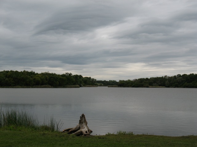
The Egan plant’s treated effluent is piped into the West Branch, which then flows east under I-290 to empty into the South Pool of Busse Reservoir. Partly for that reason, we chose to sample water from the shoreline of the South Pool as our second sampling site of the day. (Interestingly, the data from that site were quite comparable to those we gathered much farther north at Salt Creek.)
In this sense, then, Busse Lake is a giant detention pond for stormwater run-off from several suburban communities (either directly or via Salt Creek) and treated wastewater from Schaumburg. As such, it is a flood control structure for Salt Creek, which runs south/southeast out of the preserve and drains several western suburban communities before joining the Des Plaines River near Brookfield.
The south pool of Busse Lake (M. Bryson)
Effective water retention in Busse Lake means reduced flooding in downstream communities, though the persistence of flooding in the western suburbs means the reservoir as currently configured is only a partial solution. Nevertheless, the larger forest preserve complex of wetlands, prairies, and woodlands — of which the lake is but a part — act like a giant sponge for the surrounding towns and villages, absorbing precipitation and run-off from a wide area and releasing it slowly to the atmosphere and to Salt Creek.
Map of Salt Creek's watershed (Salt Creek Watershed Network)
The announcement that the Forest Preserve District of Will County has begun work on developing a short trail through Teale Woods, a small nature preserve near where I live in Joliet, Illinois, got me thinking about this little essay I wrote about that patch of urban nature for the Joliet Herald-News back in March of 2010.
The advent of spring last week inspired me to visit one of my favorite quiet corners of Joliet — a place where time slows down and wild nature flourishes amidst the paved-over, gritty landscape of concrete, traffic noise, and hustling people.
My destination was Teale Woods, a 15-acre woodland along Theodore and Center Streets on Joliet’s near northwest side. With only one low-profile sign marking its existence as Will County Forest Preserve property, Teale Woods is still undeveloped and without official public access; but a couple of informal trails cut through the woodland and afford a quiet route away from the tumult of Theodore Street’s traffic.
This humble urban sanctuary is emblematic of wild spaces that exist, and sometimes flourish, against all odds within the built landscape of our cities. Homes, businesses, and busy roads are only steps away. The thoughtless litter of humans, newly revealed from the recent melting of winter’s snow cover, distracts the eye and disturbs the spirit.
Nevertheless, these scrappy, imperfect woods provide a natural haven where one can hear the plaintive tones of a white-throated sparrow and study the rugged form of a downed oak.
I suspect very few people in Joliet today know this place’s namesake, Edwin Way Teale. Born in 1899 in Joliet, Teale’s love of and fascination with nature were stoked in his formative years during visits to his grandparents’ farm near the Indiana Dunes. He later became one of the most celebrated American nature writers and photographers of the 20th century.
One of Teale’s most admired books was North with the Spring (1951), which chronicles a 17,000-mile journey following and celebrating the season’s arrival throughout the eastern US. While Teale visits several famous landscapes along the way, he also describes many virtually unknown spots of no particular significance — except that they provided a place for him to encounter a lively insect, find a native wildflower, or admire an old tree.
I like to think that Teale Woods in Joliet — about as low-profile and neglected as a nature preserve can get — is been one of those places he would’ve cherished.
The next time I visit the woods, I’ll pause a moment to reflect on Edwin Way Teale’s immeasurable impact upon Americans’ growing interest in preserving wild nature, even in cities. Then, I’ll grab my work gloves and trash bag, and get down to work picking up some litter.
This essay was published as “Teale Woods Hidden Joliet Gem” on 25 March 2010 in the Joliet Herald-News, p20. A few month’s after the article’s appearance, the Will County Forest Preserve District held public hearings on planned future developments of Teale Woods. The WCFPD plans to start restoring the woodland in 2011.
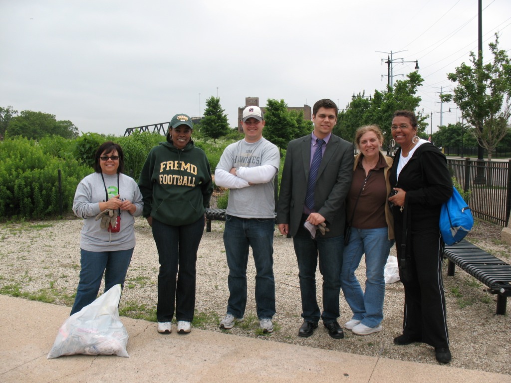
This past Saturday, June 11th, students in my PLS 392 Seminar in Humanities online summer course at Roosevelt University took an “urban landscapes” field trip to Chicago’s near Southwest Side, where we visited two city parklands: Canal Origins Park on South Ashland Avenue, and Stearns Quarry (aka Palmisano) Park on Halsted Street. This afternoon field trip was a chance for us to discuss the history and ecology of these locations and their relation to Chicago’s urban landscape, as well as think about the visual aesthetics of these areas, the integration of nature and culture in urban environments, the importance of parks to city communities, and how such areas can serve as windows into the rich history of Chicago.
PLS 392 students help clean up Canal Origins Park before our walking tour of this urban parkland along the Chicago River, June 2011 (photo by M. Bryson)
We began our afternoon by meeting at Canal Origins and, before starting our walking tour of this 2002 riverfront parkland, picking up several bags’ worth of litter along Ashland Avenue near the park’s entrance. (Thanks to my students for pitching in like troopers!) Canal Origins provides impressive views of the present-day juncture of the Chicago River’s South Branch and Bubbly Creek, and commemorates the origin of the I&M Canal, which was constructed from 1836 to 1848. Use of the canal peaked in 1882 (when over a million tons of cargo were transported), but construction of Sanitary & Ship Canal in the late 19th century spelled the eventual demise of the I&M, as did the advent of railroad transport in the latter third of the 1800s.
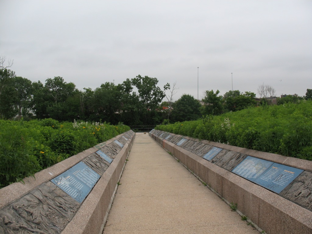
The old canal, though, has made a comeback the during the last 30 years though the establishment of the I&M Canal Heritage Corridor by Congress in 1984 by Congress, which celebrates and promotes the Canal as natural resource, wildlife corridor, recreation destination, and source of cultural memory and historical preservation. Here at this area of Chicago, the canal is filled in and is covered by Interstate 55. Visitors to the park can see it only in their imaginations.
This walkway from the entrance of Canal Origins Park leading to the river symbolizes the canal’s walls, and features artwork by Chicago high school students. Unfortunately, now the displays are heavily tagged with graffiti (photo by M. Bryson)
To the west, the South Branch soon morphs into the Sanitary and Ship Canal, begun in 1892 and completed in 1900. This canal marked the permanent reversal of the Chicago River for improved sanitation (via dilution) and navigation, and continues to be used heavily to this day for commercial transportation. North of the S&S Canal is the filled-in waterway formerly known as the West Fork of the South Branch, which flowed southwestward until it ended at the Continental Divide separating the two watersheds that meet here in the Chicago region (those of the Mississippi River and the Great Lakes). Here was located Mud Lake, between Kedzie (to the east) and Harlem (to the west), which earlier voyageurs could paddle across in wet years to travel between the Chicago and Des Plaines Rivers. The Chicago Portage National Historic Site is at Harlem Avenue, north of the canal, and it commemorates the history of the portage made via Mud Lake. The Stickney Wastewater Treatment plant, the world’s largest, now sits where the fickle waters of Mud Lake once were.
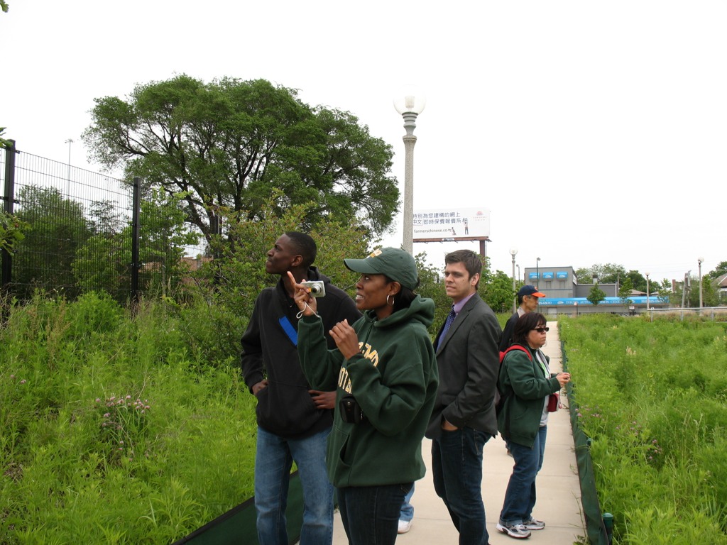
After touring Canal Origins Park, we walked a few blocks south to the Ashland stop of the CTA Orange Line, where suburban students enjoyed the novelty of an L ride one stop to the north to Halsted Street, where we disembarked and walked a couple of blocks south to Stearns Quarry Park.
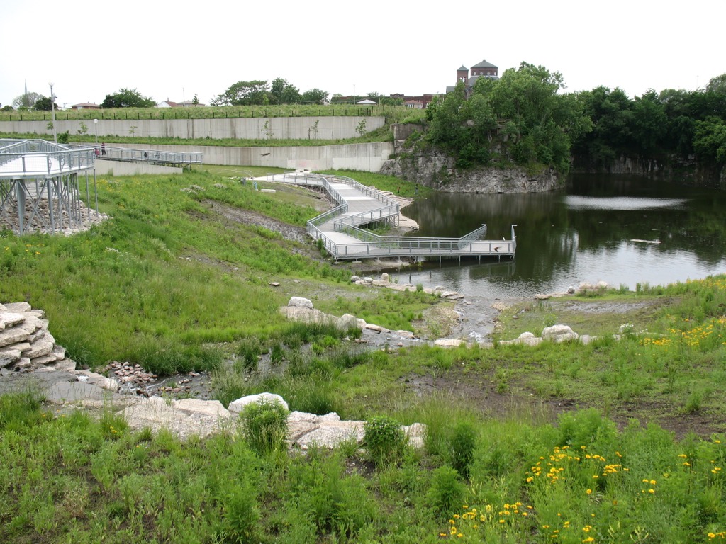
RU students walk the trails at Stearns Quarry Park in Chicago’s Bridgeport neighborhood, June 2011 (photo by M. Bryson)
This extraordinary urban greenspace finished in 2009 is a cutting-edge example of city park design with nature in mind. Its meandering walking trails provide a different kind of view as one walks along, from the terraced wetlands that filter water circulated between the park’s fishing pond to its entrance fountain; to the old walls of the limestone quarry, which operated here from the late 1830s to 1970, when the site became a landfill; to the neighboring churches and houses of the Bridgeport neighborhood; to the dramatic scene of the Loop’s skyline, as viewed from the grassy-topped mound of the park. Throughout the park, native vegetation provides natural beauty, efficient water retention, and ample wildlife habitat — and many other sustainable design features make this truly a 21st century parkland.
A view of the terraced wetlands in Stearns Quarry (photo by M. Bryson)A closer view of the one of the wetland’s terraces; red-winged blackbirds and barn swallows were in abundance here (photo by M. Bryson)A view of the stocked fishing pond at the bottom of the quarry, as well as the its limestone walls — a most unusual sight within the city of Chicago (photo by M. Bryson)
Those seeking an off-the-beaten-path Chicago experience should consider visiting Stearns Quarry Park, which is easily accessible via the CTA (Orange Line and #8 bus) as well as car, with free street parking available next to the park. An excellent audio tour is provided by the Chicago Park District, as well.
The mound at Stearns Quarry Park affords impressive views of Chicago’s downtown skyline, only a few miles to the northeast (photo by M. Bryson)
Nature within the urban landscape is simultaneously close at hand and hidden from view — a paradox of proximal obscurity. Yet its myriad forms and manifestations are as diverse in kind as their human denizens. City parks, community gardens, nature centers, green rooftops, restoration sites, golf courses, back yards, alleys, vacant lots, landscaped public spaces, plus the resident non-human biota in all its riotous diversity and plenitude — all these and more comprise urban nature.
Photo by Ryan Hodgson-Rigsbee
Despite the ubiquity and fascinating heterogeneity of urban nature, it remains largely invisible to and thus unappreciated by many city dwellers. We are much more likely to assume nature exists “out there,” away from our cities and suburbs — especially in remote depopulated places characterized by the well worn but still compelling aesthetics of the beautiful or the sublime. Our culture assumes that city, country, and wilderness are distinct landscape types with clear regional boundaries, and an implicit corollary to that is that the city is unnatural. The fact that urban green spaces are often compromised and degraded by pollution, development, or overuse only underscores that point. Yet the recent coinage of the seemingly oxymoronic phrase “urban wilderness” signals that ecologists, artists, environmental advocates, and citizens have begun to re-envision the role of nature within metropolitan landscapes.
Just about any American city could serve as a fruitful setting for analyzing the character and significance of urban nature; indeed, such analyses are best done with the specificity of a particular locale in mind. Consider, then, Chicago. The Windy City’s natural and cultural histories are not only long-studied and well-documented, but also inextricably linked with how we’ve thought about, confronted, transformed, abused, and (of late) restored the natural environment of urban areas. From its beginnings as a marshy trading post on the banks of the Chicago River, to its amazing expansion as an industrial power during the 19th and 20th centuries, to its profound reshaping of the physical landscape in that process, to its ascension as a global city in the 21st century that strives to be environmentally progressive — Chicago is an ideal laboratory in which to study the diverse manifestations of nature in urban spaces.
The Chicago River (photo by Ryan Hodgson-Rigsbee)
This nature is almost always hybrid in character, a product of human action (whether deliberate or not) even when appearing “natural” in outward form. Chicago, the self-proclaimed City in a Garden, has spent the better part of its brief existence unapologetically bending nature to its will, from the audacious engineering feat of raising the grade level of its streets and buildings in the mid-19th century in order to install a proper sewer system, to the subsequent development of lakefront parklands atop countless tons of landfill, to the famous reversal of the Chicago River’s current.
This interconnection of the made and the natural can be read in the landscape . . . if one observes carefully and knows where to look. Such is the ongoing quest of photographer and urban explorer Ryan Hodgson-Rigsbee, who investigates and documents the Chicago cityscape on foot, by bicycle, and aboard a kayak. Hodgson-Rigsbee’s growing body of photographs are a stunning visual echo of the urban nature writings of Leonard Dubkin (1905-1972), a journalist and self-taught naturalist who chronicled his explorations of and observations about Chicago’s urban landscape in the middle decades of the twentieth century, and who found a surprising biotic diversity within otherwise unremarkable settings such as vacant lots, railroad buffer zones, or residential yards. Even more importantly, Dubkin advocated the need for human connection to the wildlife — and patchwork of wild lands — that remained close at hand, within the city’s borders, an implicit theme of some of Hodgson-Rigsbee’s landscapes.
The splendid diversity of nature in Chicago can be categorized in many ways, one of which consists of a simple binary: official and unofficial. The former includes the green spaces purposefully designed and designated for human use (parklands of all kinds) as well as the conservation of natural resources (forest preserves, wetland conservation sites, prairie restoration areas). These areas comprise the official version of Chicago’s urban nature — the sort that is featured on the city’s website and which collectively is an incredibly important and irreplaceable resource for the interaction of people with the natural world. The “unofficial countryside” of Chicago, though — to use a phrase from the English naturalist-writer Richard Mabey — is the hardscrabble, unexpected, and often uncared-for everything else. It is this which drew the eye of Dubkin in the last century, and which is now framed by the camera of Hodgson-Rigsbee.
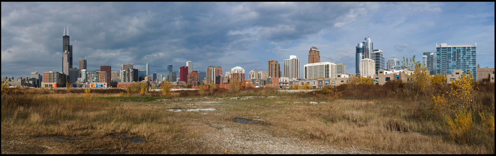
Chicago Loop, as seen from the southwest within The Brownlands (photo by Ryan Hodgson-Rigsbee)
Incredibly, part of this land was once water. The South Branch of the Chicago River wound its way through the area, bending eastward toward Lake Michigan before meandering back west and resuming its southerly course. This D-shaped curve of the river’s channel proved inconvenient for shipping and an impediment to street transportation improvements; so the river here was straightened and channelized in the late 1920s, a water infrastructure project of great scale, expense, legal complexity, and civic ballyhoo, for the reordered urban landscape was supposed to usher in an era of unprecedented economic development for this industrialized area of the city.
These plans never quite materialized, for the through streets on this “reclaimed” land were never completed. The Brownlands thus remain mostly vacant and part of Chicago’s unofficial countryside. Long owned by a railroad well into the late twentieth century, the land was sold to speculative developers in the late 1990s and has changed hands a few times since, though the goal of these recent landowners has not changed. They envision, predictably but unimaginatively, an ambitious riverfront development project of fashionable residences and upscale retail establishments. Fortunately, the mammoth expense of such a project has kept it in limbo, and the Brownlands persist in 2011 as a wide-open space of non-native brush and invasive weeds, patches of prairie grasses which hint at the land’s pre-settlement ecological legacy, informal pathways and abandoned gravel roads, discarded vehicles and miscellaneous machinery, and furtive human visitors who brave the fenced barriers and No Trespassing signs to explore, camp, photograph, bird, even live in the Brownlands.
An example of a contemporary frontier-like space in the middle of America’s third-largest city, the Brownlands simultaneously evoke the past technological transformation of Chicago’s landscape and the present human yearnings for off-the-grid experiences with an unmediated nature. They also hearken to an uncertain future in which yet another large-scale development project may dramatically alter what is now an open space in the shadow of Chicago’s Loop with remarkable restoration and recreation potential.
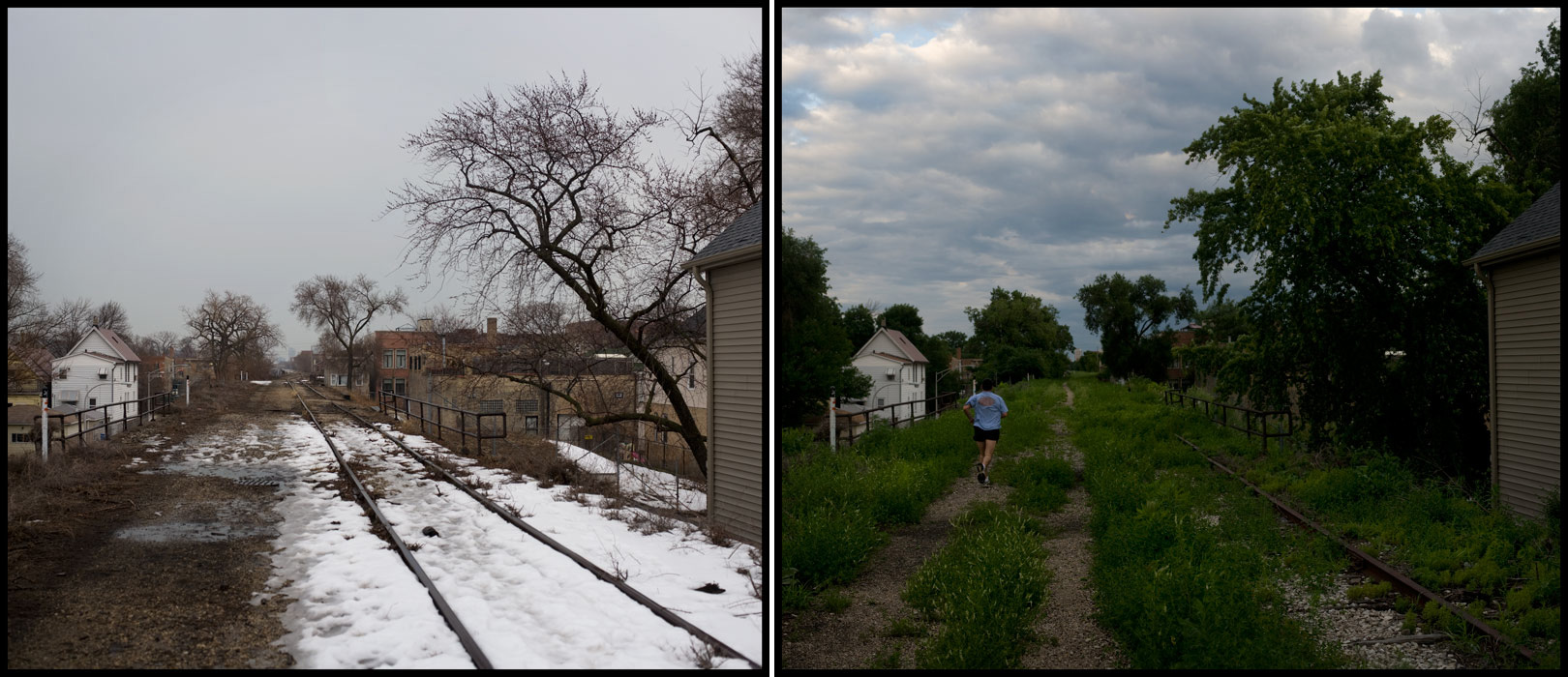
Another significant hybrid place where nature and the built environment converge is the Bloomingdale Trail, an abandoned elevated train line that runs for nearly three miles on the city’s near-North Side. A grassroots non-profit organization, Friends of the Bloomingdale Trail, is in the process of raising funds to convert the defunct railway into an elevated greenway/trail, citing the recently developed High Line linear park in Manhattan as model and inspiration. Currently the project enjoys the backing of some influential politicians (including the outgoing mayor, Richard M. Daley, a noted environmental progressive), but needs to raise upwards of $60 million to finance construction in hopes of completing the Trail by 2016.
Bloomingdale Trail, on Chicago's North Side (photo by Ryan Hodgson-Rigsbee)
Beyond the politics and economics of its development, this proposed parkland is notable for the ways in which it will perform multiple functions and tie together the built and natural landscapes with the city’s diverse human denizens in mind. Part greenway, part commuter route, part public art tableau, part recreational space, the Bloomingdale Trail illustrates how urban space can be re-imagined to embody sustainable transportation alternatives for everyone from children walking to their neighborhood schools to cyclists commuting from their homes to nearby elevated train stations on the CTA Blue Line. Besides these immediate practical benefits, though, the Trail exemplifies the many nature/culture hybrid spaces in Chicago that are in various stages of transition from an old “brown” urban infrastructure of steel and asphalt to a new “green” infrastructure of recreational trails, native plant communities, and ecology-minded landscapes. What is common to this and similar projects in Chicago and other cities is that they do not simply happen because they are good ideas; they require immense amounts of human and financial capital to conceptualize and bring to fruition, even when the political winds are favorable.
The Brownlands and the Bloomingdale Trail are but two examples of Chicago’s unofficial countryside that exists apart from the formally designated parklands, forest preserves, and other green spaces of the city. These and other hybrid spaces are amalgams of nature and culture, places that dramatize the earth’s vulnerability to human alteration even as they show us the resilience and adaptability of plant and animal life within the constraints imposed by brick, steel, and concrete. For the artist, they present a nearly inexhaustible subject for representing the complexities and paradoxes of nature in the city.
An excerpt from this essay was published as the introductory text to While Wandering: Chicago, a book a photographs by Ryan Hodgson-Rigsbee (Urban Nature Media, 2011).


")