Warning! This is NOT your run-of-the-mill recycling event!
Today Th 4.24 from 5-7pm in WB 418 — RU’s First-ever Drag Trash Competition and Show, the “Trashion Pageant”
This will be a historic first at Roosevelt, and if we may say so, long overdue! See the possibilities of “trash” in this one-night Project Runway-style competition. Free food! What’s not to like!? Hosted by the students of RU Green (WB 418). RSVP here on Laker Connect!
425 S. Wabash (looking east), Chicago, IL, June 2013 (photo: Brad Temkin)
Nature within the urban landscape is simultaneously close at hand and hidden from view — a paradox of proximal obscurity. Yet its myriad forms are as diverse in kind as their human denizens. City parks, urban farms, back yards, forest preserves, vacant lots, and green rooftops — all these and more comprise the spaces of urban nature.
Despite the ubiquity and diversity of urban nature, it remains largely invisible to and thus unappreciated by many city dwellers. We are much more likely to assume nature exists “out there,” away from our cities and suburbs — especially in remote places characterized by few people and sublime landforms. An implicit corollary to that is that the city is unnatural.
Lurie Children’s Hospital (looking southwest), Chicago, IL, May 2012 (photo: Brad Temkin)
Yet the recent coinage of the seemingly oxymoronic phrase urban wilderness signals that we have begun to re-envision the role of nature within metropolitan landscapes. This nature is almost always hybrid in character, a product of human design and action even when appearing “natural” in outward form. Consider our location right here, along the southwestern rim of Lake Michigan — where the surveyor’s grid was laid down upon the marshy prairie, a river’s current audaciously reversed, and lakefront parkland perched atop thousands of tons of landfill.
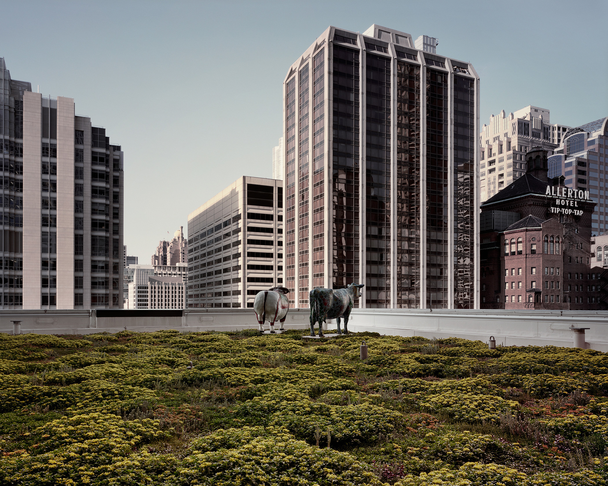
The intersections of the made and the natural can be apprehended in such settings . . . if one observes carefully, knows where to look, and possesses a spirit of exploration. The dramatic roofscapes by Brad Temkin in Rooftop: Second Nature are striking visual compositions that reveal the city from a different and unfamiliar angle, as well as information-rich object lessons in how green infrastructure enhances urban sustainability.
More broadly, though, this exhibit speaks to the vital role played by the environmental arts and humanities in envisioning a more sustainable future for humanity as well as for the millions of fellow species on our beautiful yet vulnerable planet. Thought-provoking ideas, artwork, architecture, poetry, stories, historical accounts, theater, music, and film are necessary complements to painstaking ecological analysis and pragmatic environmental policy.
Why? Because ideas and vision matter. Compelling narratives, whether literary or visual, can animate science, challenge our use of technology, inspire policy, and change hearts and minds. Such narratives must guide our thinking to ensure that social equity and environmental justice are not trampled in the relentless pursuit of short-term profits from, say, building oil pipelines across sources of drinking water in the Great Plains; or dumping the “overburden” of mountaintops into the creeks and rivers of Appalachian coal country; or selling more Pepsi or iPhones.
In such fraught and perilous times, a sustainable future can only be achieved, let alone properly envisioned, with the full participation and engagement of the environmental arts and humanities.
By showing us the “second nature” of the urban landscape in these images of green rooftops, Brad Temkin’s art not only delights and inspires with unexpected manifestations of beauty, but also implicitly challenges us to consider what “first nature” is, and what sort of relationship we want with it — one which in we are conquerors . . . or stewards.
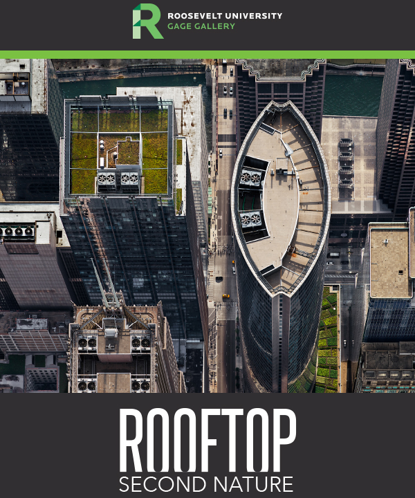
This is a slightly edited version of a short speech I gave at the opening reception for Rooftop: Second Nature on 9 Feb 2017 at Roosevelt University’s Gage Gallery, 18 S. Michigan Ave., Chicago IL. The Gallery is open 9am-5pm weekdays and 10am-4pm Saturdays.
Opening reception and talk by Brad Temkin
Thursday, February 9th, 5-7 p.m.
Roosevelt University’s Gage Gallery
18 S. Michigan Ave., Chicago IL
(312) 341-6458
Statement from the Artist
“Rooftop: Second Nature draws poetic attention to an important new movement to counter the heat island effect caused by city life. Green roofs reduce our carbon footprint and improve storm water control, but they do far more. They reflect the conflict of our existence, symbolizing the allure of nature in the face of our continuing urban sprawl.
“My images do more than merely document rooftop gardens. By securely situating the gardens within the steel, stone, and glass rectangularity of urban downtowns, I ask viewers to revel in their far more open patterns, colors, and connection to the sky. In this break, I see not merely beauty and dichotomy, but the framework for positive change.”
— Brad Temkin
On Urban Ecology, Green Rooftops, and the Sustainability of Cities Exhibit Essay for Rooftop: Second Nature, Roosevelt University, Spring 2017
What does a sustainable city look like? Solar panel arrays, bike lanes along busy thoroughfares, and urban farms converted from vacant lots all come to mind; but the iconic symbol of the contemporary green metropolis is the green rooftop. Though mostly invisible to us at ground level, these living surfaces embody key chacteristics of the urban ecosystem even as they serve as sustainability badges of honor for environmentally-minded civic leaders.
The science of urban ecology demonstrates that cities are not mere technological constructions, distinct from and diametrically opposed to nature, but complex ecosystems constituted by energy flows and waste sinks, evolving communities of organisms, and habitats both natural and designed. The green rooftops that increasingly dot the skylines of 21st-century cities are engineered to serve specific ecological, economic, and/or aesthetic functions for the buildings they crown and the people who inhabit them. Such spaces are simultaneously technological and natural: well-ordered assemblages of soil, plants, and micro-organisms that soften the surfaces and round the edges of the rectilinear built environment.
Said rooftops also are prime examples of green infrastructure, a critically important element of the urban fabric. Parklands and nature preserves, wetlands and riparian zones, bioswales and rain gardens, farm lots and backyard gardens, and green rooftops — all comprise a city’s green infrastructure. These diverse physical spaces provide a myriad of ecosystem services: they conserve freshwater resources, reduce energy consumption, mitigate air and water pollution, create wildlife habitat, and enable our own physical contact with nature.
The dramatic images in Rooftop: Second Nature are striking visual compositions that reveal the city from a different and unfamiliar angle, as well as information-rich object lessons in how green infrastructure enhances urban sustainability. Within one roof’s environs, a diverse riot of native prairie plants is juxtaposed with the boxy lines of air conditioning units, while other images expand the frame beyond the rooftop’s edge to portray its larger context, such as Chicago’s street grid bisected by its namesake river.
Such visual elements evoke the entanglement of ecological cycles in which the roof participates. These living surfaces provide superior building insulation, thus reducing heating and cooling costs and, in turn, decreasing carbon emissions. Plants evapotranspire water, which cools the micro-climate of the building’s exterior, thus mitigating the urban heat island effect. Precipitation falling on these rooftops is not wasted as runoff to an energy-intensive sewer and wastewater treatment system; rather, it is captured in place, absorbed by the resident plant community, and returned to the atmosphere in a silent yet eloquent demonstration of the water cycle.
Brad Temkin’s photographs are densely layered with meaning and invite inquiry from the viewer: From what vantage point was that shot taken? What are beehives doing on a skyscraper roof? How is this largely unseen rooftop relevant to the river flowing only two blocks away? Who has access to these spaces, and what psychological benefits might accrue from exploring them? Such questions suggest the dynamic interplay between art and science within our perceptions of the sustainable city.
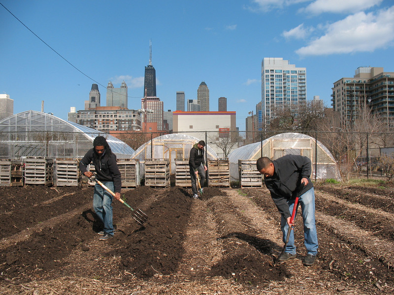
Turning the soil in the Farm’s west planting beds, 24 April 2013
Many of the writing and research assignments I give my students at RU are fairly straightforward and prescriptive. I give them a lot of concrete guidelines and freedom to choose a topic; they crank out the work; and then I grade it and give it back with feedback. That’s how it works for the most part in academia.
This spring semester, in addition to their weekly work on the farm watering plants, building compost bins, turning over soil, constructing greenhouse grow tables, etc., my 15 undergrad students were tasked with a collaborative “Action Research” project, in which they’d work in pairs or trios to develop real-world projects meant to extend and enhance the mission and work of this extraordinary half-acre urban farm.
Having never led quite such a research project before, I wasn’t exactly sure how to instruct them in this process — consequently, I just didn’t have the procedure or the finished project all scripted out like I usually do. Instead, I offered some rough guidelines (see project guidelines here [pdf]), moral and logistical support (likewise provided by the farm’s director, Natasha Holbert), and a lot of room for creativity.
Boy, did I learn something. Give motivated, smart, and engaged students a chance to do creative applied research for a place that they respect and appreciate, and they are capable of doing terrific work. (Note to self: do this again.) Here’s what they came up with. All of these Action Research Projects are designed to be implemented, expanded, and/or revised by the Farm staff and workers — and some may be taken up and extended by future SUST 350 students here at Roosevelt.
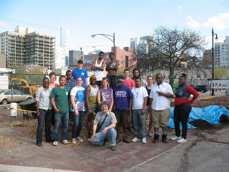
Our last workday, 1 May 2013, at the farm. Pictured here are RU students, CLUF staff, and Growing Power / Chicago Lights “Youth Corps” interns.
Community Empowerment and Youth Enrichment (CEYE) Program
Allison Breeding, Scott Rogers, and Troy Withers
The CEYE Program is comprised of three branches—Community Service, Food Access and Engagement, and Roosevelt Credit—which collectively aim to benefit the lives and futures of Chicago Lights Urban Farm (CLUF) volunteers, at-risk urban youths, and Cabrini seniors. CEYE seeks to take teens out of a path of trouble and into a path of service, volunteerism, and eventually college and career. The program also seeks to empower and assist local seniors by improving their food access and strengthening their community connections. (CEYE Proposal pdf)
Community Gardeners’ Guide
Jordan Ewbank, Kristen Johnson, and Ana Molledo
A practical how-to resource for people wishing to start their own community garden, based on the knowledge and practices of the CLUF community garden, established in 2002. Discusses land preparation, garden organization and design, raised beds vs. in-ground gardening, soil quality, compost, and what kinds of vegetables to grow. (Gardeners’ Guide pdf)
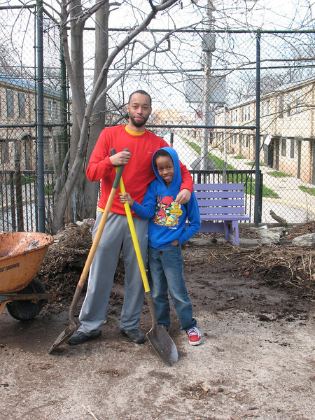
Troy and his son, working together on our 24 April 2013 workday
Farm Education Lessons and Activities
Bob Basile, Christian Cameron, and Molly Connor
Educational lessons and activities for K through Grade 6 students on composting, planting, and nutrition meant to be used at the CLUF to connect urban farm education with sustainability. May be expanded by future students for 7-12 grade levels on these and additional topics. (Farm Curriculum pdf)
Knowing Your Neighborhood: Community Assets Brochure and Map
Mike Miller and Ken Schmidt
Brochure (pdf)and interactive Google map designed to highlight resources and assets with a one-mile radius of the Chicago Lights Urban Farm.
Rainwater Harvesting Plan
Michael Magdongon and Lore Mmutle
A concrete proposal for the installation of a rainwater harvesting system on one of the Farm’s hoop houses. Would provide a sustainable supply of water to decrease dependence upon usage of the street hydrant on Chicago Ave., now the Farm’s main water source. Projected return on investment within one year.
(Rainwater Proposal pdf)
Self-Guided Tour and Farm Map
Bryan McAlister and Lauren Winkler
This beautifully designed one-page, double-sided guided tour information sheet and map is ideal for first-time visitors to the Farm who would like a brief and fun introduction to all of the spaces and growing areas within its half-acre footprint. Includes information of selected vegetables and several recipes for cooking them.
(Guided Tour and Map Brochure pdf)
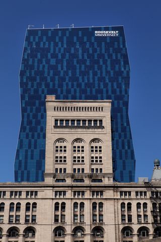
[T]here is reason to think that Roosevelt University’s striking new $123 million tower in downtown Chicago (left) will amount to something more than an eye-grabbing envelope.
The 32-story tower, which flaunts a zig-zagging silhouette and an equally arresting skin of blue and green glass, represents Chicago’s latest innovation in skyscraper design. It is a vertical campus, stacking everything from a student union to lecture halls to dorm suites within a single, all-encompassing structure.
Located at 425 S. Wabash Ave. and known simply as the Wabash Building, the tower is the nation’s second tallest academic building after the University of Pittsburgh’s Cathedral of Learning. More important, it marks the first time that the dramatic expansion of colleges and universities in Chicago’s Loop has made a major mark on the city’s vaunted skyline. Happily, that impact is worth celebrating.
The tower’s powerfully sculpted exterior soars memorably above the mighty wall of historic buildings along Michigan Avenue (left), including Louis Sullivan and Dankmar Adler’s adjoining Auditorium Building, which has served as Roosevelt’s home since 1947. It achieves a genuine, artful dialogue between past and present.
As noted elsewhere in Kamin’s review, as well as in Laura Janota’s “Growing A Green Campus” essay in the Fall 2010 Roosevelt Review alumni magazine, the Wabash vertical campus is a LEED-Silver building that incorporates a host of sustainable features — from recycling facilities to energy- and water-efficient fixtures to sustainable building materials. As such, it is an integral part of RU’s continuing efforts to green its physical campus, from its buildings to its exterior landscapes (in the case of the 22-acre Schaumburg Campus).
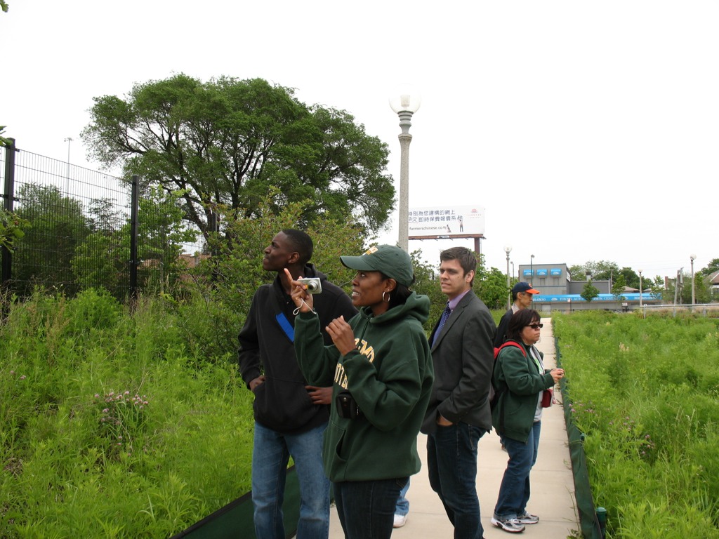
This past Saturday, June 11th, students in my PLS 392 Seminar in Humanities online summer course at Roosevelt University took an “urban landscapes” field trip to Chicago’s near Southwest Side, where we visited two city parklands: Canal Origins Park on South Ashland Avenue, and Stearns Quarry (aka Palmisano) Park on Halsted Street. This afternoon field trip was a chance for us to discuss the history and ecology of these locations and their relation to Chicago’s urban landscape, as well as think about the visual aesthetics of these areas, the integration of nature and culture in urban environments, the importance of parks to city communities, and how such areas can serve as windows into the rich history of Chicago.
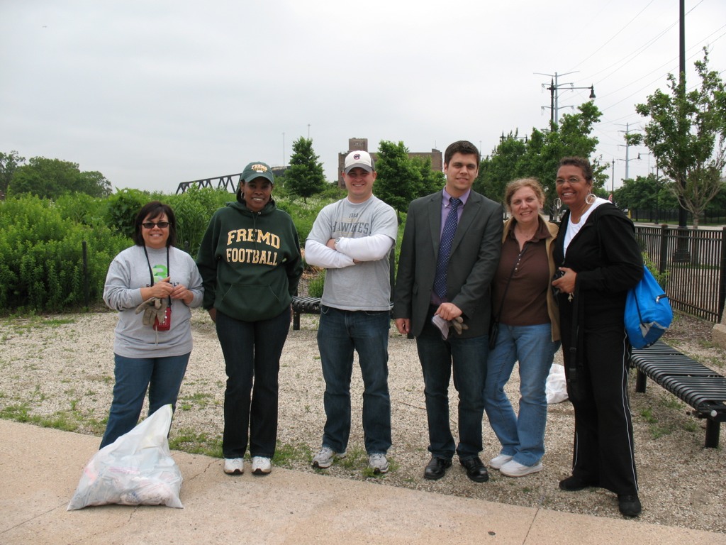
PLS 392 students help clean up Canal Origins Park before our walking tour of this urban parkland along the Chicago River, June 2011 (photo by M. Bryson)
We began our afternoon by meeting at Canal Origins and, before starting our walking tour of this 2002 riverfront parkland, picking up several bags’ worth of litter along Ashland Avenue near the park’s entrance. (Thanks to my students for pitching in like troopers!) Canal Origins provides impressive views of the present-day juncture of the Chicago River’s South Branch and Bubbly Creek, and commemorates the origin of the I&M Canal, which was constructed from 1836 to 1848. Use of the canal peaked in 1882 (when over a million tons of cargo were transported), but construction of Sanitary & Ship Canal in the late 19th century spelled the eventual demise of the I&M, as did the advent of railroad transport in the latter third of the 1800s.
The old canal, though, has made a comeback the during the last 30 years though the establishment of the I&M Canal Heritage Corridor by Congress in 1984 by Congress, which celebrates and promotes the Canal as natural resource, wildlife corridor, recreation destination, and source of cultural memory and historical preservation. Here at this area of Chicago, the canal is filled in and is covered by Interstate 55. Visitors to the park can see it only in their imaginations.
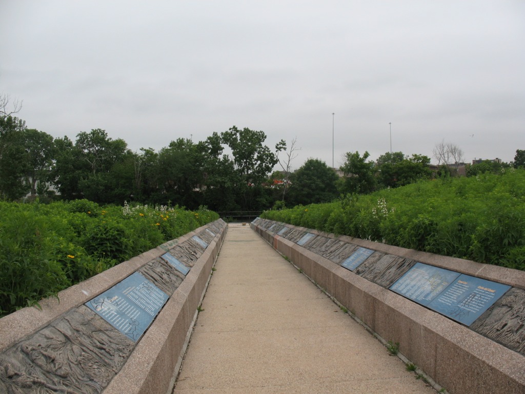
This walkway from the entrance of Canal Origins Park leading to the river symbolizes the canal’s walls, and features artwork by Chicago high school students. Unfortunately, now the displays are heavily tagged with graffiti (photo by M. Bryson)
To the west, the South Branch soon morphs into the Sanitary and Ship Canal, begun in 1892 and completed in 1900. This canal marked the permanent reversal of the Chicago River for improved sanitation (via dilution) and navigation, and continues to be used heavily to this day for commercial transportation. North of the S&S Canal is the filled-in waterway formerly known as the West Fork of the South Branch, which flowed southwestward until it ended at the Continental Divide separating the two watersheds that meet here in the Chicago region (those of the Mississippi River and the Great Lakes). Here was located Mud Lake, between Kedzie (to the east) and Harlem (to the west), which earlier voyageurs could paddle across in wet years to travel between the Chicago and Des Plaines Rivers. The Chicago Portage National Historic Site is at Harlem Avenue, north of the canal, and it commemorates the history of the portage made via Mud Lake. The Stickney Wastewater Treatment plant, the world’s largest, now sits where the fickle waters of Mud Lake once were.
After touring Canal Origins Park, we walked a few blocks south to the Ashland stop of the CTA Orange Line, where suburban students enjoyed the novelty of an L ride one stop to the north to Halsted Street, where we disembarked and walked a couple of blocks south to Stearns Quarry Park.
RU students walk the trails at Stearns Quarry Park in Chicago’s Bridgeport neighborhood, June 2011 (photo by M. Bryson)
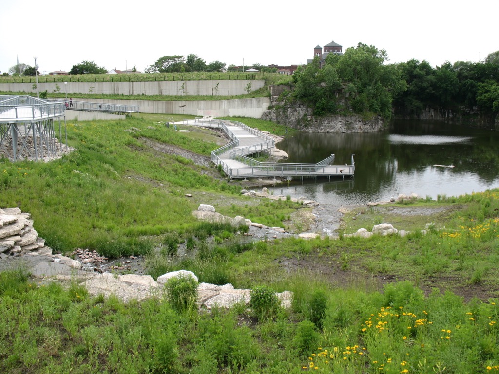
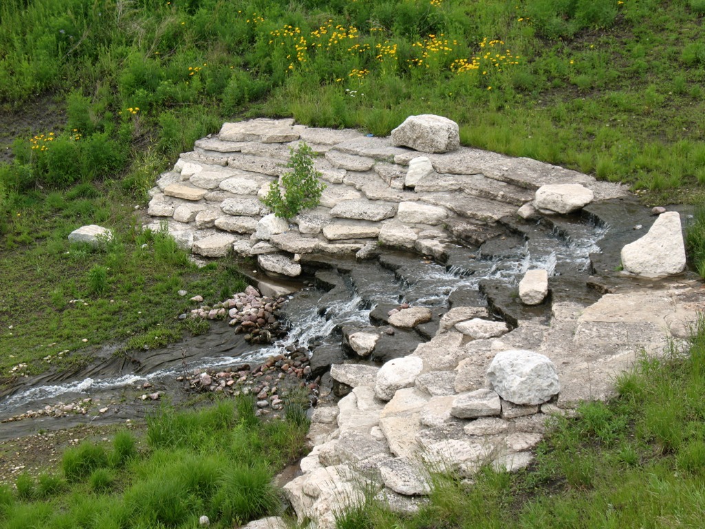
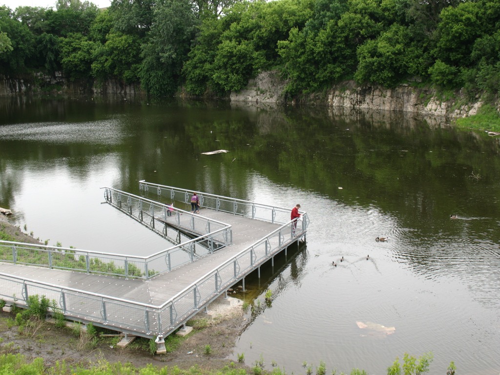
This extraordinary urban greenspace finished in 2009 is a cutting-edge example of city park design with nature in mind. Its meandering walking trails provide a different kind of view as one walks along, from the terraced wetlands that filter water circulated between the park’s fishing pond to its entrance fountain; to the old walls of the limestone quarry, which operated here from the late 1830s to 1970, when the site became a landfill; to the neighboring churches and houses of the Bridgeport neighborhood; to the dramatic scene of the Loop’s skyline, as viewed from the grassy-topped mound of the park. Throughout the park, native vegetation provides natural beauty, efficient water retention, and ample wildlife habitat — and many other sustainable design features make this truly a 21st century parkland.
A view of the terraced wetlands in Stearns Quarry (photo by M. Bryson)A closer view of the one of the wetland’s terraces; red-winged blackbirds and barn swallows were in abundance here (photo by M. Bryson)A view of the stocked fishing pond at the bottom of the quarry, as well as the its limestone walls — a most unusual sight within the city of Chicago (photo by M. Bryson)
Those seeking an off-the-beaten-path Chicago experience should consider visiting Stearns Quarry Park, which is easily accessible via the CTA (Orange Line and #8 bus) as well as car, with free street parking available next to the park. An excellent audio tour is provided by the Chicago Park District, as well.
The mound at Stearns Quarry Park affords impressive views of Chicago’s downtown skyline, only a few miles to the northeast (photo by M. Bryson)
The month of May will be a transformational month for the Robin Campus landscape. Per our Sustainable Site campus landscape plan created over the last year, low input native plantings will be replacing much of the high input and resource intensive turf grass areas. Over the next few weeks, those who visit the Robin Campus will begin to see much of the turf grass in open areas and on the parking lot islands turning brown. Last Friday, eight of the thirteen acres of turfgrass were treated with a contact herbicide that will kill the grass. The open areas will then be seeded in mid to late May with native prairie mixes. The parking lot islands will be planted with native grasses using seed, plugs or plants. A few native flower beds will also be installed on the west parking lot islands. Native seedings take three years to fully establish as they build their root systems for the first few years before displaying their characteristic top growth.
This year, you will see primarily cover grasses and a few showy natives late in the season. More native plants will be evident in the second summer, and then by the third year the seeded areas should start to look like a healthy native plant community. As the new seedings and plants are getting established, we ask that you begin to watch with interest to see if you can identify our new native plants as they begin to get emerge, and please, use care to avoid walking over the newly planted native areas.
On Thursday, Feb. 17th, landscape architect Bill Bedrossian of Bedrock Earthscapes visited Mike Bryson’s SUST 210 The Sustainable Future class in Schaumburg and gave a special guest lecture on green landscaping practices. Bill is working with a faculty/staff/student green campus committee led by Paul Matthews, Asst. VP for Campus Planning/Operations, to design a new look and sustainable landscape plan for the Schaumburg Campus. This past Thursday, Bill updated us on this ongoing planning process as well as presented his knowledge about sustainable landscape design and maintenance, a topic that connects with a variety of themes in SUST 210 this semester. Also in attendance that night were members of Prof. Greg Buckley‘s seminar in natural science (who among other things are working on a project of identifying all the tree species on the Schaumburg Campus grounds), SUST major Alan Swartz, Paul Matthews, and a few other members of the Schaumburg Campus community.
Excellent discussion ensued about the advantages of various landscape design features for energy and water conservation, as well as about the in-progress ideas for the Schaumburg Campus redesign, which includes extensive native vegetation replacing the bulk of the current turf grass; a restored wetland at the detention pond site; native plant demonstration beds and a potential orchard; bioswales, a rain garden, a cistern, and pervious paving in the parking lots for on-site water retention; a composting site and possible “edible wall” vertical garden; and better outdoor recreational space, including a baseball field. Open areas near McConnor Parkway on the campus periphery will be planted in native grasses in the short-term, but could be re-developed later as a small-scale urban farming operation.
A pdf version of Mr. Bedrossian’s presentation to SUST 210 is included here: Sustainable Site Practices and RU Concepts. Slides 46-49 address RU’s campus grounds planning process, and slide 48 is the current draft Sustainable Landscape Plan Map. Take a look at that map (zoom in on it to see details) and as you analyze it, ask yourself some questions:
Who are the various groups of people that would use and experience this landscape — students, staff, faculty, visitors, etc. — and what are their needs and interests? (Think about, for example, the value of a walking/biking trail that could wind through the campus.)
What kinds of learning and leisure activities should the campus landscape support and encourage? How can it connect the university to the surrounding community of Schaumburg?
What about the plan at present do you like, and why?
Is there anything missing that you’d like to see incorporated into the plan?
If you have any comments, questions, or suggestions about the plan, please post them here on this blog post (if you’d prefer to simply email me feedback privately, you may do so at mbryson@roosevelt.edu ). I’ll make sure your suggestions find their way to the Schaumburg Campus committee working on this plan. Thanks for your input!
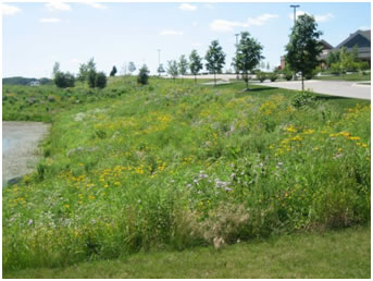
A detention pond with native planting along its banks, one of the landscapes restored by Bedrock Earthscapes
During the Week 4 Thursday class session for my SUST 210 Sustainable Future class in Schaumburg, we will have a guest presentation by landscape architect Bill Bedrossian of Bedrock Earthscapes. Bill is working with a faculty/staff/student green campus committee to design a new look and sustainable landscape plan for the Schaumburg Campus. He will update us on this ongoing planning process as well as present his knowledge about sustainable landscape design and maintenance, a topic that connects with a variety of themes in SUST 210 this semester.
All 210 students as well as Sustainability Studies majors are particularly encouraged to attend; RU students/faculty at large are also welcome. Light refreshments will be served. Please RSVP to me at mbryson@roosevelt.edu by Monday, Feb. 14th, if you plan to make it.
When / Where:
Time: 6:30pm (45-min presentation followed by 20-min Q/A discussion)
Location: Schaumburg Campus, room 627 Travel Info: Check out the Shuttle Service from the Chicago Campus if you’re coming from downtown


