Exploring Salt Creek and Busse Lake

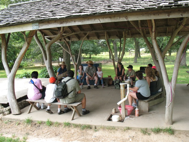
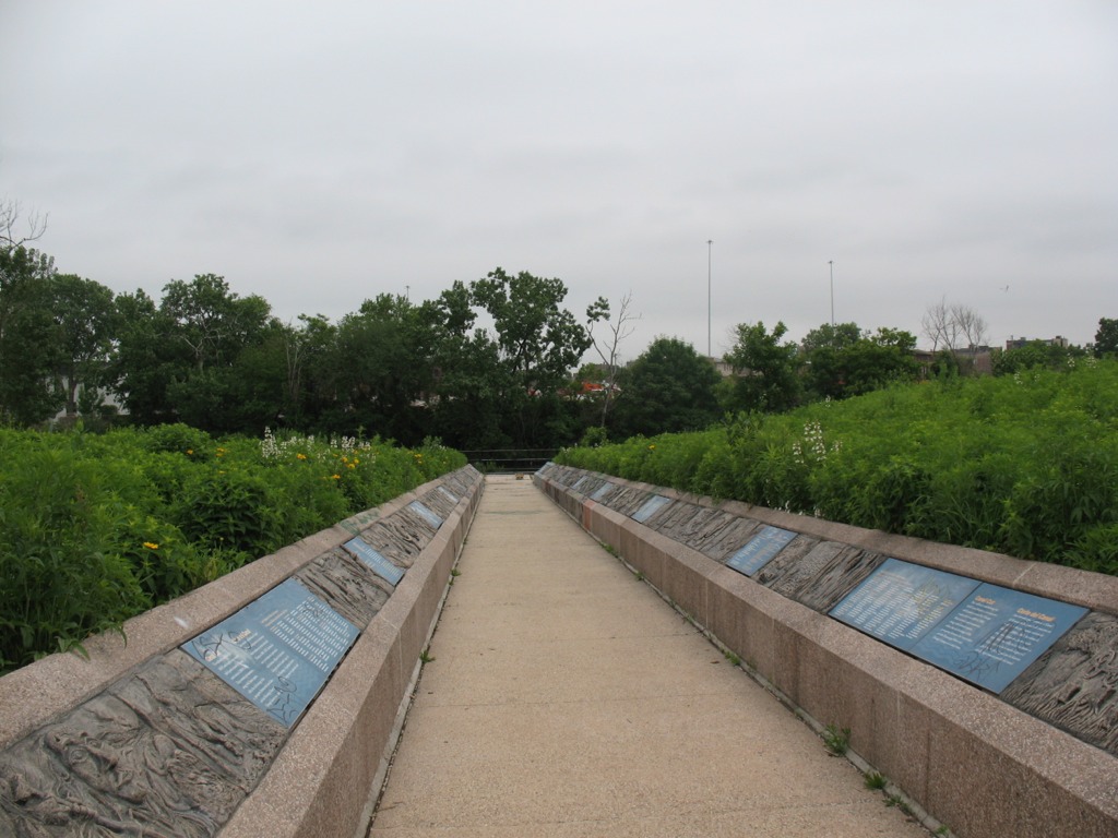
Every semester I take my Roosevelt University undergraduate students on field trips — hands-on learning experiences that allow us to put some of the academic ideas we’ve studied into practice, work together in teams, and create a sense of community. That’s especially important in online classes, where virtual interaction is intense and sustained, but face to face action is rare or nonexistent.

This fall at RU’s Schaumburg Campus, my Sustainability Studies 220 Water course’s hybrid format (a combination of occasional Saturday sessions plus weekly online interaction) is ideal for scheduling field trips to likely sites of interest. Normally I would wait until one-third of the way through the semester before venturing on a trip with a group of students — but since SUST 220 had a long Saturday campus session to kick off the semester and early September is usually a good time to be outside in the Chicago area, we decided to get right to it.

Busse Woods (M. Bryson)

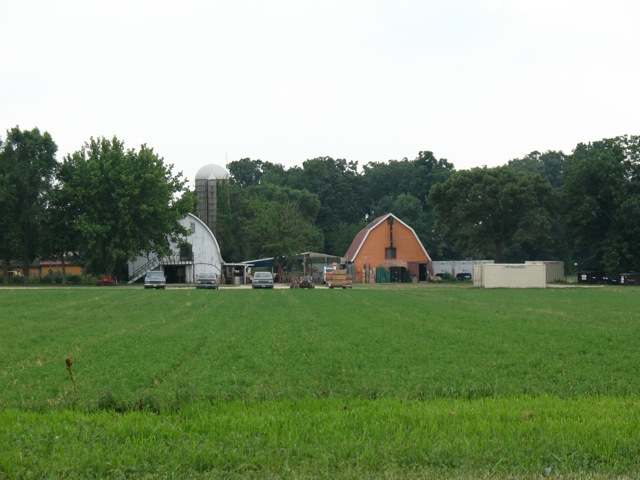
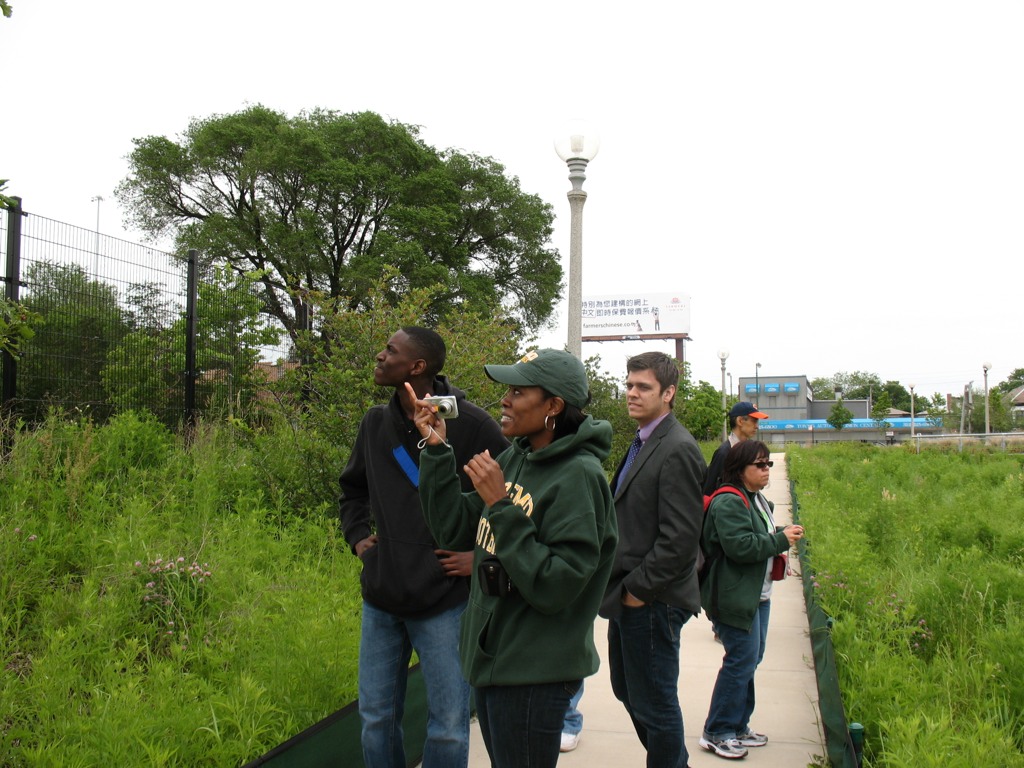
So after two hours of morning lecture and discussion on September 10th and meeting each other for the first time, my students and I enjoyed a picnic lunch in the campus courtyard and then headed over to Busse Woods, one of the largest holdings within the Cook County Forest Preserve system (at 3,700 acres), for field-based introduction to water quality sampling techniques.

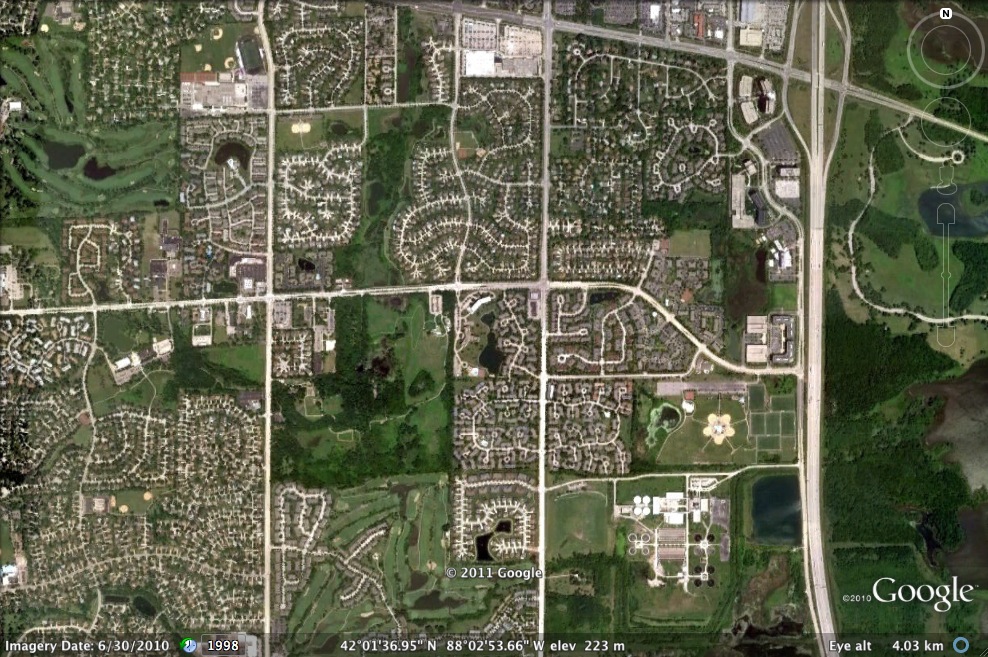
Busse Woods, aka the Ned Brown Forest Preserve, is a massive and multi-functional piece of green infrastructure in the northwest suburban region, a culturally significant recreation site for the many communities it serves, and a fascinatingly complex mosaic of northern Illinois ecosystems — riverine, woodland, wetland, and prairie. The preserve directly borders the suburbs of Rolling Meadows, Arlington Heights, Elk Grove Village, and Schaumburg; but within a short drive or even bike ride are numerous other communities, including Palatine, Prospect Heights, Mount Prospect, Des Plaines, Wood Dale, Itasca, Roselle, Hoffman Estates, and Inverness. People in these suburbs and beyond converge on Busse Woods year-round to boat, bike, hike, rollerblade, picnic, fly model airplanes, visit the elk herd (yes, elk!), and more, making it one of the most-heavily used forest preserve units in Cook County. Fortunately, the preserve’s sheer size and diverse offerings of groves, parking areas, meadows, and trails enable it to accommodate all this activity and still provide much needed open space for the region and the chance of someone to roam within an extensive natural area. The Cook County Forest Preserve and the Friends of Busse Woods actively work on conservation and restoration projects in the preserve.

Just to the southeast is O’Hare Airport, which at approximately the same size as the preserve represents a completely different way of using land — the concrete and asphalt “hardscape” of O’Hare strongly contrasts with the verdant landscape of Busse Woods. Besides recreational opportunities and open space for its human visitors, Busse harbors a significant amount of regional biodiversity:

Busse Forest Nature Preserve Topo Map (USGS)

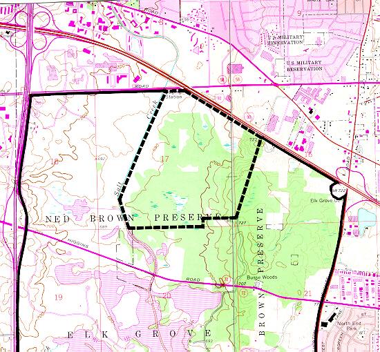
the 440-acre Busse Forest Nature Preserve, located in the northeast section of the Forest Preserve unit, is not only a state-designed nature preserve (the third one so dedicated, in 1965) but also a National Natural Landmark. This protected area harbors bottomland flatwoods, extensive wetlands, and upland forest, some of which are in the process of restoration.

Salt Creek, looking south from the northern edge of Busse Woods Forest Preserve (M. Bryson)

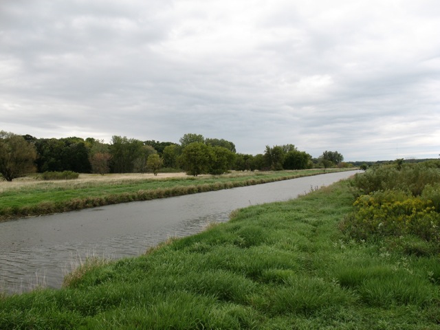
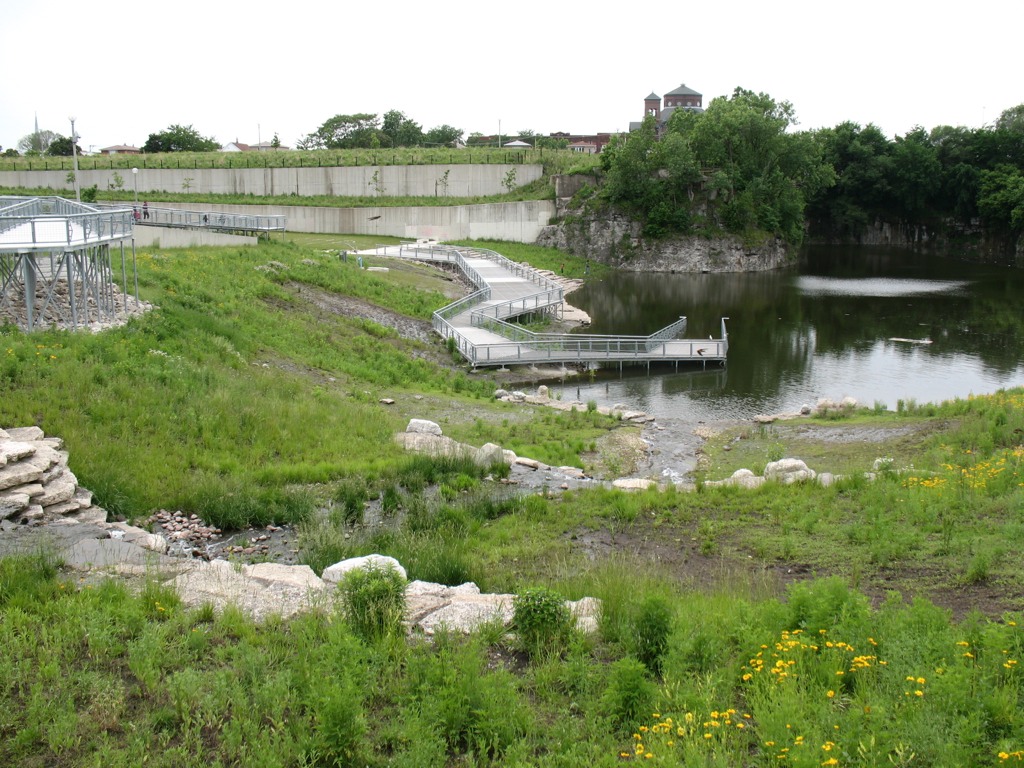
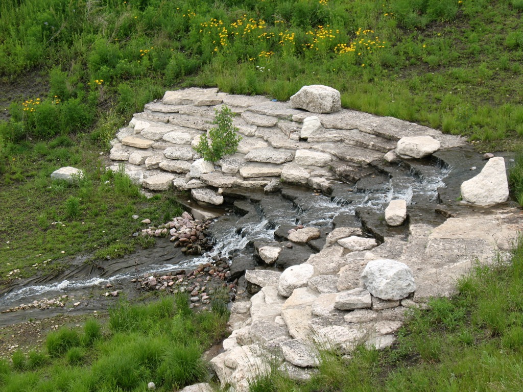
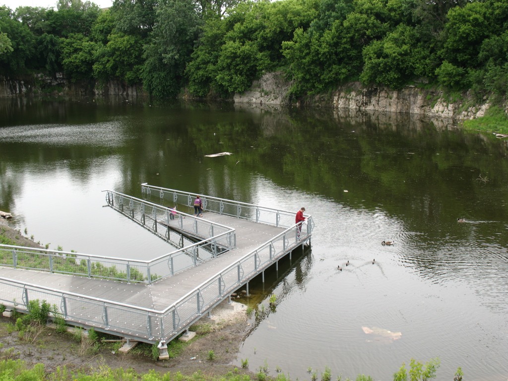
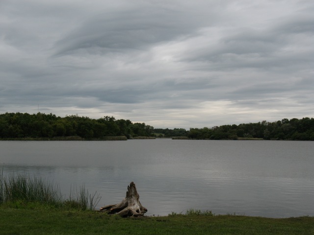
Busse Woods is home to a couple of significant water features including Salt Creek, which was the first stop on our trip. After hiking through a forest-and-wetland path along the northern border of the woods, we came to the Golf Road overpass of Salt Creek, where the river south into the preserve before it empties into Busse Lake, a sprawling artificial reservoir created by a dam structure at the south end of the preserve. Using a couple of different water quality field testing kits, we sampled the creek and measured a range of physical/chemical water quality indicators: chlorine, copper, dissolved oxygen, hardness, iron, nitrate, pH (acidity), phosphate, temperature, turbidity, and total coliform bacteria. In doing so, we not only took the ecological pulse of Salt Creek at one point in time, we also learned how to use our sampling equipment, compared test results from different measurement procedures, assessed the possible sources of error in our data collection, and analyzed the impact of the surrounding landscape upon the water quality of Salt Creek.

You can see our tabulated results here: Water Quality Data and Results for Salt Creek and Busse Lake 10 Sept 2011 (pdf).

The entire Busse Woods preserve is a significant green space within the Salt Creek Upper Watershed, as it receives stormwater run-off from the eastern half of Schaumburg via the main channel of Salt Creek as well as the Creek’s West Branch. That tributary is important for another reason, as it flows through the heart of Schaumburg before passing around the periphery of the John Egan Wastewater Treatment plant of the Metropolitan Water Reclamation District.

Satellite view of Schaumburg's east side, showing the West Branch of Salt Creek and the John Egan Treatment Plant (lower right)
Satellite view of Schaumburg's east side, showing the West Branch of Salt Creek and the John Egan Treatment Plant at lower right (Google Earth)

The Egan plant’s treated effluent is piped into the West Branch, which then flows east under I-290 to empty into the South Pool of Busse Reservoir. Partly for that reason, we chose to sample water from the shoreline of the South Pool as our second sampling site of the day. (Interestingly, the data from that site were quite comparable to those we gathered much farther north at Salt Creek.)

In this sense, then, Busse Lake is a giant detention pond for stormwater run-off from several suburban communities (either directly or via Salt Creek) and treated wastewater from Schaumburg. As such, it is a flood control structure for Salt Creek, which runs south/southeast out of the preserve and drains several western suburban communities before joining the Des Plaines River near Brookfield.

The south pool of Busse Lake (M. Bryson)

Effective water retention in Busse Lake means reduced flooding in downstream communities, though the persistence of flooding in the western suburbs means the reservoir as currently configured is only a partial solution. Nevertheless, the larger forest preserve complex of wetlands, prairies, and woodlands — of which the lake is but a part — act like a giant sponge for the surrounding towns and villages, absorbing precipitation and run-off from a wide area and releasing it slowly to the atmosphere and to Salt Creek.

Map of Salt Creek's watershed (Salt Creek Watershed Network)

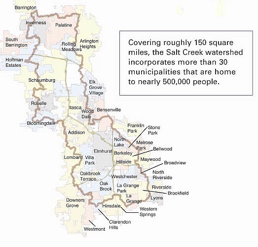
In short, Busse Woods are a vital component of the hydro-ecology of the Upper Salt Creek Watershed. In turn, as a stream that winds through a score of suburban communities and which is a major tributary of the Des Plaines River, Salt Creek is a waterway that displays the impacts of urbanization on natural systems, even as it provides vital green space for half a million citizens in the Chicago area. It’s also an ideal ecosystem in which to explore and assess the need for sustainable water management as a means of improving the quality of our region’s surface waters and minimizing the risk of pollution and flooding within the watershed.

An Agricultural Landscape Adventure

Angelic Organics Farm, Caledonia, IL (photo by L. Bryson)

This past Sunday, July 10th, students in my PLS 392 Seminar in Humanities online summer course at Roosevelt University took an “agricultural landscapes” field trip to north-central Illinois, near the city of Rockford and just south of the Illinois-Wisconsin border. Such an adventure might seem an odd outing for a class like ours, which focuses on “representations of the urban landscape.” However, as the environmental historian William Cronon argues in his prologue to Nature’s Metropolis (1991), the city and country exist in a symbiotic relation, one defining the other in a dance of mutual dependence. And given the continued importance of farming in the otherwise heavily urbanized six-county Chicago region, we found it appropriate to explore northeastern Illinois’ remaining agricultural lands and to think about the shape and character of these lands and their relation to the city.

Enter Angelic Organics Farm, an organic community supported agriculture (CSA) operation based in Caledonia, IL. Angelic Organics was founded in the early 1990s by John Peterson, whose family had farmed this land since purchasing it in the Great Depression of the 1930s.

The Learning Center's pavilion (photo by L. Bryson)

Peterson’s colorful history as a soul-searching farmer, writer, performance artist, and philosopher is the subject of the fascinating 2006 documentary film, The Real Dirt on Farmer John. The Angelic Organics Learning Center provides public tours and a wide variety of educational programs to teach visitors the craft of sustainable agricultural and its vital connection to the stewardship of nature. This farm is a living classroom where visitors observe how local diverse agricultural traditions thrive in our age of mega-industrial monocultural croplands and large-scale animal confinement operations.

Our tour guide on Sunday was April, an instructor at the Learning Center with a background in outdoor education and natural history. She led us on a two-hour walk around the grounds of the 180+ acre site and introduced us to the methods of vegetable production as well as animal husbandry employed on this diversified farm. Along the way, her narrative gave us a sense of how the ideas and philosophy behind such a farm are as important as the technical knowledge and hard physical labor that keep it going.

The farm has 30 acres under cultivation at any one time (photo by L. Bryson)

While there was only minimal active work being done on the farm that day (mostly the daily tending of animals), we did get a chance to inspect the many acres of vegetable fields up close and personal; pick some beets and basil; take home a broccoli flat or two; see the newborn baby bull frolic with his mother in a bucolic pasture; and hang out with the goats and chickens in their pens.

What one takes away from such an extraordinary opportunity to tour a working organic farm depends upon, in part, one’s background and connection to agriculture. Those in our group ranged from city folk like me with little to no experience working or living on farms, to those who grew up on farms or visited them frequently as children. For several people in our class, this represented their first time ever setting foot on a working farm. In that context, the opportunity to see where food comes from — what it looks like and how it’s grown in the fields — is a remarkably eye-opening experience.

Good Illinois soil is mighty productive (photo by L. Bryson)

For those familiar with conventional agriculture in the Midwest, the seemingly unending fields of corn and soybeans destined to be processed into a myriad of industrial agricultural products (from corn syrup to ethanol to animal feed), Angelic Organics is a throw-back to an earlier age when farms were diverse. And for those who garden small plots in their yards, the long orderly rows of perfectly cultivated vegetables — kale, lettuce, fennel, garlic, onions, tomatoes, potatoes, sweet corn, beets, and much more –represent a staggering achievement of scale using labor-intensive growing methods.

In such a neo-traditional model, dozens of different vegetables are grown in a well-orchestrated crop rotation in which fields are rested two out of every four years so that the soil is replenished; different types of crops are planted on a given plot of land, so as to avoid excessive nutrient depletion; animal waste is composted and used to fertilize the soil; hand labor and the intelligent use of technology is used to mitigate against pests and avoid the use of chemicals in protecting plants.

A recently born calf and its mother (photo by L. Bryson)

I say “neo-traditional” because while Angelic Organics, as the largest CSA farm in the Midwest, is at the cutting edge of contemporary farming, it also is a throwback to the time before World War Two when most American farms were family-run, highly diversified operations that used animals to produce eggs, cheese, milk, and meat; rotated crops and pastureland to maintain soil fertility; and recycled key elements of the farm — grass and manure — in a closed-loop ecosystem.

Angelic Organics, like other CSA operations, is a great place to contemplate the connection of farm to city. The idea of a CSA — where citizens purchase shares in a farm in advance of the growing season in order to help finance the farm’s operation, then receive a weekly box of harvested produce throughout the summer and/or fall — is a method of food production in which the farmer sells directly to the consumer and the purchaser feels an economic, social, and even physical connection to the farm.

Lily, age 9, crossing a field (photo by L. Bryson)

This sort of social contract is a strong element of Angelic Organics’ method and identity, and it connects this part of rural Illinois to urban residents in Rockford, Chicago, Schaumburg, and several other urban and suburban communities where the farm delivers its CSA share boxes to customers.

Another means of connection is the farm itself, which has developed its own education and public outreach programs through the Angelic Organics Learning Center. Here people can travel from cities, suburbs, and small towns to see a working Illinois organic farm in action, where all its operations are visible to the public and various kinds of skills and traditions (making soap, baking bread, tending animals) are taught in family-oriented programs. CSA members can also come to the farm and pick their own produce, a privilege that encourages them to think of the place as “their farm” — something they have ownership of in a very literal way.

The two Esmés (photo by L. Bryson)

This kind of welcoming attitude which defines many small-scale CSA farms stands in stark contrast to the industrial mega-farms and confined animal feeding operations (CAFOs) that bar visitors, reporters, and cameras from their premises — a common practice depicted in recent agricultural documentaries such as Food, Inc.

For our group from Roosevelt University, the visit to the Angelic Organics Learning Center was a transformative experience. Students gained a much deeper appreciation of the work, planning, and creativity that go into a sustainable farm operation; and we were impressed by the aesthetics of the farmland and the sense of place it engenders within the rural landscape. A few students brought their children, as I did, and they were excited to learn about the crops and animals. Future Roosevelt field trips to this agricultural haven are definitely in the works!

An Urban Nature Adventure

This past Saturday, June 11th, students in my PLS 392 Seminar in Humanities online summer course at Roosevelt University took an “urban landscapes” field trip to Chicago’s near Southwest Side, where we visited two city parklands: Canal Origins Park on South Ashland Avenue, and Stearns Quarry (aka Palmisano) Park on Halsted Street. This afternoon field trip was a chance for us to discuss the history and ecology of these locations and their relation to Chicago’s urban landscape, as well as think about the visual aesthetics of these areas, the integration of nature and culture in urban environments, the importance of parks to city communities, and how such areas can serve as windows into the rich history of Chicago.

PLS 392 students help clean up Canal Origins Park before our walking tour of this urban parkland along the Chicago River, June 2011 (photo by M. Bryson)

We began our afternoon by meeting at Canal Origins and, before starting our walking tour of this 2002 riverfront parkland, picking up several bags’ worth of litter along Ashland Avenue near the park’s entrance. (Thanks to my students for pitching in like troopers!) Canal Origins provides impressive views of the present-day juncture of the Chicago River’s South Branch and Bubbly Creek, and commemorates the origin of the I&M Canal, which was constructed from 1836 to 1848. Use of the canal peaked in 1882 (when over a million tons of cargo were transported), but construction of Sanitary & Ship Canal in the late 19th century spelled the eventual demise of the I&M, as did the advent of railroad transport in the latter third of the 1800s.

The old canal, though, has made a comeback the during the last 30 years though the establishment of the I&M Canal Heritage Corridor by Congress in 1984 by Congress, which celebrates and promotes the Canal as natural resource, wildlife corridor, recreation destination, and source of cultural memory and historical preservation. Here at this area of Chicago, the canal is filled in and is covered by Interstate 55. Visitors to the park can see it only in their imaginations.

This walkway from the entrance of Canal Origins Park leading to the river symbolizes the canal’s walls, and features artwork by Chicago high school students. Unfortunately, now the displays are heavily tagged with graffiti (photo by M. Bryson)

To the west, the South Branch soon morphs into the Sanitary and Ship Canal, begun in 1892 and completed in 1900. This canal marked the permanent reversal of the Chicago River for improved sanitation (via dilution) and navigation, and continues to be used heavily to this day for commercial transportation. North of the S&S Canal is the filled-in waterway formerly known as the West Fork of the South Branch, which flowed southwestward until it ended at the Continental Divide separating the two watersheds that meet here in the Chicago region (those of the Mississippi River and the Great Lakes). Here was located Mud Lake, between Kedzie (to the east) and Harlem (to the west), which earlier voyageurs could paddle across in wet years to travel between the Chicago and Des Plaines Rivers. The Chicago Portage National Historic Site is at Harlem Avenue, north of the canal, and it commemorates the history of the portage made via Mud Lake. The Stickney Wastewater Treatment plant, the world’s largest, now sits where the fickle waters of Mud Lake once were.

After touring Canal Origins Park, we walked a few blocks south to the Ashland stop of the CTA Orange Line, where suburban students enjoyed the novelty of an L ride one stop to the north to Halsted Street, where we disembarked and walked a couple of blocks south to Stearns Quarry Park.

RU students walk the trails at Stearns Quarry Park in Chicago’s Bridgeport neighborhood, June 2011 (photo by M. Bryson)

This extraordinary urban greenspace finished in 2009 is a cutting-edge example of city park design with nature in mind. Its meandering walking trails provide a different kind of view as one walks along, from the terraced wetlands that filter water circulated between the park’s fishing pond to its entrance fountain; to the old walls of the limestone quarry, which operated here from the late 1830s to 1970, when the site became a landfill; to the neighboring churches and houses of the Bridgeport neighborhood; to the dramatic scene of the Loop’s skyline, as viewed from the grassy-topped mound of the park. Throughout the park, native vegetation provides natural beauty, efficient water retention, and ample wildlife habitat — and many other sustainable design features make this truly a 21st century parkland.

A view of the terraced wetlands in Stearns Quarry (photo by M. Bryson)
A closer view of the one of the wetland’s terraces; red-winged blackbirds and barn swallows were in abundance here (photo by M. Bryson)
A view of the stocked fishing pond at the bottom of the quarry, as well as the its limestone walls — a most unusual sight within the city of Chicago (photo by M. Bryson)

Those seeking an off-the-beaten-path Chicago experience should consider visiting Stearns Quarry Park, which is easily accessible via the CTA (Orange Line and #8 bus) as well as car, with free street parking available next to the park. An excellent audio tour is provided by the Chicago Park District, as well.

The mound at Stearns Quarry Park affords impressive views of Chicago’s downtown skyline, only a few miles to the northeast (photo by M. Bryson)