This past week saw some great news this week for citizens of the greater Chicago region as well as southeast Wisconsin. The US Dept of the Interior has announced the approval of the Hackmatack National Wildlife Refuge, a constellation of planned open spaces and conservation areas that will link existing green spaces in NE Illinois and SE Wisconsin. It will be the closest wildlife refuge to the Chicago area, and is a future boon for regional ecotourism, land preservation planning, and sustainable economic development.
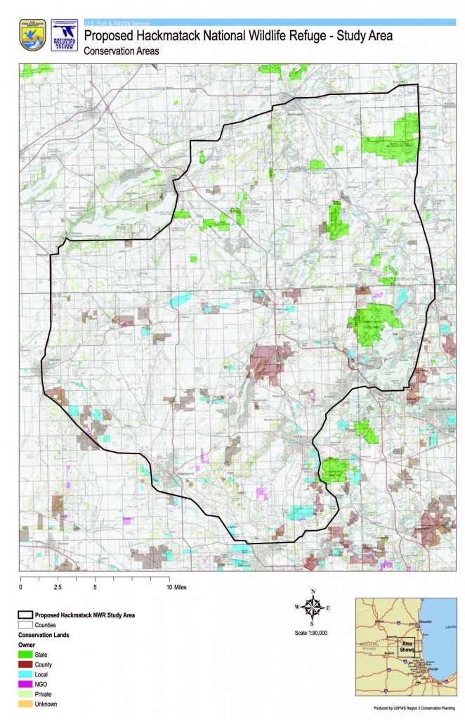
The map above depicts the original study area of the proposed refuge. According to the USFWS Division of Conservation Planning, it “includes the refuge Study Area boundary in black plus conservation lands currently owned by the State of Illinois, the State of Wisconsin, counties in both states, non-governmental organizations, land conservancies, and private individuals. Because land ownership is dynamic, some existing conservation lands may not be shown and some areas may have changed in status since this data were obtained.”
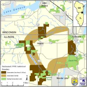
This somewhat more schematic map below, which was distributed widely via the media, shows the now-authorized boundaries of the new refuge, and clearly depicts the donut-shaped collection of open space and protected lands (including future conservation areas) that straddles the Illinois-Wisconsin state border.
What makes the Hackmatack Refuge unique within the longstanding national wildlife refuge system is its close proximity to a major metropolitan area (and therefore millions of potential visitors per year) and the fact that it will be composed of a mosaic of present and future protected landscapes, rather than a single contiguous parcel of federal land. For more information on the scope and significance of Hackmatack, see this news article from the Daily Herald, the Friends of Hackmatack website, and US Fish & Wildlife Service’s official webpage for the Hackmatack National Wildlife Refuge.

